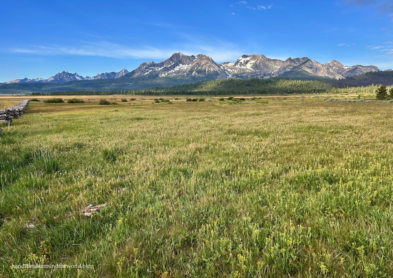
After two years off for various reasons, this summer it was finally time for my mom and me to resurrect our annual mother-daughter roadtrip tradition.
For our destination this year, we decided upon the scenic Sawtooth Mountains in south-central Idaho. It’s a place we’d been before, almost 25 years ago. I scarcely remembered it and there was a lot we’d left unexplored, so it was almost like visiting a brand new place.
Our trip didn’t entirely go as planned, as you’ll see, but overall the positives outweighed the negatives. The Sawtooths (or would that be Sawteeth?) are absolutely stunning, and I will absolutely be returning for the hikes that weren’t on our itinerary this time around.
But for now, let’s talk about what was on the itinerary.
Table of contents
- Sunbeam
- Stanley Lake
- Stanley Lake Trail
- Sawtooth Lake
- Fishhook Creek
- Redfish Lake
- Southern Sawtooths
Sunbeam
The main highways through the Sawtooth National Recreation Area form roughly a T shape. We entered from the east (the top right of the T) on Idaho Highway 75, making our first stop at the Sunbeam area. Here, the remains of a dam on the Salmon River are visible. This dam was built to provide power for the mill at a gold mine upstream.

Like so much of the west, this area of Idaho was settled by miners. Across the highway from the dam, a well-maintained dirt road travels a few miles up the Yankee Fork of the Salmon River to the old Custer Ghost Town and the Yankee Fork Dredge.
Custer was not all that different from any other ghost town I’ve visited, though it was still fun to walk around it and see what remains of the old structures. There is a pamphlet in the museum that can be used for a self-guided tour.


The dredge, on the other hand, was a very unique experience for us!
A dredge is an enormous, as it turns out – and this was just a medium-sized one – piece of machinery used in mining. An anchor at the rear was dug many feet into the ground, while the dredge itself floated on the creek (in a surprisingly shallow amount of water). A chain of 71 buckets churned up the creek bed, bringing water, rocks, and hopefully gold into the giant machine.
Using water, a conveyor belt, and a series of giant sieves, sediments were sorted by size and weight to isolate the gold, while the rest was kicked out the back into giant piles called tailings. The dredge then moved roughly 5 feet (1.5 m) upstream and did the whole process all over again. Progress was painfully slow. During its years of operation, the Yankee Fork Dredge ran 24 hours per day, 7 days per week, and traveled just 5.5 miles (8.9 km).


It was so interesting to enter the dredge and see it up close and learn how it worked. It was also kind of horrifying to see what dredges do to the landscape and to learn that all this destruction was created to isolate an estimated 40% of the gold. As it turns out, dredges are very inefficient. It’s hard to comprehend how much time and effort and money (the dredge used 300 gallons/1135 liters of diesel per day) was required for relatively little reward.

Stanley Lake
From Yankee Fork, we returned to the main road and continued toward the center of the T, which is the site of the tiny town of Stanley, Idaho. This was also where we were granted our first views of the jagged Sawtooth Mountains.


Our campsite for the next three nights was a few miles west off Idaho Highway 21 at Stanley Lake. This is a highly coveted area and obtaining a reservation required a lot of patience. Thankfully, we snagged a site when someone else cancelled. To clarify, there are some first-come-first-serve sites available but we figured we would arrive too late in the day for that (and we were, in fact, correct with that assumption).
As soon as we arrived, it became clear why Stanley Lake is so popular. Many sites, including ours, are set just back from the lake amongst tall stands of lodgepole pines.

Sadly, a significant portion of the Sawtooths have burned in multiple large fires over the last 5 years. While it’s a natural part of the forest ecosystem, it does not make for good scenery. Thankfully, the campground was saved. And while the surrounding hillsides are blackened, the backdrop of the mountains rising above Stanley Lake is still largely unmarred.

We really enjoyed our time at this campground. It was peaceful, shaded, and quiet.
It was also extremely well-kept. Never before have I described primitive campground bathrooms as immaculate, but in this case it’s really the only appropriate adjective. They were spotless. I have to give a shoutout to Justin, the campground host, because he’s stellar. He’s friendly, hospitable, and clearly takes his role seriously. Hands down the best campground host I’ve ever experienced.
I also captured some of the best sunset and sunrise photos I’ve gotten in a while.


Stanley Lake Trail
Day two was supposed to be the day we hiked to Sawtooth Lake. Key words being “supposed to.”
For starters, with all the recent fires, there was no shade along the Stanley Lake Trail. It was hot and everything was just black. Our hike wasn’t off to the most enjoyable start.


Then, about 2 miles (3.2 km) in, we did something we rarely do: we gave up. We were staring down our second of five bridgeless creek crossings.
The first one had already proved to be a sufficient obstacle.


This second crossing was even more challenging. The water was too deep and flowing too fast to safely walk through, which meant our two options were a series of burned out logs that looked as though they could break at any moment, or a more robust dead tree that, even if we’d been able to climb up to it, was full of dead craggy branches that would have ensnared our feet and sent us tumbling right into the cascading water.
Not to mention that it had become clear this hike was much longer than the 10 miles (16 km) the trail pamphlet claimed it to be.
Fortunately – or so we thought – it was easy enough to pivot and do tomorrow’s hike today instead. All we had to do was go back to the earlier trail fork and take the other branch, which would lead us to Bridal Veil Falls.
So up the other fork we went, through even more burned trees toward the waterfall.
Eventually, we reached our turnoff and descended to the creek. Upon reaching it, we found yet another crossing. There was a log, though it was so narrow and wet and slippery in the middle that I only made it halfway across before abandoning ship.
Clearly, we’d just have to wade across.
Then we looked up and saw Bridal Veil Falls, way up on the mountainside in front of us.


Right: Bridal Veil Falls (way up on the hillside, in the gap between the trees)
By this point, it was 12:30pm, we’d already hiked over 6 miles (9.6 km), had at least 4 miles (6.4 km) to go back to the car, it would be another 2 miles (3.2 km) roundtrip to the waterfall, and we’d have to take our shoes off (twice) to cross this creek.
Quite frankly, we had neither the time nor the energy for all of this.
So we ate a snack next to the creek and then turned around and headed back toward the trailhead.
In a last ditch effort, on the way back, we took the unmarked side trail out to Lady Face Falls. As was on par for the day, we could barely see it due to the steep terrain surrounding the creek.

Pretty much the only upside to the whole hike was an unburned meadow and a few wildflowers.


Right: mariposa lily

Sawtooth Lake
Having learned on day #2 that we needed to do some more research and probably update some of our remaining plans, we headed into town after the failed hike for phone service and ice cream by the river.
It was here that I realized my error: I had totally missed the other Sawtooth Lake trailhead. You know… the main one, with all the cars and people and a trail that actually looked like it got some use. After all, this was supposed to be one of the most popular hikes in the area.
I will be devoting an entire post to this hike – the actual version where we made it to the lake – next week. For now here is a preview.


Fishhook Creek Trail
After two days with a combined total of over 20 miles (32 km) of hiking, day #4 was a chance to give our legs a bit of a break.
After packing up our campsite, we headed off toward the Redfish Lake area. First up was an easy 4.5 mile (7.2 km) roundtrip hike along the peaceful Fishhook Creek Trail. This hike roughly follows the creek to a lovely meadow.


Redfish Lake
Our hike was complete by lunchtime, so we headed to the Redfish Lake Lodge Marina to purchase tickets for the scenic boat tour.


Redfish Lake got its name from the enormous number of sockeye salmon that used to be born here. The fish would swim downstream to the ocean for 2-3 years and then migrate 900 miles (1450 km) back up the Columbia River watershed to Redfish Lake to spawn.
At an elevation of 7200 feet (2195 m), Redfish Lake is the highest elevation location that salmon return to. This is also the southernmost population of migrating salmon in the United States.
So many salmon used to be present that they actually turned the lake red. Nowadays, thanks to all the dams on the Columbia River, only around 100 salmon return each year to this large lake. We, unsurprisingly, didn’t see any.
But we did enjoy learning about the geology and history of Redfish Lake and traveling all the way across the lake and back (it’s 5 miles/8 km across!) during our 80 minute tour.


After the tour, we had about an hour still until we could check into our room at the Redfish Lake Lodge, so we drove around the north and south shores of the lake as far as we could to visit the beaches. Due to the glacial origin of the Redfish Lake basin, the lake has actual sandy beaches.


We spent the night at the lodge, taking full advantage of the showers and running water (Stanley Lake Campground has neither), enjoying a delicious dinner by the lake, and relaxing on the front porch.


Ultimately, I have mixed feelings about the lodge. The location can’t be beat, and after three nights in a tent it was so nice to have a bed and a shower. It’s not the fanciest place; each floor has a shared bathroom, though each room has its own private sink.
But after the quiet of Stanley, the crowds and noise of the lodge were a stark contrast. People were still outside on the lawn well after the 10pm quiet hours, and we could hear them in the hallways too.
Also, the rooms were hot, giving us no choice but to sleep with the ceiling fan on. I have nothing against ceiling fans… except when I’m sleeping on a top bunk and the fan is close enough to touch. If you’re a person who tends to startle awake or sit up suddenly in the night, you’ll probably want to opt for the bottom bunk.

Southern Sawtooths
Unfortunately, the remainder of our time in the Sawtooths fell apart due to a truly abysmal weather forecast. Neither of us mind tent camping and hiking in a little bit of inclement weather. We do mind tent camping in two days of steady rain (and possibly even some snow), thunderstorms, and sustained 30 mph (48 kmh) winds with gusts up to 50 mph (80 kmh).
Clearly, it was time to go.
So we packed up and continued south on Idaho Highway 75. We opted out of our planned hike for the day, but we did still stop to see as much as possible before the storms rolled in.

Our first stop was Pettit Lake, calm and clear in the early morning.

Next was Alturas Lake, which is where we’d been intending to camp that night. Truthfully, the campground didn’t look that great, so we weren’t all that disappointed about having to cancel.

Our final stop was the Pole Creek Ranger Station. This station is no longer in use, but was the first one in the Sawtooth Mountains, built by the Forest Service in 1909.
Notably, it took us a bit to actually find the ranger station. The signs indicate it’s 3 miles (4.8 km) up the road, but after driving more than 3 miles and failing to find it, we gave up and turned around. We’d seen a building off in the distance, which we assumed was it, but it seemed odd that something so inaccessible would be on the sign to begin with.

It wasn’t until we were headed back to the highway that we spotted the sign, clearly visible from this direction and pointing us down a side road to the ranger station. We double-checked on our way out, and there is in fact no sign visible on the way in, which explains our confusion. Definitely use your odometer to find the turnoff; it’s 1.9 miles (3.1 km) up Pole Creek Road on the right.


Back on the highway, the road begins to climb toward the 8701 foot (2652 m) Galena Pass Summit. Unfortunately, by the time we reached the summit, the storms we were escaping were already rolling in and obscuring what would have been an incredible view.


And that was it for our time in the Sawtooths. It certainly wasn’t a perfect trip. We hadn’t made it to Bridal Veil Falls. We’d scrapped two other planned hikes (one due to trail conditions and one due to weather). We left a day early to escape the rain and snow.
But we had a fantastic campsite at Stanley Lake, we made it to Sawtooth Lake (the undeniable highlight), and we’d had a fun time at Redfish Lake. And really, those were the things we’d most wanted to do, so in the end I’m not complaining.
Sawtooths: you’re beautiful, and I will be back.
Up next: Hiking to Sawtooth Lake


Leave a Reply