A question commonly asked of people who are working on all the 14ers is: which one is your favorite? Among those who have summited most or all of them, one of the more common answers I see is Huron Peak.
Needless to say, this is one I’ve been really looking forward to. So when my friend mentioned on a Monday in June that she was thinking of climbing Huron that Thursday, I immediately invited myself to join her.
(We do this to each other frequently, so she didn’t mind at all.)
We set off late Wednesday afternoon for the drive to Leadville, where she’d booked an inexpensive motel for the night. The drive to the Huron trailhead is about 3 hours each way, which would’ve meant a 3:00am (or earlier) departure and 6 hours of driving in one day – not something either of us were interested in. Plus, sleeping in Leadville, at just over 10,000 feet (3050 m) of elevation, would hopefully help us acclimate. Neither of us had been over about 11,000 feet (3350 m) since last summer.
We rolled out of bed at 4:00am and were on the way by 4:30am. Though the distance from Leadville isn’t far, the trailhead is about 12 miles (19 km) down a dirt road (County Route 390). It’s a maintained 2WD road, though it was unpleasantly washboarded in places and therefore slow going.
When we reached the old mining town of Winfield, we turned left onto the Huron/Lake Ann road. This road is not maintained, and the condition deteriorates quickly. We made it about 0.2 miles (0.3 km) up before deciding it was time to stop. We were in my friend’s Toyota Rav4, and though it’s AWD with moderate clearance and good tires, the road was getting narrower and bumpier and rockier, and she didn’t feel comfortable attempting it.
Quite frankly, we were probably going to be able to walk the road about as fast as we’d have been able to drive it.

Luckily, it was just under 2 miles (3.2 km) from our parking spot to the trailhead, and from the trailhead it’s about 3.5 miles (5.6 km) to the Huron summit, so it would still be a manageable hike.
We geared up and set off up the road toward the Huron Trailhead. It was a chilly morning but the sun was shining, the sky was clear, and the wind was calm. It was a beautiful day to be up in the mountains!

The road ends at the Huron Peak/Lake Ann Trailhead. Note that these are two separate trails – for Huron, take the left one.

The Huron trail immediately disappears into the forest, so off we went, unable to see where we were headed. In fact, we still hadn’t seen Huron Peak at all – and wouldn’t for another couple miles, as it turns out.
The trail zigzags through the forest, steadily gaining elevation, but we made sure to take it slow and before long we were above tree line.

It was here – at an elevation of about 12,000 feet (3655 m) – that the lack of oxygen started to catch up with me.
It was also here that we caught our first glimpse of Huron, rising over 2000 feet (610 m) above us still. We had a long way to go.

But first, we had to reach the base of the northwest slope (on the left side of the photo above). The trail flattens out for a bit here, which was a welcome reprieve for my lungs.

Up in the tundra now, wildflowers were blooming and we were surrounded by the fresh mountain air. Alpine summer had arrived, and I was very happy to be immersed in it.


Bottom: marsh marigold and sky pilot


The trail meanders through the meadow before beginning to climb once more – and continuing to climb all the way to the summit. This final section gains about 1550 feet (470 m) in 1.1 miles (1.8 km). It’s relentless.


Initially, the trail switchbacks through the tundra and is well-defined. Once it reaches the talus, the trail deteriorates into multiple paths through a jumble of rocks. As long as you’re heading up, though, you’ll get there; it’s mostly just about choosing the most stable route. None of the rocks moved beneath my feet, but there were some slippery sections of dirt.


At last, I reached the ridge. From here, it was just a matter of weaving through the boulders for the last 40 vertical feet (12 m) to the summit.


Right: the final ridge

And then, there I was, above 14,000 feet (4267 m) for the first time in almost a year!
At an elevation of 14,006 feet (4269 m), Huron Peak is the second shortest of all the Colorado 14ers. But it’s a 14er nonetheless, and we’d made it to the summit.

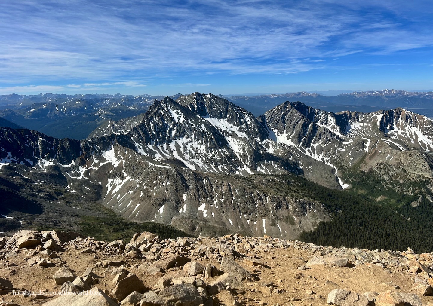
I haven’t done many 14ers in the Sawatch Range, but something I’m learning about the Sawatch summits is that when you’re on them, you’re surrounded by mountain ranges in all directions. We could see most of the remaining Sawatch 14ers, extending to the north and south. We could see west to the Maroon Bells and other 14ers in the West Elk Range. We could see south to the San Juan Mountains and a couple of the northernmost 14ers there. The sky was clear and the views were panoramic!


I do think Mount Eolus remains my favorite of the 14ers I’ve done so far. But the views from the summit of Huron are indisputably stellar.
We spent about 20 minutes on the summit before beginning our descent. Navigating the talus portion was not fun at all – steep and slippery, and my knees did not enjoy it. Thank goodness for hiking poles.
Once we were back to the tundra, it was just a steady hike down, and down, and down some more, all the way back to the trailhead. And we weren’t done yet, because we still had to walk back down the road to our car.


Lucky for us, with about 1 mile (1.6 km) to go, two hikers who had parked at the upper trailhead caught up to us and offered us a ride. They’d been camping in their car overnight and barely had room for us, so it was extremely nice of them to offer. Bouncing down the road in their Jeep – which was a more capable vehicle than ours – confirmed that we’d made the right call by not attempting to drive the road ourselves.
And then it was back down the 2WD road to the highway, and then back home. Even with staying in Leadville the previous night, it was a long day. But it was also a good day! We’d checked another 14er off our lists, and we were already making plans for the next one.
More to come on that in a few weeks.
And on that note, my husband and I are headed off on our next adventure in just a few days, so I’ll be mostly offline for the next three weeks. I look forward to catching up on everyone’s adventures – and sharing more of mine – when I return.
The Important Stuff:
- Getting there: this is the standard route up Huron Peak. It departs from Huron/Lake Ann Trailhead, which is located at the end of Chaffee County Route 390. Any car should be able to make it the first 12 miles (19 km) to the 2WD parking area. Most high-clearance AWD and 4WD vehicles can reach the actual trailhead (2 miles/3.2 km further), though the condition of this road varies throughout the summer, so sometimes a true 4WD high-clearance vehicle will be required. While we probably could have (very slowly and carefully) gotten our Rav4 up there as of June 2026, we opted not to.
- Fees and passes: none.
- Hiking: from the trailhead, this hike is approximately 7 miles (11.3 km) with 3300 feet (1000 m) of elevation gain. From the 2WD parking area, it’s about 11 miles (17.7 km) with 3700 feet (1230 m) of elevation gain.
- Route: a complete and detailed route description can be found here. Before heading off on this hike, be sure to download the 14ers.com app and save the text and photos for offline use.
- Where to stay: there are multiple dispersed campsites along Route 390 on both the 2WD and 4WD sections of road. We did this hike during the week, and most spots were available. On summer weekends, I imagine most fill. There’s also an established campground at the beginning of Route 390, and lodging in Buena Vista and Leadville (which are both about 20 minutes from the turnoff onto Route 390 and about 1 hour from the trailhead).
- Other: as is always the case with 14ers, a significant portion of this hike is above treeline, completely exposed to the weather with nowhere to hide if a storm rolls in. We were lucky to have a day with 0% chance of storms, but this is rare. It’s always good practice to start early (for Huron, that probably means 5:00-6:00am, depending on your hiking speed) and plan to be back down below treeline by 12:00pm.


Leave a Reply