Back in April, fellow blogger The Travel Architect contacted me with an invitation to join her and The Husband on a trip to northern Minnesota to summit the state’s highest point. Initially it seemed like a long shot, but as the logistics of our summer came into focus, I realized we might actually be able to pull it off.
As evidenced by the fact that I’m writing this post, we did!
We’d spent the first few days of our midwestern adventure visiting family and then exploring Wisconsin and Lake Superior. This blog buddy meet-up and high point, then, was the grand finale.
I left off last post at Temperance River State Park, our home base for these final two nights of our trip. The four of us had spent the evening getting to know each other (which is a somewhat weird experience when you already sort of feel like you know each other) and finalizing the logistics of our hike, and we were up fairly early the following morning for our high point attempt.
(Early by normal standards, I should clarify, as this trip made me realize that Colorado has completely skewed my perception of what’s considered an early start to a hike.)
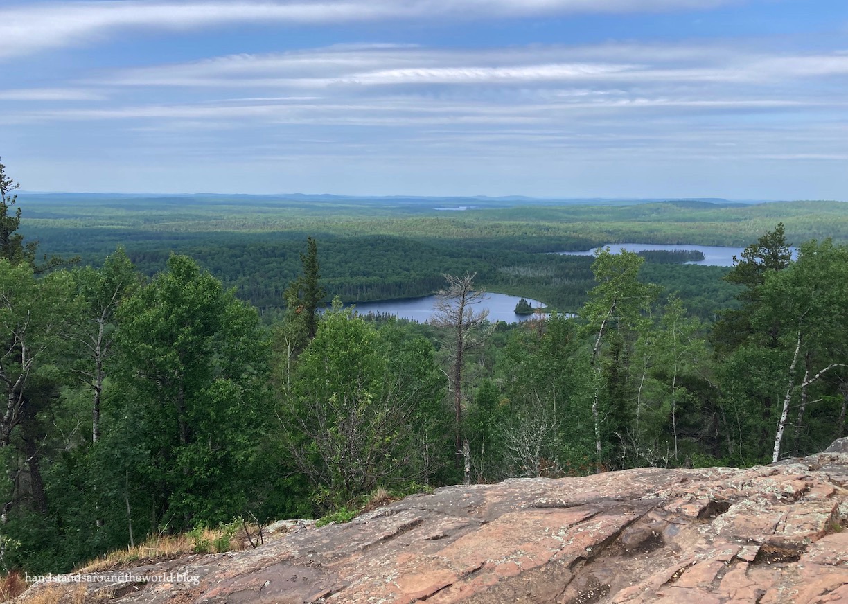
The trailhead for Minnesota’s highest point – a 2301 foot (701 m) hill called Eagle Mountain – is about an hour north, situated in the southern portion of the Boundary Waters Canoe Area (BWCA). This vast expanse is a largely roadless wilderness, over 1 million acres of rolling tree-covered hills rising between hundreds – if not thousands – of lakes.
But more so than hills and lakes and trees, our time in BWCA was defined by mosquitoes. Roughly 9 million of them, all of which quickly set upon the four of us as soon as we exited the car. Coating ourselves with DEET warded off most of the bites, but we spent the entire day swatting at the swarms of them that insisted on following us up the entire trail. They were persistent little buggers, never giving up in their search for the tiniest sliver of non-DEET-covered skin. One of them even found its way up my nose, which was perhaps the most unpleasant experience of the day.
It quickly became clear why ours was one of the only cars in the parking lot. Everyone else hoping to stand on Minnesota’s highest point is clearly smart enough to wait until September when all the mosquitoes are dead.
Lesson very much learned.
But here we were, having made our way up north at the end of June, so we were just going to have to make the best of it. Thankfully, we had excellent company and all manner of conversation topics to distract us from what would have otherwise been a pretty miserable hike.
The trail was a mixture of rocks and roots, with pockets of mud and some rather soggy and uneven boardwalks thrown in. It was the kind of thing where if one person stepped onto a plank that you were already standing on, the entire thing would shift and threaten to dump you right into the murky water below.


At last, we reached a rock outcrop on the side of Eagle Mountain, with a large enough opening in the trees to have a bit of a view and enough of a breeze to blow away the mosquitoes. For the first time, we were able to stop and take a break without being eaten alive.

Unfortunately, this was not quite the summit, so back into the trees we went. The mosquitoes found us immediately, buzzing endless circles around our heads as we tried to figure out which of the various unlabeled trails led to the actual highest point.
There were a few wrong turns before we located the plaque marking the summit. It’s right smack in the middle of mosquito territory, so we paused only long enough to take a few photos before fleeing back down the trail toward the viewpoint for a few more minutes of reprieve.


And then it was back into the mosquito swarms once more, hustling our way down Eagle Mountain and back to the trailhead as quickly as possible.
Goal accomplished, we then spent the afternoon at a blissfully mosquito-free winery/cidery, enjoying some food and drinks and conversation to wrap up our final day on Minnesota’s North Shore.
I’m so glad we were able to make this trip happen! Though perhaps any future meet-ups will occur in the relatively mosquito-free mountains of Colorado instead.

Truly, this was the most mosquito-filled hike of my life. It was awful. But I take comfort in the knowledge that the remaining 35 high points can’t possibly have more mosquitoes than this one.
The Important Stuff:
- Getting there: there are two starting points for this hike – Eagle Mountain Trailhead and Brule Lake Trailhead, the latter of which is more than twice as long. We started at Eagle Mountain Trailhead, at the intersection of Forest Service Routes 153 and 158. The roads are dirt but passable by any car.
- Fees and passes: there are no fees required to hike this trail, however one member of each group should fill out a free day-use permit at the trailhead as this helps the Forest Service track usage of the trail.
- Hiking: the round-trip distance from the Eagle Mountain Trailhead was 6.9 miles (11.1 km) with 570 feet (175 m) of elevation gain.
- Where to stay: while many people stay overnight in the BWCA – accessing the sites either on foot or by canoe – I absolutely don’t recommend doing so in the summer as you’ll be eaten alive by mosquitoes. Find a hotel or campsite on the shores of Lake Superior, where the wind will keep the mosquitoes at bay, and plan to just drive to the trailhead for a day hike.
- Other: mosquitoes, mosquitoes, mosquitoes. Slather yourself in DEET or, better yet, do this hike in the mosquito-free offseason.
Leave a Reply