Every year, my husband and I try to get out for an overnight backpacking trip in Rocky Mountain National Park. Once you’ve secured your reservation, the park allows you to pick up your permit (in-person) up to 30 days before the start of your trip. Sometimes, this means we pick it up the morning of our trip. Other times – for example, when we’ll need to begin our hike before the wilderness office opens – we pick it up in advance.
This year was a pick-up in advance situation. But we weren’t going to drive all the way to Rocky just to get the permit. If we were going to be there, we were going to hike.
As I’ve mentioned in previous posts, though, June and July were terrible months for wildfires in Colorado, and as the day of our planned hike approached, we were keeping a close eye on the sky. We’d been spared the worst of the smoke up to this point, but the wind was changing direction.

Thankfully, the air quality held out. We arrived at the trailhead to the vague smell of a campfire, and we caught occasional whiffs of it during the first couple hours of our hike, but visibility was decent and the air cleared throughout the day.
The hike to Shelf and Solitude Lakes begins at Glacier Gorge Trailhead, which is best reached via the free park shuttle (unless you want to arrive at 5:00am to secure parking… which we have no interest in doing). We’ve hiked into Glacier Gorge multiple times before, so I won’t recap those details now except to say: follow signs for Alberta Falls, Mills Lake, and Black Lake.

Past Mills and Jewel Lakes, we were now looking for the side trail that would lead us up to Shelf and Solitude Lakes. Because reaching these lakes requires navigating unmaintained trails, they are not on any of the signs. The turnoff onto this unmaintained route is also unmarked, though it’s shown on some maps.

I’m always a little nervous for hikes on unmaintained trails, because you never quite know what you’re getting into. I’d read some personal accounts online in preparation, many of which mentioned how difficult it was to locate the trail, so that was my biggest concern.
And in fact, finding the beginning of the trail was not easy. If not for my maps app, we would’ve walked right past it because it’s barely visible.


Just a few steps down the trail, we found ourselves at the banks of Glacier Creek. There is no bridge here, of course, but three large flat boulders form a route across… assuming you’re willing to jump.
My husband, with his long legs, had no trouble making it across. I didn’t struggle with it on the way there. I did find getting back to be a little more difficult because the first jump requires you to go not just forward, but also slightly up. My husband gave me a hand, though, and I was able to make it.
Anyway. Once across the creek, the trail begins to climb. Steeply. And it really doesn’t stop until the first lake, gaining just over 1000 feet (305 m) in 0.5 miles (0.8 km). Yes, you read that correctly. I’m fairly certain this is the most unrelentingly steep thing I’ve ever hiked.
It was also the most rugged unmaintained trail we’ve ever been on in Rocky. You really have to work for this one.


I was in the lead for most of the ascent, which meant I ended up with the highly undesirable job of “spider web breaker.” It was clear no one had been up the trail in front of us, meaning the strands of silk the resident arachnids had strung from branch to branch in the past few hours were still fully intact, waiting for me to walk into them.
My husband definitely got the better end of the deal through this stretch.
With his longer legs, it was also much easier for him to navigate the giant steps formed by roots and rocks along the trail.
I will say, though, my shorter height was an advantage when it came to wedging ourselves beneath fallen trees.


Like I said… you really had to work for this one.
(The plus side of being crazy enough to work this hard to see a couple of lakes: having both of them completely to ourselves while hundreds of hikers flooded the trails below. Once we left the main trail, we saw nobody else. I’m fairly certain we were the only people that visited the lakes on this particular day.)
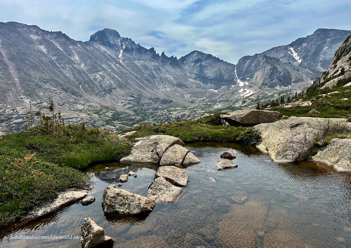
Within about fifteen minutes, we were beginning to have some expansive views of Longs Peak, Keyboard of the Winds, and the upper Glacier Gorge area. A few years ago, we backpacked into Glacier Gorge and day hiked up to the four lakes in the upper gorge. It was neat to look across at those lakes now.

Within about forty minutes, the terrain opened up and we found ourselves navigating boulders rather than fallen trees.


And finally, an hour after departing the main trail and crossing the creek, we reached the top of the “shelf” upon which Shelf Lake sits. We weren’t quite there, though; we still had to walk through the krummholz surrounding the lake. Thankfully, the path was pretty obvious.

At last, Shelf Lake came into view!


We decided to continue on to Solitude Lake first and return to Shelf Lake after. To reach the upper lake, you have to cross Shelf Creek. There are two fairly obvious spots where this can be done via rock-hopping.


From here, it’s just a matter of making your way up the rocks to the left of the waterfall. On the way up, we stayed further to the left. On the way down, we were closer to the waterfall. I don’t necessarily think one was better than the other. The terrain is all pretty straight-forward.
And speaking of the waterfall – which we’ll call Shelf Falls, since I can’t find an official name for it – I actually think it’s one of the best waterfalls in the park. Rocky is not necessarily known for its waterfalls, and this particular waterfall didn’t have that much water flowing over it. But we both really liked it.


About 0.2 miles (0.3 km) and 200 feet (60 m) above Shelf Lake, we reached Solitude Lake. It really is an accurate name; the lake is tucked back in the uppermost reaches of the gorge, surrounded by Arrowhead Mountain, McHenrys Peak, Powell Peak, and Thatchtop Mountain.


We enjoyed a snack on the eastern end of the lake, relaxing for a while before heading back down to Shelf Lake.


Normally, when it comes to alpine lakes, I’m very much on team “the higher the better.” But in this case, I actually found myself more drawn to Shelf Lake. With the waterfall in the background and greenery on three sides, it appealed to me more than Solitude Lake.


Left: elephant head
Right: king’s crown
We couldn’t linger for much longer, though. We’d already been up here for an hour and a half, and clouds were moving in. We definitely didn’t want to be above treeline if it started to storm, and we also didn’t want to be slipping and sliding our way back down a wet trail. It was slippery enough when dry.


We did have trouble finding the trail in a couple places during the descent. In both cases, we were able to locate it with the help of the GPS. And in both cases, our difficulty turned out to be due to a fallen tree blocking the path.
It had taken us an hour to ascend from the creek to the lakes, and it took about 50 minutes on the way back down. It’s slow going on terrain this steep.
After being completely alone for the last 3.5 hours, the sudden influx of people on the main trail was a bit jarring. Still, we made good time back to Mills Lake and then escaped the worst of the crowds by taking the bypass trail back to the trailhead.
With a line of hikers in front of us, we had to wait about 20 minutes for the shuttle back to our car. But all in all, the crowds weren’t overwhelming.
The truth is, there’s no way to visit this area of Rocky in the summer and not encounter crowds. But if you’re willing to climb straight up a mountainside on an unmaintained trail, it’s possible to escape the crowds for a few hours.
That said, I think this is a one and done hike for us. The lakes were pretty, we loved the waterfall, and we had views of upper Glacier Gorge and Longs Peak that we wouldn’t find anywhere else. But there’s no getting around how brutally steep the ascent is.
Been there, climbed that, don’t need to climb it again.
Up next: a much less strenuous hike in the Indian Peaks Wilderness
The Important Stuff:
- Getting there: this hike departs from the Glacier Gorge Trailhead on Bear Lake Road; consider leaving your car at the park-n-ride and taking the free shuttle to the trailhead, as the parking lot typically fills by 5:00am in the summer. From the trailhead, follow signs toward Alberta Falls, Mills Lake, and Black Lake.
- Fees and passes: there is a $30/car daily or $35/car weekly entrance fee to RMNP; America the Beautiful passes are accepted. From May-Oct, if you arrive after 5:00am you will also need a timed entry + reservation to access this trailhead.
- Hiking: round-trip distance to Shelf and Solitude Lakes from Glacier Gorge Trailhead is 9.2 miles (14.8 km) with 2205 feet (670 m) of elevation gain. 1100 feet (305 m) of that gain is in the final 0.7 miles (1.1 km), which travels through steep, rocky terrain and requires strong route-finding skills to remain on the trail.
- Other: while the first 4 miles (6.4 km) of this hike is straightforward, the final 0.7 miles (1.1 km) is not. It’s absurdly steep, there are downed trees and rocks to navigate, and it requires solid route-finding skills. I would not recommend this hike for beginners or for those with limited experience hiking trails that are marked only by rock cairns.
- Also: wear pants and maybe even a long-sleeved shirt on this hike. I came home with a nasty scratch on my arm and multiple bruises on my legs.
- For more information on visiting Rocky Mountain National Park and navigating the timed entry system, shuttle system, and trails, see this post.


Leave a Reply