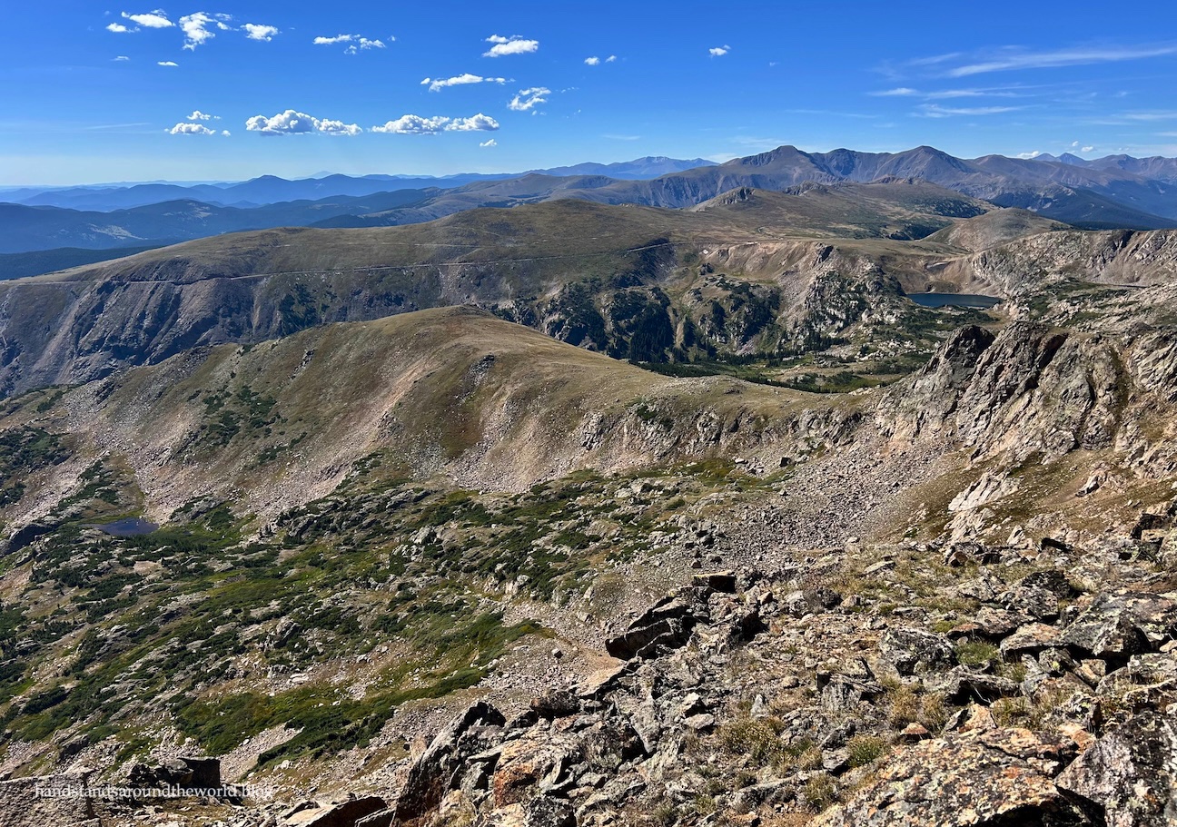
Like me, Chelsea always aims to go for a hike (or some other sort of outdoor adventure) on her birthday. Sometimes, it works out that I’m able to join her. This year was one of those times.
Our destination: Rollins Pass, high in the Indian Peaks Wilderness. There were a couple peaks she was hoping to summit as well as some historical remains she was hoping to find. I was happy to be along for the ride.
So off we went, bumping and bouncing our way up Rollins Pass Road from the west side, on what turned out to be a long, annoying, and at times challenging route. Twelve miles (19 km) of dirt road separated us from our destination. Parts of the road weren’t too bad, but parts of it pushed her Subaru almost to its limits. She’s a much more confident driver than me; I’m not sure I would have made it. But Chelsea got us there.

After our hour-long bumpy, rocky, and largely unenjoyable journey, we reached the parking area at the top of the pass. The Continental Divide Trail (CDT) crosses through here, with other trails and old roads branching off in various directions. It turns out there’s quite a bit to see and do at Rollins Pass.

The 12,832 foot (3911 m) Skyscraper Peak was the longest of our three planned hikes, so this was our first destination.
We began on the High Lonesome Trail, an 18 mile (29 km) stretch of the Continental Divide Trail. I’d actually hiked this section of trail before as part of the High Lonesome Loop, but it’s so pretty that I had no complaints about hiking it again.


After about 1.7 miles (2.7 km), we branched off toward Skyscraper Peak. There’s not a trail, but as long as we followed the ridgeline, we’d get there. There was a bit of up and down, but overall it wasn’t a terribly difficult walk… until the very end, where there’s a short section of scrambling required to reach the true summit.


We went up and over the false summit on the ascent and stayed lower on the descent, and both worked just fine. Lower was better, though, for purposes of not gaining and then immediately losing some elevation.

The combination of a summit with views of lots of lakes made this a great hike for the two of us, given my love of lakes and Chelsea’s love of peaks. With the summit rock pile as our windblock, we were able to enjoy the views for a few minutes while refueling and figuring out our plan for the remainder of the day.


There’s not much to say about the descent, as we just (approximately) retraced our steps back to High Lonesome Trail and then back to the car.

From here, Chelsea’s next goal was the remains of some Native American game runs on the high point to our south. Having returned from two weeks at sea level only a week ago, I wasn’t feeling up for this ascent, so we decided to briefly part ways. She went up, while I set off to the east on the mostly flat walk out to the trestles from the old Denver, Northwestern, and Pacific Railway that used to travel up and over Rollins Pass.


I can’t imagine these wooden structures supporting the weight of a train, though thankfully they were intact enough to safely support a person.

We arrived back to the car at almost the same time, at which point it was time for the final hike of the day: Mount Epworth. This 11,847 foot (3611 m) peak is best reached from the Corona Lake Trailhead, located about 1 mile (1.6 km) back down Rollins Pass Road. So we bumped and bounced our way down to the parking area and then set off on the Corona Lake Trail.

We’d seen a moose in the willows during the drive, though thankfully he was well uphill of the trail. We also encountered a couple hiking back out who mentioned seeing a bear about an hour earlier. We later spotted a second moose off in the distance, but we never saw the bear.
This trail begins by going down, which is never my favorite. We dropped about 200 feet (60 m) to the shore of Pumphouse Lake, at which point we left the trail and contoured around the end of the lake and then diagonally up the northeast slope of Epworth Peak. Wherever possible, we avoided the rockiest terrain, though by the time we were nearing the summit that was no longer an option.


From the summit, we decided to take a more direct route down, sticking to the east side of the peak and zigzagging across the grassy slope above the lake. It was really steep, but we made it back to the lake. I think our route up was preferable, though.

From the lake, we regained the trail and then huffed and puffed our way through the final ascent back to the car.
And that was it. We’d hiked almost 10 miles (16 km), summitted two peaks (three for Chelsea), seen two moose, and spent the day frolicking in the fresh mountain air.

I hadn’t lost as much acclimation as I feared after two weeks at sea level, but I was definitely feeling the effects of a day spent at elevation. Now it was time to head home for some well-earned beer, mac & cheese, and a nap.
Up next: a challenging but rewarding hike to Gore Lake


Leave a Reply