After 8 years in Colorado, I’m no stranger to last-minute changes of plan due to weather. But this was absolutely the most last-minute change I’ve ever made. In fact, Chelsea and I were nearly two hours into plan A when we bailed and scrambled to find a plan B.
We were already running an hour behind schedule thanks to heavy rain and traffic, and we were now sitting in miles upon miles of standstill traffic due to a crash and subsequent road closure that was predicted to last at least another hour.
Our three hour drive was now going to be a five hour drive (or, as it turned out, six hours; the road actually ended up being closed for two hours), which would put us at the trailhead to set up our tent well after dark… assuming we could even find a spot to camp. So we gave up, drove back home, and decided to try a closer 14er in the morning.
Truth be told, though, the idea to climb Pikes Peak didn’t come out of nowhere. It’s a 14er neither of us had climbed, but one we’d talked about tackling before. In fact, a couple years ago we’d had plans for a summit attempt but had to cancel due to weather. Long story short, it had been on our radar for a while, so it made for a good plan B.
That said, neither of us went into this hike with very high expectations. In addition to two trails, there’s a road and a cog railway to the summit of Pikes Peak. And while these options make the peak more accessible for those who aren’t able to hike up to 14,000 feet (4267 m), I’ve climbed mountains with roads to the summit before and it makes for a very different summit experience.
(Nothing against the road or railway, though. My husband and I have ridden the cog railway to the summit, and while I don’t feel the need to do so again, it was a fun experience!)
Something I don’t think most people realize about Pikes Peak is that it’s a truly a massive mountain. It’s far from the tallest of Colorado’s 14ers, but it has a huge footprint, especially when viewed from the side (which is not the view you typically see). There are no short routes to the summit of a mountain this size.

The 15 mile (24 km) roundtrip Crags route is the shorter of the two, though, so for us that was the obvious choice.
We pulled into Crags Trailhead just shy of 7:00am and were on our way shortly after. The temperature was barely above freezing and the ground was covered in a layer of frost. Had we slept in a tent at the trailhead of the other peaks, as we’d planned to, we’d have been so cold we probably wouldn’t have actually slept.
More proof that we’d made the right decision with our last-minute change of plans.


Crags Trail begins at an elevation of approximately 10,000 feet (3048 m), which meant we’d be in the trees for a while. We were approaching peak fall colors, and there were a few aspens along the trail that added some nice pops of color.


As we climbed, breaks in the trees gave way to views across the landscape, including the Sawatch Range peaks we’d been planning to climb. Even from such a distance, we could see they were covered with quite a few inches of snow – a final confirmation that we’d made the right decision by turning around. Clearly, the universe had been looking out for us.
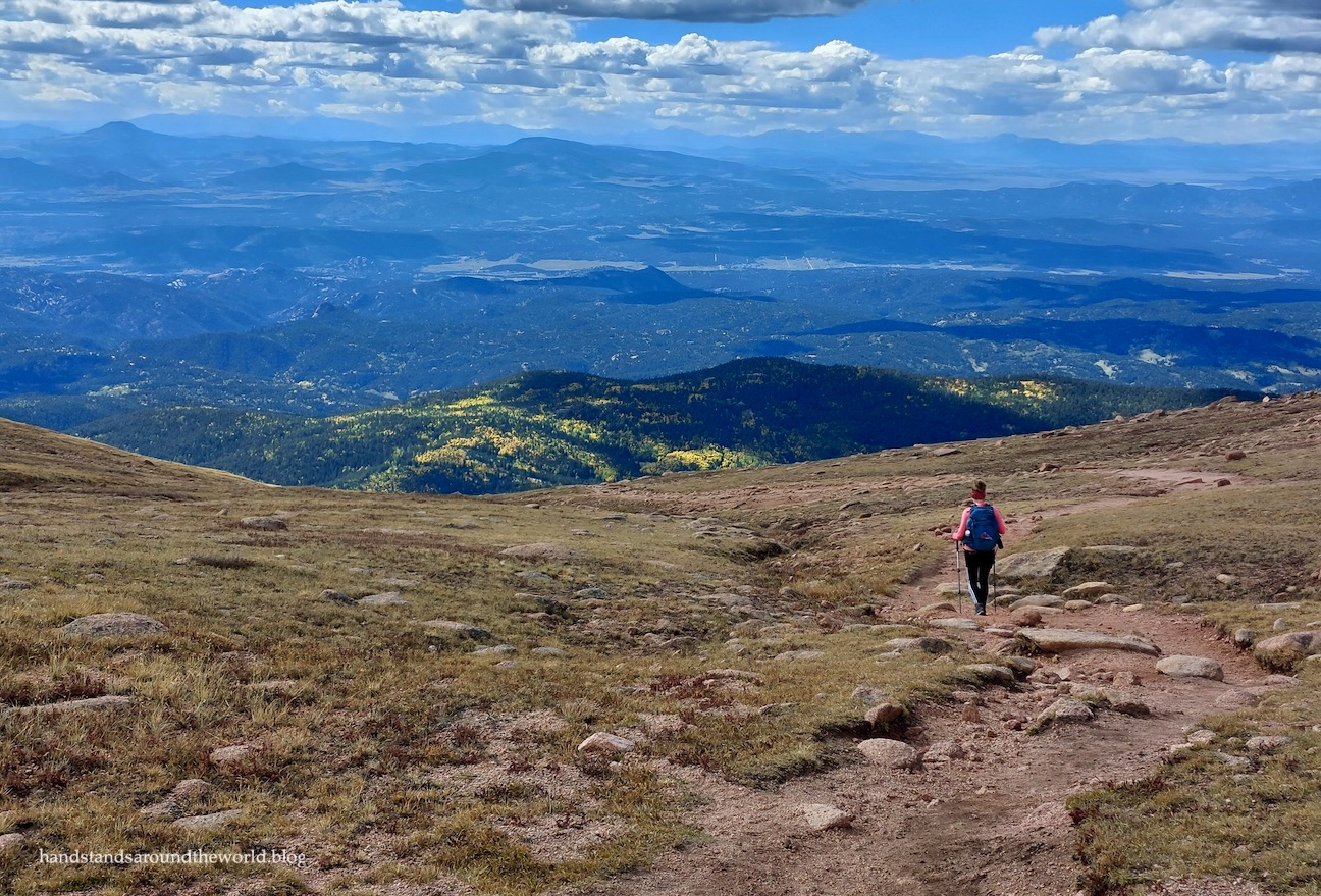
We could also see pockets of aspens amidst the pines, bright yellow and illuminated by the sun. The weather was clear and calm; despite the chilly morning, we really couldn’t have asked for a better day to be up high. The entire day, there was hardly any wind.

As we climbed higher and higher, the trees disappeared entirely, and we reached my favorite part of every 14er hike: the tundra. The summit of Pikes Peak was visible now, nearly 3 miles (4.8 km) away still – we had a lot of hiking ahead of us. I enjoyed it, though, as this meant 3 miles of expansive alpine views.

After the high point in the photo above the terrain flattened out for a bit. This gave us a chance to catch our breath so that once the ascent began again, we were feeling at least a little bit refreshed.


For the next hour or so, Chelsea and I made our way across the endless expanse of Pikes Peak, finally reaching the unique rock features of Devil’s Playground.

This is also where we intersected with Pikes Peak Road for the first time. While the sudden influx of traffic and people was a bit jarring, having an actual bathroom to use was nice.
From here, the trail crosses the road and continues to gently undulate across the landscape for about another mile. Much of this stretch does roughly parallel the road, so it’s not the quietest or most peaceful segment of trail. But there wasn’t too much traffic.


The trail veers away from the road a bit, comes back to it, and then diverges a bit for the final climb: about 200 vertical feet (61 m) of talus and, on this particular day, a light dusting of snow. Thankfully it wasn’t too slippery, because it wasn’t enough snow for microspikes to be of any use.

Finally, almost 5 hours after setting foot on the trail, Chelsea and I reached the summit of Pikes Peak.
And honestly? I was too tired to care that the summit area was full of cars and people. I really just wanted to sit in the visitor center for a bit and enjoy some donuts and hot chocolate before having to hike more than 7 miles (11 km) back to the car.
So that’s exactly what we did. Thankfully, it wasn’t too difficult to find a seat at the café, and the hot chocolate and donuts definitely hit the spot. The donuts are actually baked right there on the summit – no small feat, given the impact elevation has on the chemistry of a recipe.

Sufficiently refueled, we headed outside to walk around the summit area. It’s a large summit, with multiple viewing platforms plus a summit marker. We didn’t end up making it all the way to the southern edge, but we walked most of the rest of it.


(Updated survey technology recently measured the summit at 14,109 feet/4300 m, but the official summit sign still shows the previous elevation of 14,115 feet/4302 m)
After about an hour, though, we knew it was time to head down. We had a lot of miles ahead of us. Thankfully, once we got through the snow-covered talus, we were able to make pretty good time.


It was about 4:30pm when we made it back to the car. All in all, we’d maintained a decent pace for such a long hike.
It was also a hike I’d enjoyed far more than expected – perhaps because I went into it with such low expectations. But the scenery and neat geology really surprised me.
Don’t get me wrong; it was utterly exhausting. Hiking 7.2 miles (11.6 km) up a 14er was tiring enough, but then having to turn around and hike 7.2 miles back down?
Brutal.
But we did it. Another 14er checked off the list!
Up next: 48 hours in Brooklyn, New York
The Important Stuff:
- Getting there: Crags Trailhead is located about 3 miles (4.8 km) up County Road 62/Forest Service Road 383 outside of Divide, CO. The road is dirt but pretty well-maintained; we had no problems in our Subaru and even a sedan probably could have made it with careful driving, at least in dry weather. The parking lot was half full when we arrived just after 7:00am on a Saturday in September.
- Fees and passes: none
- Hiking: this hike is about 15 miles (24 km) roundtrip with 4550 feet (1385 m) of elevation gain.
- Route: a complete and detailed route description can be found here. Before heading off on this hike, be sure to download the 14ers.com app and save the text and photos for offline use.
- Where to stay: we did this as a day hike, but Crags Campground is just up the road for a convenient overnight option. For lodging, there are hotels and rentals in Divide, Woodland Park, and Colorado Springs.
- Other: Crags Trail is the shorter of the two routes up Pikes Peak, but it’s by no means an easy option. It’s long, with a lot of time spent at high elevation (we were above 12,000 feet/3655 m for nearly 6 hours). It’s a full-day commitment. Start early and plan to be back below tree line by noon due to risk of afternoon thunderstorms.


Leave a Reply