I’m just going to come right out and say it: this might be the most underrated waterfall in Rocky.
Given the deluge of rain we received in May and early June this year, I figured it would be an optimal time to hike to a waterfall. And boy, was it ever.
Of course, we also hiked through quite a lot of mud and water just to get to the waterfall. But it was absolutely worth it!
The shortest route to Bridal Veil Falls is via Cow Creek Trailhead, which is down a well-maintained dirt road on the eastern border of Rocky. There are only about twelve parking spaces at the trailhead so an early start is necessary.
Our planned 6:30am arrival time was thrown into chaos about halfway to the park, however, when we encountered an unannounced road closure with no detour signs, meaning we didn’t know how extensive the closure was and – therefore – the best way around. Our first attempt was met with more ‘road closed’ signs, but fortunately our second attempt brought us out on the other side.
Luckily, we ended up at the trailhead only about 15 minutes behind schedule and secured one of the last parking spaces.
The Cow Creek Trailhead is located at the former headquarters of McGraw Ranch, an old cattle ranch that is now owned by the National Park Service. The buildings have been converted into work and living spaces for researchers and volunteers; only the bathroom is open to the public.

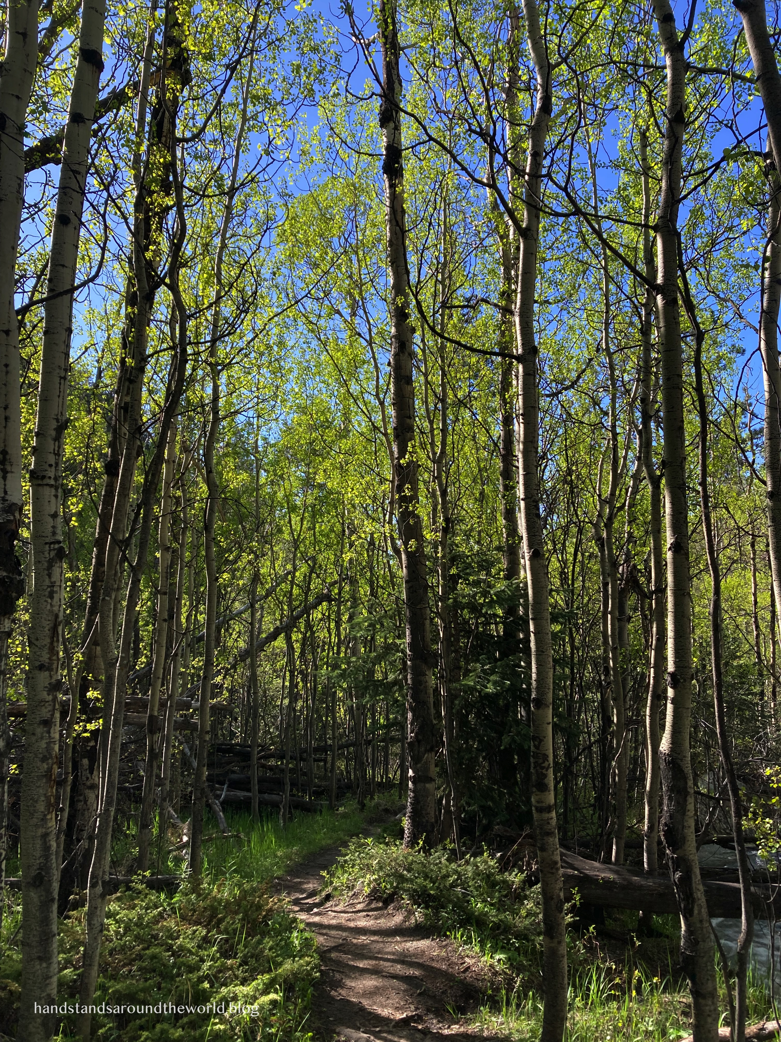
From the trailhead, you have two options: turn right onto the narrow, minimally-used North Boundary Trail or follow the Lower Cow Creek Trail straight toward Bridal Veil Falls. We went straight. At this point, we were walking on what used to be a road.
This hike can best be divided into three approximately equal segments. The first mile (1.6 km) is mostly flat and, aside from a few puddles, the trail is in good condition. The landscape is more open, with a few bright green aspen trees and hundreds of wildflowers blooming.


This section ends at the junction with the North Gem Lake Trail; stay right on the Lower Cow Creek Trail and continue for approximately another mile. This is actually a section of trail I’d hiked before as part of the Lumpy Ridge Loop, though it looked quite different in June than it had in October.
This second mile was a little muddier, including one section with extremely deep mud that we really had no choice but to just walk right through since the trail was too narrow to walk around. Some steps, my entire foot would sink in. I ended this hike with very muddy shoes and extremely wet feet.


At the final junction, stay right toward Bridal Veil Falls.
This final 1.2 miles (1.9 km) of the hike was one of the wettest sections of trail I’ve ever hiked in my life. Cow Creek was overflowing, and at one point I actually couldn’t find the trail because it looked like a creek. One of the creek crossings was super sketchy as well because the water was right up to the bottom of the bridge.


But we did it, and soon we caught a glimpse of the waterfall through the trees. Getting to the base of the falls requires a bit of scrambling. This was my least favorite part of the hike because the rocks are slanted and they were a little wet, and a fall would have sent us sliding right into the creek.
Fortunately, we were able to find solid footholds and make our way across.
Once we did, we found ourselves staring at a truly massive volume of water. Another couple was leaving just as we arrived and they told us they’d been to the falls multiple times and this was the most water they’d ever seen. I have no trouble believing that. In particular, we were amazed by how much the water was splashing back up at the bottom.


We spent about 25 minutes enjoying the waterfall (and the solitude), and I could have stayed longer except we were in the shade and it was getting chilly. So we re-traced our steps, back across the sketchy rocks, over the bridge with the creek raging just beneath our feet, and through all the water and mud once more as we made our way back toward the trailhead.

Colorado isn’t exactly known for its waterfalls, and the ones we have don’t even come close to the towering beauty of Yosemite Falls or the immensity of Niagara Falls. But I really enjoyed this one, and I liked even more that it was off the beaten path and we were there all by ourselves.
Later in the season there would be much less water, and while that would mean the trail would be dry, the falls itself would also be much less spectacular. I’m glad we went when we did. Even if we did end up with dirty pant legs, soaking wet socks, and mud-caked hiking boots.
The Important Stuff:
- Getting there: the most direct route to the falls is from Cow Creek Trailhead at the end of McGraw Ranch Road north of Estes Park. The longer route leaves from Gem Lake Trailhead, located off Devils Gulch Road.
- Fees and passes: there is a $30/car daily or $35/car weekly entrance fee to RMNP; America the Beautiful passes are accepted. From May-Oct, if you arrive between 9:00am-2:00pm you will also need a timed entry permit to access this trailhead. Since you do not pass through an entrance station, both items should be displayed on your dashboard.
- Hiking: roundtrip distance from Cow Creek Trailhead is 7.1 miles (11.4 km) with 1150 feet (350 m) of elevation gain.
- Other: arrive early to secure parking, and please obey the ‘no parking’ signs. Also, especially if hiking this trail in the spring or early summer, wear shoes you don’t mind getting wet and muddy.
For more information on timed entry permits, hiking, and the park in general, see my post on visiting Rocky Mountain National Park.
Leave a Reply