The Spruce Creek Trail to Mohawk Lakes is one of the most popular hikes near Breckenridge, Colorado. Generally, we try to avoid extremely busy trails such as this one. But some hikes are pretty enough that you just have to suck it up and brace yourself for the crowds.
We hoped that arriving early morning in November would result in slightly fewer people. It mostly did. The parking lot was completely overflowing by the afternoon when we returned to the car, but we had a pretty peaceful morning hike.
There are two options for where to begin this hike. Most people park at Spruce Creek Trailhead. However, there is a very rough road up to an upper parking area. Reviews said high clearance 4WD required and we never quite know where our Subaru stands with that designation. We decided to just park at the trailhead, and after walking along the road I can say that we made the right decision.
From Spruce Creek Trailhead, the hike begins either off to the left on Spruce Creek Trail, or you can walk up the 4WD road to the upper parking lot. We took the trail on the way up and the road on the way down; the road is about 0.5 miles (0.8 km) shorter but also steeper. Either way, you’ll begin a fairly steady climb, never straying far from Spruce Creek.

After 2 miles (3.2 km) we reached the upper lot and followed the signs to continue on the Spruce Creek Trail. The trail up to this point is almost entirely in the woods, with the exception of a moderately-sized clearing containing a small pond.


After a short distance, the path begins to zig zag as it climbs more steeply alongside Continental Falls. This is a tall, multi-tiered waterfall that was partially frozen by this point in the season. There are multiple points at which to view the different tiers of the falls. There are also some old mining remains in this area.
The trail through this area is unfortunately very confusing. There are so many social trails and different paths out to the falls that it’s next to impossible to figure out which one is correct. We tried our best using our GPS app but I’m not entirely sure we succeeded. Regardless, as long as the path you’re following is heading up and you keep the creek on your right, you’ll get there eventually.


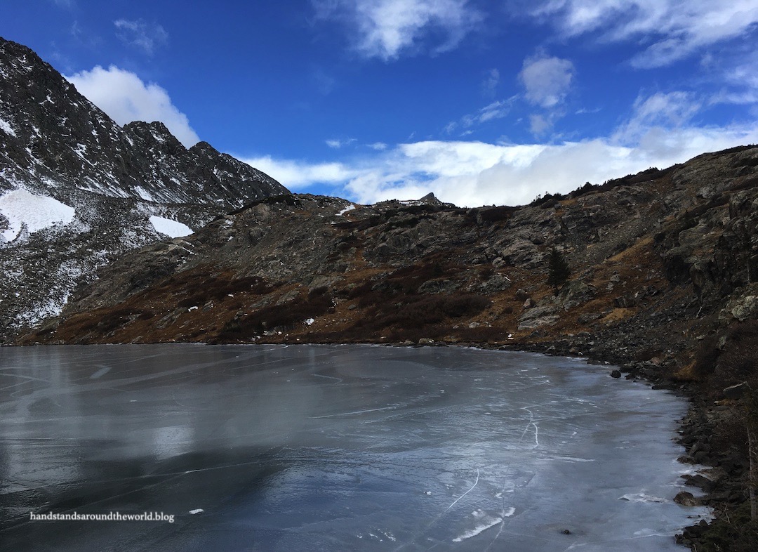
Once above the falls, it’s just a short distance to Lower Mohawk Lake. The lake was partially frozen, its numerous boulders protruding from the ice. It was here that we also spotted the first 2 of an eventual total of 6 mountain goats of the day, high on the mountain to the right of the lake.


Most people only go as far as Continental Falls and the lower lake. We, however, had a more ambitious goal. There are five more lakes up above and our plan was to hike to all of them.
Next is Upper Mohawk Lake, located about 0.5 miles (0.8 km) and 300 feet (91 m) beyond the lower lake. This section of the trail was steep and icy, forcing us to don our microspikes for the first time in months. Definitely plan for snow and ice if you complete this hike in the offseason!


Upper Mohawk Lake was partially frozen as well. There are lots of great snack spots on the shore so we spent some time here enjoying the beautiful scenery and the fresh high mountain air.


We really loved the ice on this lake, especially as we continued on the trail to a view from above. We both agreed that it looked like someone had taken a Zamboni for a joyride.

Very few people make the trek to the upper lake. Of those that do, a vast majority don’t go any further. Beyond this point, we only saw one other person. The trail continues to the right of Upper Mohawk Lake, zig zagging up a hill and through some bushes before opening to a fairly expansive view and a small lake. It doesn’t seem to have an official name; I’ve dubbed it Lake Four, as the remaining three are called Lakes Five, Six, and Seven.
(And for anyone who is counting, I have no clue where Lake Three is…)


I really really loved the scenery up here. At first glance it might seem dull and barren, but I’ve always found beauty in this kind of high elevation desolation. I’ve never been to Alaska, but it made me think of photos I’ve seen of the remote and rugged Alaskan tundra.

The remaining three lakes were variations on a theme. All were mostly frozen and set against the backdrop of Pacific Peak and Father Dyer Peak. The official trail ends at Lake Six and it’s clear that very few people follow the barely-visible path through the grass up to the final lake. On this particular morning, we saw no one else.


A winter storm was predicted to roll in the next day and the clouds and gusty winds were already poking their way into the area as we explored these uppermost lakes before beginning the trek back to the trailhead. Fortunately neither were a constant presence, making this a pretty beautiful November day in the Colorado high country!
The Important Stuff:
- Getting there: the trailhead is located at the end of Spruce Creek Road off Highway 9 outside Breckenridge, Colorado.
- Fees and passes: none.
- Hiking: from the main trailhead parking area, round-trip distances are: 5 miles (8 km) to Continental Falls, 6.2 miles (10 km) to Lower Mohawk Lake, 7.4 miles (11.9 km) to Upper Mohawk Lake, and 9.7 miles (15.6 km) to Lake Seven.
- Where to stay: this is a long day trip from the plains, or a much shorter drive from the ski towns of Breckenridge, Frisco, Dillon, or Silverthorne.
- Other: this is the most popular hike in the area, so arrive early and/or be prepared for big crowds and a parking nightmare.
Leave a Reply