This happens to everyone, right: you do something wrong and you get corrected and then you can never remember which version is wrong and which one is correct?
As a kid I briefly attended a school named for a Native American chief and, in one of the more embarrassing moments of my time there, I misspelled the word ‘chief’ at the school spelling bee. To this day, I can never remember if it’s spelled ‘ie’ or ‘ei’… as evidenced by the fact that I just spelled it wrong yet again as I wrote the title of this post (thanks, spellcheck!).
Anyway, Chief Mountain is a nice moderate summit (approx. 11,700 feet/3566 m) located about an hour west of the plains. This is a great half-day hike at any time of year; we summitted it once in late April, and I climbed again it with a friend in June a little over a year later.
This post was initially published after the April hike, but it was a fairly different experience in June so I decided it was time for an update.
The Chief Mountain trailhead is located along Colorado Hwy 103, which can be reached from the north via the town of Idaho Springs or from the west via Echo Lake. There’s a large, unmarked pullout on the opposite side of the road that serves as a parking area; a GPS should get you there without issue. To find the trail, cross the road and walk back a short distance until you see the trailhead sign. Beware that it might be completely buried in the winter.
The Chief Mountain trail begins by climbing steeply up the hillside before moderating across the lower slopes of the mountain. The hike itself is fairly moderate, at 3.1 miles (5 km) round trip with just under 1000 feet (305 m) of elevation gain. The trail was fully snow-covered in April, but it’s well trafficked and was packed down. We didn’t need microspikes or snowshoes, though I imagine one or both would be necessary at certain times of the year. In June, the trail was dry.
The trail reaches tree line just shy of the summit and enters into the tundra. Tundra plants are small and fragile, and even just a few footsteps can damage them, so from this point on it’s extra important to remain on the trail. If you have to step off-trail for any reason, be sure to keep your feet on rocks wherever possible. This is also where the wind usually picks up now that you’re out in the open, so have some extra layers handy.
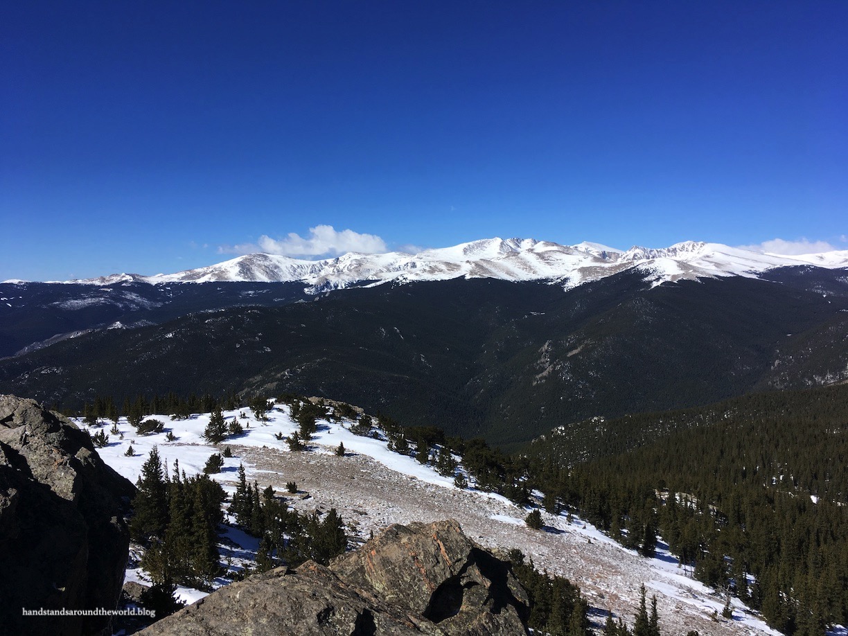
From the summit of Chief Mountain, we had 360° views: Mount Blue Sky rises massively to the west, the Front Range extends to the north and south (we could see south all the way to Pikes Peak!), and the plains are visible to the east. During the April hike, low clouds hung over the plains. In fact, when we left our house we couldn’t even see the mountains and we were bracing for a cold, miserable hike. Instead, we ended up above the clouds, which is always really neat.


From the summit, you can also see nearby Mestaa’ėhehe Mountain. In fact, if you’re looking for something else to do in the area, this would be a good addition to your day. The trailhead is just up the road and it’s not a very long hike either.


And there you have it; a moderate and beautiful Colorado Front Range summit!
The Important Stuff:
- Getting there: the trailhead located on CO Highway 103, 5 miles (9 km) from Echo Lake. Parking is at an unmarked pullout on the north side of the road and the trailhead is on the south side. If you park head in rather than parallel, there’s room for many more cars.
- Fees and passes: none.
- Hiking: 3.1 miles (5 km) round trip and 1000 feet (305 m) elevation gain.
- Where to stay: this hike is not far from the Front Range, so there are plenty of camping and lodging options in the general area, including near Echo Lake and Idaho Springs.
- Other: go early to avoid crowds, and be prepared with spikes and/or snowshoes if you plan to hike this trail in the winter. You may not need them, but better safe than sorry.
Leave a Reply to travelling_hanCancel reply