The wild fluctuations and extremes of mountain weather is something that can be hard to grasp, particularly for someone who hasn’t spent much time in them. Hell, I’ve spent most of my life living near and exploring the mountains, and I still underestimate them from time to time. Mountains do weird and intense things to the weather.
Case in point: the day Chelsea and I hiked Greyrock Mountain, a last-minute change of plans when the weather at our original higher elevation destination was predicted to be cold with 50 mph (80 kmh) winds.
So we headed for the foothills instead, driving a few miles up Poudre Canyon to the Greyrock Trailhead.
(By the way, Poudre is pronounced ‘poo-der’… and yes, that bothers me greatly.)
Greyrock Mountain is by no means the highest mountain in Colorado. It’s not even one of the highest 1000 mountains in Colorado. But in my opinion it’s one of the neatest, as you’ll see in the photos below. At an elevation of about 7625 feet (2325 m), it’s also much more accessible than the high peaks, particularly in the off-season or for anyone not acclimated to the altitude.

This trail is a lollipop loop, with an offshoot that leads to the summit. We headed left first, as this half of the loop has a lot more ups and downs and was better suited to the beginning of the hike when our legs were fresh. The left half of the loop is also very clearly less traveled and less maintained. Sections were somewhat overgrown, and there were at least four giant trees that had fallen across the trail and were not easy obstacles to navigate.


Poudre Canyon has been hard hit by wildfires, enduring two large fires and numerous smaller ones in the past 10 years. We saw the remnants of at least two of these fires throughout the course of our hike.

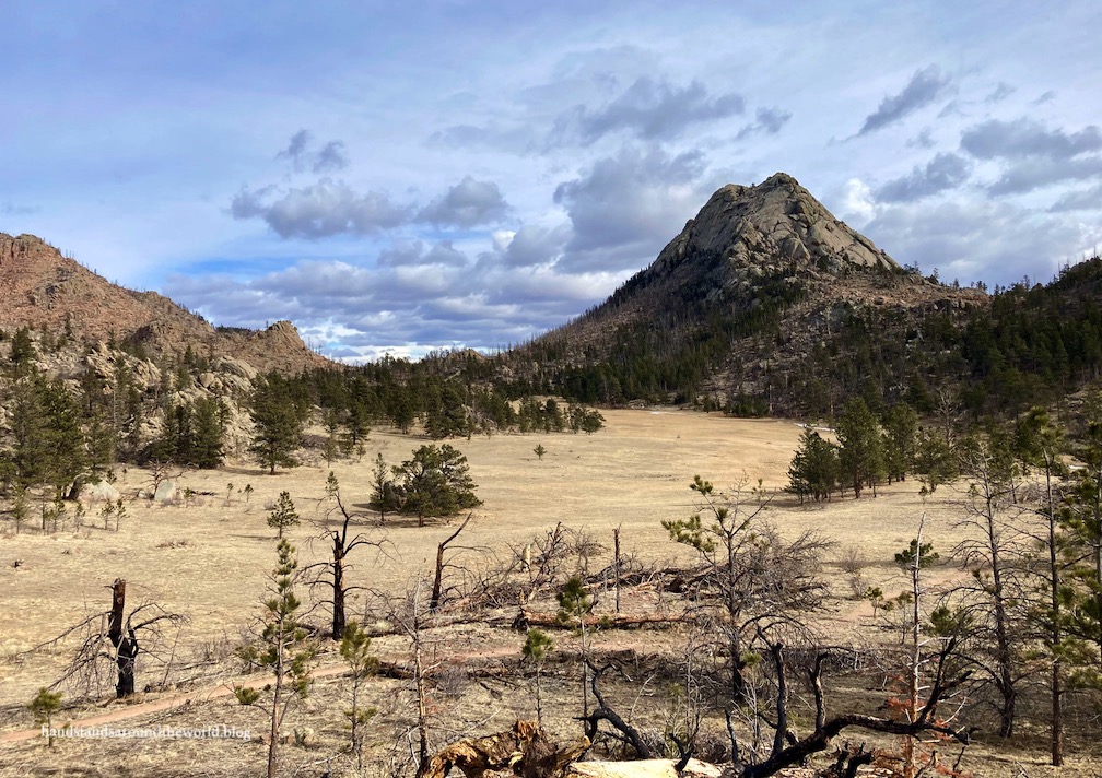
By about the halfway point of this portion of the loop we found ourselves cresting a ridge, which we then more or less followed up to a high point. It was here that we had our first views of Greyrock.


From this point, the trail descends to a meadow. As we looked up at it, Greyrock suddenly appeared very prominent and daunting.


Just beyond the meadow is where the summit trail branches off from the loop. The trail curves around to the opposite side of the mountain – the one part that can actually be ascended without technical climbing. There was some bouldering involved, though, and at times we also had to search for the trail.

Eventually we found ourselves at the top. It’s a wide, flat-ish area with some pine trees and various jumbles of boulders. The actual summit is very obviously the tallest rock pile on the western edge, which can be reached with some easy class 3 scrambling. We had Chelsea’s dog with us and he did struggle a little with some of the scrambling… something to note when deciding whether to bring your pup.


Right around the time we arrived a cold mass of air settled over us, dropping the temperature rather abruptly. That combined with the disappearance of the sun and the periodic gusts of wind made for a chilly summit. We didn’t last long before it was time to seek a sheltered snack spot and then head back down.


Once back to the main trail, we took the other half of the loop back to the car. It was a pretty steady descent, and this section of trail was in better shape. No giant trees to dodge and not as many bushes encroaching onto the path. However, the views of Greyrock from this side are much more limited.

I’m glad we decided to hike the loop in a clockwise direction; it was much more scenic and made for an all downhill hike back to the car!
The Important Stuff:
- Getting there: Greyrock Trailhead is located in Poudre Canyon (CO Highway 14) 30 minutes northwest of Fort Collins.
- Fees and passes: none.
- Hiking: the entire loop was 8.2 miles (13.2 km) with 2427 feet (740 m) of elevation gain.
- Where to stay: this can easily be done as a day hike from anywhere around Fort Collins, and even as far south as Denver metro; for an overnight stay, there are numerous campgrounds in Poudre Canyon and we even saw a couple backpacking sites on the summit.
- Other: Poudre Canyon was the site of an enormous wildfire in 2020 and as a result has suffered numerous mudslides so far in 2021 that have resulted in road closures. Before you go, check to ensure the road through the canyon (CO Highway 14) is open.
Leave a Reply