The Guanella Pass area is moose territory. So when we headed up Burning Bear Trail one January morning, adjacent to an expanse of willows, I was on the lookout.
Just a few minutes up the trail we encountered a fellow hiker who informed us there were four of them just ahead in the willows. Despite our best efforts, we only spotted three of them. It’s amazing how well willows conceal these enormous animals, even in the winter when they don’t have any leaves.
Nonetheless, it’s a good day on the trail when you see more animals than humans. This gentleman was the only person we saw on our entire ascent to Burning Bear Summit.
Aside from the moose, our other animal sighting was a grouse… which scared the bejeezus out of us when it suddenly took flight. I’m sure we startled it too. But in the silence of the forest, its wings were louder than I thought wings could be.
We arrived at the Burning Bear East trailhead just after 8:00am on the last morning of January. The parking area is just up the road from the trail itself, so we geared up and walked along the shoulder to the unlocked gate and signs marking the start of the trail.


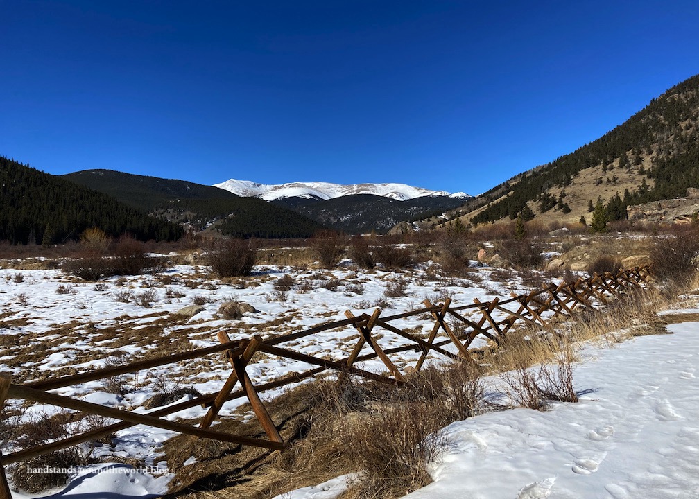
The first mile (1.6 km) or so of trail meanders along the boundary between forest and meadow, crossing Geneva Creek on a nice solid bridge and weaving in and out of the trees. It was in this section that we spotted the three moose. The best views of the hike are also found here.


After curving around to the south, the trail leaves the meadow and enters the forest. Not much elevation gain has been accomplished at this point, but after a fairly flat next mile through the trees, the climb begins and continues fairly steadily to the summit. As we climbed, we caught teasing glimpses of the mountains through the trees; a preview – or so we thought – of the views to come.


The high point of the trail is advertised on the sign as Burning Bear Summit. Technically it is the highest point of the trail, but it’s not your typical summit. There are higher hills to the north and south, and there aren’t any views thanks to the trees. That was a little bit of a bummer… but I guess that’s on me for not adequately researching this trail.


The trail continues from this high point, dropping about 2 miles (3.2 km) to the Burning Bear South trailhead at Hall Valley Ranch. If you have two cars, you can complete this as a point-to-point hike. Or you could start from the south trailhead. Judging by the handful of footprints in the snow, fewer people hike it from that side… whereas our hike was completely snowpacked and we hadn’t needed our microspikes or snowshoes.
By the time we headed down there were a few more people on the trail – I think we passed four other parties. But it was still relatively quiet. The most dramatic part was probably when I tripped over a tree root, almost regained my balance, and promptly slipped on a patch of ice.
Out of sheer luck, I ended up on my feet.

In summary, if you’re looking for a hike with outstanding Colorado views, this probably isn’t it. But if you’re searching for a quiet and peaceful interlude in the forest, Burning Bear Trail would be an excellent choice.
The Important Stuff:
- Getting there: Burning Bear East trailhead is located 5 miles (8 km) from Grant, Colorado on Guanella Pass Road; beware that the uppermost portion of the road closes in winter so you cannot access this trail from the Georgetown side in the offseason.
- Fees and passes: none.
- Hiking: it’s 7.5 miles (12 km) round trip with about 1250 feet (381 m) of elevation gain to Burning Bear Summit from the east trailhead.
- Where to stay: This can easily be done in a day from Denver and surrounding areas. For overnight stays, there are established forest service campgrounds along Guanella Pass and dispersed camping is allowed in marked spots only.
- Other: Parking for this trail is at the Abyss/Burning Bear trailhead lot… note that there are ‘no parking’ signs along the road near the actual start of Burning Bear Trail; please park in the lot.
Leave a Reply