There are numerous canyons extending into the Front Range of the Rockies.
Some are the routes for major highways from the plains into the mountains, but others have been set aside for recreation.
One of the latter is Eldorado Canyon, located just a few miles south of Boulder, Colorado. It’s a narrow canyon with tall walls composed of angular rock slabs – fairly typical topography for this area of the state.

This state park is a very popular place for rock climbing, but there are some hiking options too. Two of the trails are short, easy nature walks along South Boulder Creek, which I have not done. Two climb up the canyon walls to various views of the Inner Canyon section of the park. And the fifth is Walker Ranch Loop, which actually begins outside the park on Boulder County lands but loops into the Crescent Meadows section of the park. I’ve completed all three of these longer trails and will discuss each below.
Table of contents
Eldorado Canyon Trail
Eldorado Canyon Trail departs from the end of the Inner Canyon road (dirt but accessible to most cars in good weather) and ascends roughly 3.3 miles (5.3 km) and 1000 feet (305 m) up to expansive views of the Continental Divide to the west and the plains to the east. It also intersects with the aforementioned Walker Ranch Loop. I’ve hiked this trail twice, both times in the spring, and it was nice and sunny and relatively free of snow and ice.


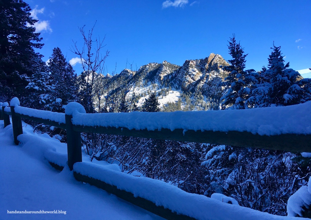
Rattlesnake Gulch Trail
Last winter, a friend and I snowshoed up Rattlesnake Gulch the morning after a fairly sizeable snowstorm, breaking trail through about 8 inches (20 cm) of fresh powder. This trail leaves from a small parking area about 0.5 miles (0.8 km) past the Inner Canyon entrance station and zigzags up the southern canyon wall.
We were the first ones there and saw very few others as we made our way up to a pretty viewpoint and what little remains of the historic Crags Hotel. This hotel was built in 1908 and burned down only 4 years later under mysterious circumstances. The trail follows what used to be a wagon road up to the hotel. It wasn’t exactly a wide trail and the incline is steady… I’m not sure how a wagon would have made it up there.


While this is a main turnaround spot, a 0.8 mile (1.3 km) loop climbs an additional 400 feet (122 m) up to a high point just below a railroad track. It’s still in use; we saw what looked like a scenic train pass by. We opted to complete this loop and were rewarded with some additional views of the canyon as well.


By this point in the morning the sun was blazing and the temperature was climbing, resulting in a fairly steady stream of snow and water tumbling out of the trees and conveniently dripping onto our heads and falling down the backs of our necks. We did our best to dodge the falling projectiles but were largely unsuccessful.
One byproduct of all the snow falling from trees is that some of the blobs would roll down the hill, collecting additional snow as they went. The snow was wet and stuck together in layers, resulting in some pretty neat looking natural snowballs. I wasn’t able to capture the best photos with my phone, but I think you can kind of see what I mean from the photo below.

Walker Ranch Loop
The third longer trail in the park is Walker Ranch Loop, which I hiked with a friend last November. It was a windy day, but once we descended into the trees we were afforded some protection from the elements. There are three different trailheads for this loop; we began at the one off Flagstaff Road.
From here, we traveled in a clockwise direction down to South Boulder Creek, up and around into the state park, back out of the park and down to South Boulder Creek once more, and then a final climb back to the trailhead. It was a fairly moderate 8 mile (12.9 km) loop, made easier by the fact that one of her dogs was pulling me up most of the hills.


Sometimes I have trouble deciding if a place is prettier in the summer or the winter, but with Eldorado Canyon there was no question. I definitely enjoyed it more in the winter, not only due to the lack of crowds, but also because snow-covered scenery beneath the backdrop of the bright blue sky will always be one of my favorite things.
The Important Stuff:
- Getting there: the main entrance to the state park is on Eldorado Springs Drive, just past the tiny town of Eldorado Springs. During busy times of year (summer weekends, mostly), you may need to park elsewhere and take a shuttle into the park.
- Fees and passes: a daily entrance fee or Keep Colorado Wild Pass is required for park entry.
- Hiking: there are 5 trails in the park, ranging from short, flat, and accessible, to longer and steeper (i.e. the three I mentioned above); more info here.
- Where to stay: there is no camping in the park but lodging is available immediately adjacent in Eldorado Springs, and the park is also a relatively short drive from Boulder and Denver.
- Other: access to the park is along a dirt road that can be traveled by most cars; however, in the winter the park may require 4WD or chains to go beyond the entrance station.
Leave a Reply to DianaCancel reply