When I agreed to a Sunday hike up a mountain with Chelsea, I knew it was going to be a busy and tiring weekend. My husband and I already had plans for a hike on Friday, but I’d have Saturday to rest my legs, so I wasn’t too worried.
Except, my husband and I ended up having to postpone our hike until Saturday. And it wasn’t just a casual hike, either. It’s the one I wrote about last week that was nearly 11 miles (17.7 km) long and involved lots and lots of steep scrambling.
I wasn’t going to bail on my plans, though, so I dragged myself out of bed on Sunday morning and headed out to meet Chelsea. Our goal for the day was a 12,939 foot (3944 m) summit in the Arapaho National Forest: Vasquez Peak.
In other words, it was time for some more climbing. My legs were not on board.
Vasquez Peak is located just off the Continental Divide Trail (CDT), meaning there are multiple possible starting locations for this hike. Most, however, are quite lengthy. We opted for the most direct route via the Jones Pass Trailhead.
From here, the trail immediately begins to climb, gaining about 900 feet (275 m) over 1.4 miles (2.3 km) up to its intersection with the CDT. Here, we turned left onto the CDT, also called the Mount Nystrom Trail. We wouldn’t be going all the way to Mount Nystrom, though. We planned to followed the trail for a while and then branch off.
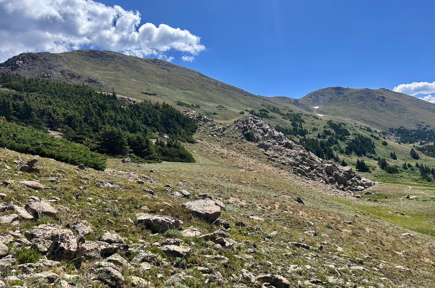
Not long after turning onto the CDT, as we wrapped around the southwest slopes of Vasquez Peak, the forest began to give way to the tundra. Soon, we were surrounded by wildflowers and views.
To our left, we could see across the valley below and up to the other mountains along the Continental Divide (which forms a U-shape here).
Up and to our right was the summit of Vasquez Peak. Actually, we couldn’t see the true summit quite yet. But we could see at least approximately where we needed to go.

Around 11,900 feet (3625 m), shortly after the trail crosses a talus slope, we left the official path behind and headed right. There’s no trail up Vasquez Peak, so we blazed our own path toward the saddle between the official summit and the south summit.

Over the course of the next 0.5 miles (0.8 km), we ascended over 700 feet (215 m) to the saddle. It was very slow going, a few steps up the steep terrain and then a pause to catch my breath. Luckily, we had the views and the wildflowers to distract ourselves from the chill in the air and the lack of oxygen.


It took about 45 minutes to reach the saddle. From there, it was a fairly quick jaunt to the south summit.


Although we were now in the sun, being on top of the ridge meant no protection from the wind. It was cold! We huddled behind a rock pile for a quick snack break and then we were on our way once more, descending back to the saddle and beginning the climb up to the true summit.
There’s no trail but the route is obvious.


Before long, we were standing atop Vasquez Peak, gazing across the mountainous landscape.


The main route off Vasquez Peak is to simply retrace your steps back to the trail. However, Chelsea planned to also tag the west summit, so we headed west off the main summit, carefully picking our way down the rocky ridge to the more solid, grassy terrain below. This led us back down to the CDT.
By this point, my legs were very done so I opted to skip this final ascent. Instead, I found a nice rock outcrop where I could relax, have a snack, and watch Chelsea zigzag her way up to the west summit.


It didn’t take her long; about 30 minutes later, we were reunited and headed back down the CDT.


And that’s about it. It was a straightforward hike back to the car and then a pretty easy drive back home.
I arrived home utterly exhausted after two straight days of hiking. But I was also feeling pretty accomplished. My first summit of the summer was now under my belt. And, after hiking 19.4 miles (31 km) with almost 6000 feet (1830 m) of elevation gain in just two days, I was feeling much more confident about my upcoming hiking trip.
But first, it was time to give my legs a few days to recover.
Up next: it’s time to summit some 14ers!
The Important Stuff:
- Getting there: the Jones Pass Trailhead is located about 2 miles (3.2 km) up Jones Pass Road off US Highway 40. The last stretch of road is dirt, but any car should be able to make it in dry weather. There is no bathroom at the trailhead, but there is one at the Jones Pass Picnic Area at the beginning of Jones Pass Road. For us, it was a BYO toilet paper situation.
- Fees and passes: none
- Hiking: roundtrip distance for me was 8.8 miles (14.2 km) with 2785 feet (849 m) of elevation gain. Exact statistics will vary based on the route you take on the off-trail section and whether you go to all the summits. I went to the south and main summits, but not the west one.
- Where to stay: this can easily be a day hike from the Front Range, or from Clear Creek, Grand, or Gilpin Counties. To make it an overnight, you could backpack (though I don’t recall seeing many good places to pitch a tent) or dispersed camp further up Jones Pass Road (4WD vehicle required to reach some of the sites).
- Other: due to the off-trail nature of parts of this hike, it’s important to study a topo map in advance and assess the terrain as you’re hiking to ensure you’re staying on route. If you’re not comfortable with off-trail hiking and route-finding, I wouldn’t necessarily recommend this hike.
Leave a Reply to wetanddustyroadsCancel reply