A couple years ago, I wrote all about Mesa Verde based on my previous visit to this fascinating park. But my fiance had never been there and it’s a place I was happy to return to, so last summer we headed out for a week long exploration of southwestern Colorado, including 2.5 days at Mesa Verde.
Since my previous posts were written based on what I could remember many years after the fact (which, it turns out, wasn’t much), I’ve decided to heavily edit them and add in new information and photos and share them with you again here.
Table of contents
- Geology and history
- Visiting the park
- Scenic drive
- Wetherill Mesa
- Long House
- Long House Loop
- Step House
Geology and history
Mesa Verde – Spanish for “green table” – probably conjures up images of a giant plateau topped with luscious greenery. From a distance, that is in fact what Mesa Verde looks like. Up close, that’s pretty much what it looks like as well.
Geologically speaking, though, Mesa Verde isn’t a mesa. It’s technically a cuesta, which is a plateau that isn’t quite horizontal. In this case, Mesa Verde is tilted 7% to the south, which makes it sunnier and more optimal for farming than the land down below. This is thought to be at least one of the reasons why Mesa Verde was historically such a populated area.

Here at Mesa Verde National Park, thousands of years of history is preserved in the cliff faces and stone remains left behind by ancient peoples. Because of this, Mesa Verde has been designated as a United Nations World Heritage Site. The park contains over 4,000 well-preserved archaeological sites, including the largest known cliff dwelling in North America.
Mesa Verde and the surrounding area has been inhabited since approximately 9500 BC by various Native American lineages, though archaeological evidence of their presence in the region is limited due to their nomadic lifestyles. By 550 AD, it was primarily the Ancestral Puebloan peoples who lived in the area and built the many cliff dwellings and other structures that remain today.
All evidence suggests that they left by the end of the 13th century. Archaeologists have hypothesized drought, declining resources, and social or political concerns as possible explanations for their southward migration.
Modern day Puebloans, however, simply say that their ancestors left because it was time to move on.
One important point before I go any further: you will sometimes hear the Ancestral Puebloans called the Anasazi. However, “Anasazi” is actually a word meaning “ancient enemy” in a different language; for obvious reasons, present day Puebloans have asked that this word not be used.
Visiting the park
Mesa Verde is located in the southwestern corner of Colorado near the city of Cortez. It’s an oddly-shaped park, with just one entrance station and winding, narrow roads. Travel through the park takes longer than you’d expect, and trailers and large vehicles (i.e. RVs) aren’t allowed past the campground.
Upon arrival, our first stop was the Visitor Center which is the main place to purchase tickets for tours of the cliff dwellings. Tickets must be reserved in advance. We managed to secure tickets for all three tours!
Our second stop was Morefield Campground, located 4 miles (6.4 km) up the road from the Visitor Center. Morefield Campground is… fine. It has showers, coin op laundry, and a small camp store. The showers are free, although the three (yes, three) signs in every stall asking people not to poop in the shower made me seriously consider not showering.
The campground accepts reservations, though it didn’t even come close to filling. Also, I’m not really sure you gain anything from reserving because you don’t get to pick a site in advance. You just check in and they tell you to choose any open site.
We initially chose a sunny site that offered some views. This lasted about 2 hours, at which time we carried our tent across the road into a shady site. July sun at 7700 feet (2350 m) of elevation is no joke; I’d recommend prioritizing shade over views. I’d also recommend arriving by mid-afternoon, particularly if you’re a tent camper, as the shady sites are the first to fill.


Scenic drive
Beyond the campground, the road travels through a tunnel and then begins winding its way along the mesa. I was under the impression that the top of the mesa would be flat, but that’s very much not the case. Mesa Verde is actually topped with numerous smaller finger mesas, and navigating them means lots of ups and downs and curves.
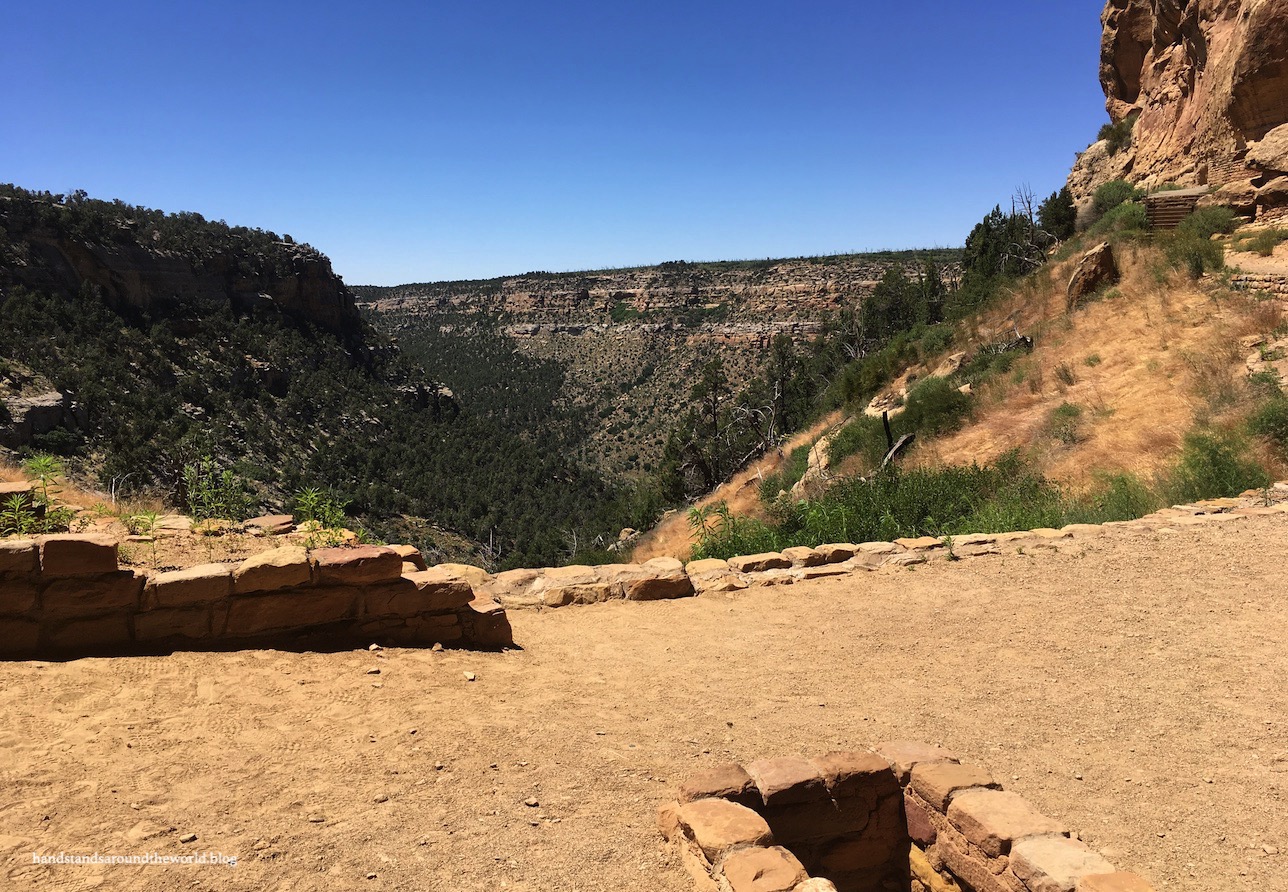
There are several overlooks along the way, with short walks out to viewpoints. From some of these overlooks, views extend into Colorado, Utah, New Mexico, and Arizona!


Wetherill Mesa
Eleven miles (17.7 km) beyond the campground is Far View Junction. From here, the road forks; right leads to Wetherill Mesa and left to Chapin Mesa. For this post, we’re going to go right. The Wetherill Mesa road is only 12 miles (19.3 km) long, but it takes 45 minutes to drive due to the abundance of sharp curves.
I remember reading that and assuming it was an exaggeration.
It was not.
The road comes to an end at the Wetherill Mesa parking area and kiosk. From here, the paved 6 mile (9.6 km) Long House Loop Trail leads out onto the mesa.
Wetherill Mesa is the lesser visited half of the park, likely a combination of the long winding road and the fact that, if you want to see anything here, you have to do some hiking. We didn’t mind, though. It was nice to escape the traffic and the crowds.

Long House
Long House is one of the cliff dwellings that can only be visited as part of a ranger-led tour. Beware that tickets cannot be purchased on Wetherill Mesa. The Long House tour is about 2 hours long and involves a 2.25 mile (3.6 km) round trip hike with 130 feet (40 m) of elevation gain. The tour also includes a climb up two 15 foot (4.5 m) ladders.


As with all the Mesa Verde cliff dwellings, Long House was built during the AD 1200s. It’s the second-largest cliff dwelling in Mesa Verde; it’s estimated that approximately 70 people lived here.
One of the commonly asked questions about the cliff dwellings is: why here? These weren’t necessarily easy places to live. The alcoves did provide some shelter from the elements, but farming was occurring on top of the mesa and hunting and water collection weren’t things that could happen from the alcoves either.
However, Long House contains a large seep spring on the back wall, removing one of these challenges. Also, its orientation is such that it remains mostly shaded in the summer but receives sunlight in the winter.


Another question you will hear quite frequently in Mesa Verde is: what is a kiva?
A kiva is a round room found at every single site we saw in Mesa Verde, as well as in present day pueblos. In the Hopi language, “kiva” translates to “room underneath.”
A kiva is built with a very particular design and always has 6 pilasters (rock columns) for support for the roof, a fire pit in the middle of the floor, and a small hole in the floor called a sipapu, which is believed to be where the spirits of their ancestors entered the world. The sipapu and fire pit are always lined up with a ventilation shaft, facing south. Air is pulled into the ventilation shaft and hits a specially placed deflector wall which serves to mix the cold outside air with the internal fire heated air.
Though the kivas in Long House have been excavated, they would have also included a roof with a hole for smoke to escape and for entry into the kiva by ladder.
Kivas are primarily used for ceremonial purposes, but archaeological evidence and present day Puebloan accounts also indicate that kivas were used for education, other daily activities, and, at times, as a living space.

While many of the cliff dwellings share similar features, Long House is the only one where we saw a great kiva. This is the wide open area at the front of the dwelling, likely designed for celebrations and dances.
Remains of rock structures on the great kiva floor are thought to be for foot drums, over which hides were stretched to form the instrument. The echo properties of the canyon walls surrounding Long House mean that sounds of such ceremonies and celebrations would be heard from a good distance away.


Long House Loop
The Long House tour ends back at the Long House trailhead, from which you can return to the kiosk or continue around the Long House Loop. We opted to continue and complete a portion of the loop, beginning with a 1 mile (1.6 km) walk through the Badger House Community Sites. These four sets of ruins are located not in an alcove, but on top of the mesa.
Although Mesa Verde is predominately known for its cliff dwellings, Ancestral Puebloans only built and occupied these dwellings for about 80 years. Prior to this, they lived on top of the mesa from approximately 550-1175 AD. The Badger House Community Sites includes the Basketmaker Pithouses, Pueblo Village, Badger House, and Two Raven House.
The Basketmaker era refers to the period of time from 500-600 AD when pottery was not yet used by the Ancestral Puebloans. However, very intricate and functional woven baskets were used for everything from storing water to cooking.
Meanwhile, a Pithouse is a style of dwelling that involved digging down into the ground to form the basic foundation and lining it with a row of stone slabs. Next, wooden walls were erected, woven together with branches, and subsequently coated in mud plaster. This wood/clay method of architecture is called jacal (ha-CALL).

Moving forward in the archaeological record to about 1000 AD, pithouses evolved into pueblos, which were villages built from the ground up using rocks rather than jacal. Some of these pueblos are very extensive and are found throughout Mesa Verde. Pueblo Village is unique for the discovery of an older kiva beneath the pueblo walls, suggesting that newer structures were built on the remnants of a prior living site.

Badger House depicts a similar phenomenon, with the older pueblo dwelling units built with just one layer of rock while later pueblo construction (approx. 1075 AD) included double layered rock walls that would have been much more stable.

Lastly, Two Raven House is a fairly well preserved example of these mesa top pueblos.

After completing the Badger House loop, we took the 1 mile (1.6 km) round trip hike out to a viewpoint of Nordenskiöld Site #16, a small cliff dwelling. This site is named for Swedish scientist Gustaf Nordenskiöld (pronounced NOR-den-shold), who was the first scientist to visit Mesa Verde. His methods of study were considered very good at the time, and his publications and photographs were very thorough.
However, his work raised much controversy, as he took many artifacts back to Sweden with him. His actions spurred the passing of the Antiquities Act and the designation of Mesa Verde as a national park in 1906, thereby preventing further removal of artifacts from the sites.

Step House
After returning to the parking lot, we completed one final hike on Wetherill Mesa: Step House. This cliff dwelling can be visited on your own for free and requires only a 1 mile (1.6 km) round trip hike.
Step House is interesting because half of the ruins are similar to the pit houses typically found on the mesa top while the other half represents a fairly typical cliff dwelling. You can view a partially-reconstructed pithouse here, complete with a roof. There are also a few petroglyphs at Step House.

And this concludes our exploration of Wetherill Mesa.
Up next: the other half of Mesa Verde and lots more historical and archaeological fun facts!
The Important Stuff:
- Getting there: Mesa Verde is located off of US Highway 160 in the southwest corner of Colorado; to get to the areas discussed in this post, follow the park road to the fork, then keep right onto Wetherill Mesa Road.
- Fees and passes: an entrance fee or America the Beautiful pass is required to enter the park. Visiting the cliff dwellings requires an additional guided tour reservation, which range in cost from $5-$45/person depending on the tour (there are short tours, full-day tours, and backcountry tours). Tickets are available in advance. More info can be found here.
- Hiking: in addition to the cliff dwelling tours, there are many lesser travelled hiking options in Mesa Verde.
- Where to stay: Morefield Campground accepts reservations, but usually doesn’t fill. Far View Lodge is open April-October and is the only non-camping option in the park.
- Other: food can be found throughout the park, but there is no gas beyond Morefield Village. Also, any vehicle over 8000 lbs (3600 kg) or 25 feet (7.6 m) long is not allowed on Wetherill Mesa.
Leave a Reply