Mayflower Gulch is a beautiful winter destination!
The only downfall is that to get there from the Front Range, one must brave the ski traffic on I-70. And boy does that suck.
We were on the road before dawn and traffic was already building. It took an extra 30 minutes to get there and an extra hour to get back home. I don’t know how people do this every weekend in the winter. Once was enough for me.
(Okay, technically twice. I hiked this trail once with a friend and once with my husband.)
The Mayflower Gulch trailhead is located along CO Highway 91 about 6 miles (9.6 km) past Copper Mountain ski area. The parking lot isn’t marked, but it’s plowed in the winter and will be visible as you approach. There are no restrooms or water at the trailhead.
The first portion of the trail is a high-clearance 4WD road in the summer. In winter, the gate is closed but the road remains open for skiing and hiking. Both times, we strapped on our snowshoes and began making our way up the road into Mayflower Gulch.
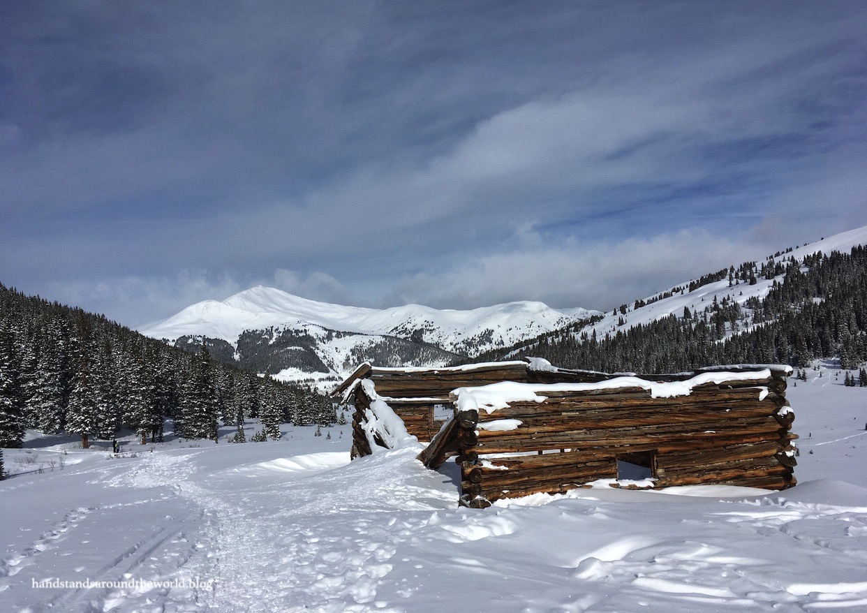
This area is home to the old – and ultimately unsuccessful – Boston Gold Mine. The first of the ruins are visible along the trail. A photo of one is below; the other was so buried in snow that I didn’t even see it on my first visit and wasn’t able to get a good photo of it the second time around.


After about 2 miles (3.2 km), the trail emerges from the trees and forks; we initially continued to the right and up toward the ridge but promptly abandoned this attempt as it was headed straight up an avalanche-prone slope.
Retracing our steps, we returned to the intersection and went left this time, past a gate (which was nearly buried in snow) and up into the center of the gulch. This area is home to the rest of the Boston Mine remains and is open for exploration. You can even walk into a couple of the buildings.


From the main area, there is another building up the hillside that’s just barely visible. On my first visit, no one had yet been up there that morning so we decided to break trail up to it.


Prior to my second visit this past weekend, I’d heard rumors there were a couple more buildings up even higher. We took a chance – a pretty big chance, given that we had to break trail through deep snow for quite a distance – and there were in fact two more buildings up there. One of them was the largest structure in the area and from it, a cable extended up the hillside to a second structure that appeared to be built into the side of a cliff.


Truthfully, though, it would’ve been worth the trek even if there hadn’t been ruins, because once we reached this upper bowl we had gained enough elevation to see over the western wall of Mayflower Gulch to the rugged mountains beyond.
And just as we were preparing to forge a path back down, we glanced over our shoulders to see an example of a phenomenon called cloud iridescence (photo below). These rainbow illusions form when sunlight reflects or refracts off certain types of clouds, and since the sun hadn’t yet crested the ridge we were able to see the full array of colors.

It was an unexpected and colorful ending to a beautiful winter hike!
The Important Stuff:
- Getting there: the trailhead is located off CO Highway 91 about 6 miles (9.7 km) south of Copper Mountain. Coming from Copper Mountain, the parking lot will be on your left. It’s unmarked but fairly obvious. With appropriate winter tires, any car can make it to the trailhead.
- Fees and passes: none.
- Hiking: total distance from the parking area is about 3 miles (4.8 km) round trip and 600 feet (180 m) elevation gain, plus any additional exploring/climbing you want to do once you reach the gulch. With all the exploring, we ended up hiking about 5 miles (8 km) total and adding another 700 feet (215 m) of elevation gain.
- Where to stay: there are many options for camping and lodging in the area, as you’ll be in the heart of ski country. This can also be done as a day hike from Clear Creek and Summit Counties, or even the Front Range (plan for 3-4 hours round trip driving time, not including traffic).
- Other: though the trail travels through terrain that’s at fairly low avalanche risk, Mayflower Gulch itself is surrounded by slopes that are at an optimal angle for avalanches. We felt fairly safe, as we stayed relatively in the middle of the gulch and the avalanche forecast was low. However, if you’re planning to continue climbing up the slopes you should carry avalanche gear and be mindful of all the hikers down below you.
Leave a Reply to scottandloristravelsCancel reply