Most everyone hoping to summit their first Colorado 14,000 foot (4267 m) peak faces the same dilemma (or, shall I say, quandary): what’s the easiest one to start with? By most accounts, Mount Bierstadt and Quandary Peak are two of the “easier” ones, but I put easier in quotes because it’s all relative. There are no easy 14ers. Hiking websites rank them all as strenuous, and some routes may actually require technical climbing.
But, relatively speaking, Quandary is one of the feasible beginner ones. The trail is marked and easy-to-follow, and there will be many people around if anything goes wrong. No scrambling, bouldering, or technical climbing is involved. And it’s only 3.3 miles (5.3 km) each direction… though you gain 3,400 vertical feet (1006 m) over the course of those 3.3 miles!

We’d spent the night in Keystone with a couple friends in their family’s vacation home, so the trailhead was only about 40 minutes away. Nevertheless, we were up well before dawn and pulling into the trailhead at 6:00am. Parking was already extending down the road. It was nuts. Upwards of 500 people/day summit Quandary on weekends so arriving early is mandatory to avoid having to park way down the road. Also, as mentioned many times before, you want to be back below tree line by noon to avoid any thunderstorms.
(Update: as of 2021, you must reserve parking in advance. More info can be found here.)
We set off at about 6:15am by the light of our headlamps, which was a first for me. I’ll openly confess that the forest at night makes me uneasy, so nighttime hikes are never going to be my idea of a good time. But the sun was already beginning to light the eastern sky and within about 20 minutes we were able to put the headlamps away.
I can also admit that I do see the allure of sunrise hikes; watching the first rays of sun illuminate the surrounding mountains was beautiful!

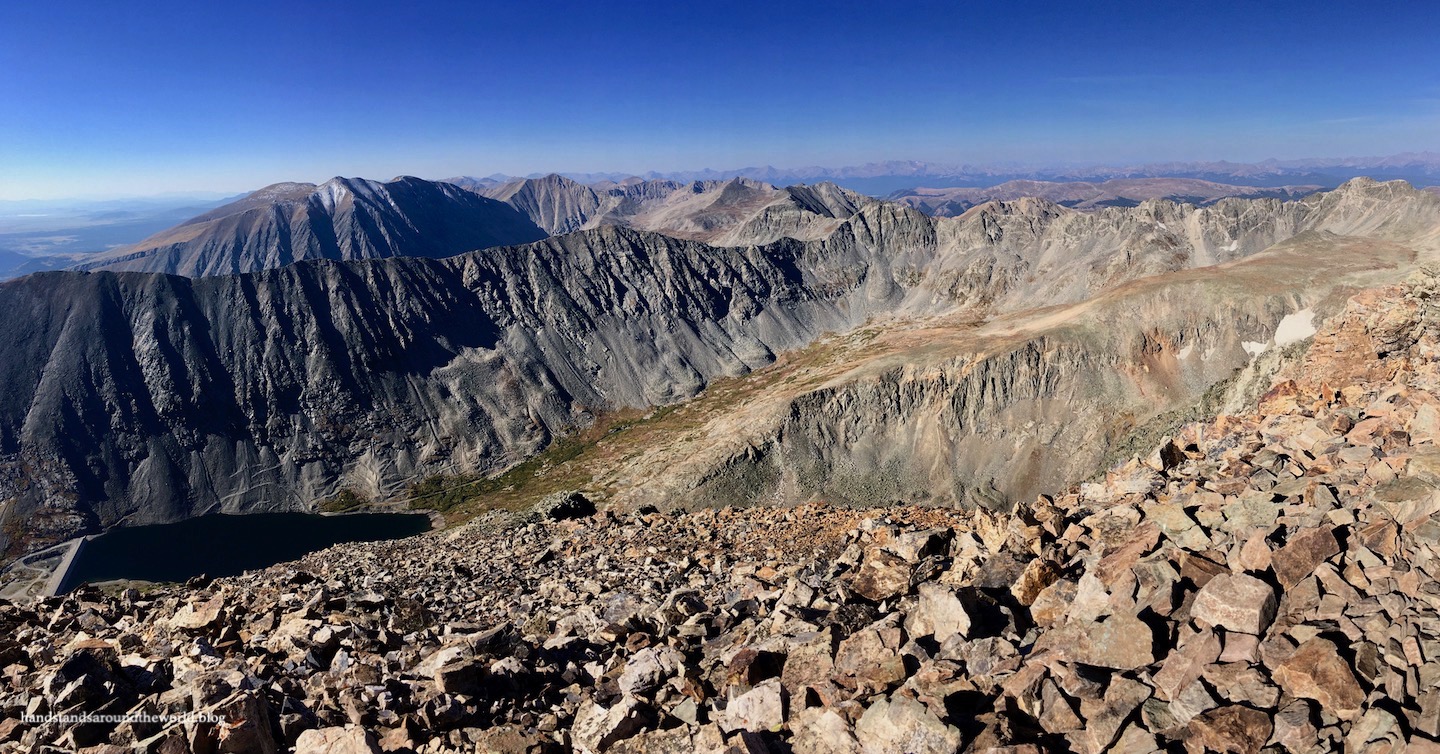
The trailhead for Quandary Peak is located at almost 11,000 feet (3350 m) so we emerged from the trees very quickly and spent the remainder of our hike above tree line. Any hike at this elevation is going to be very exposed, and this trail was no exception. There was no shade, constant intense sun, and a fairly steady dose of wind. Sunscreen and lots of layers are the name of the game.
(Also, lots of food, water, and electrolytes. It’s extremely easy to become dehydrated at this elevation, especially when exerting yourself this much. It’s also common to not feel hungry at higher elevations, but it’s still necessary to periodically replenish some calories.)

The hike itself was mostly just a solid upward grind, gaining about 900 feet (275 m) in the first mile, 1300 feet (400 m) in the second, and 1200 feet (366 m) in the third. It’s steep. It’s very steep. This is by far not the longest hike I’ve ever done but it’s definitely one of the most difficult, aided by the fact that there’s no oxygen at this elevation. Even just walking on the flat sections was difficult.
That being said, it was absolutely worth the effort. I’d never been above 14,000 feet before, and the world looks very different from up there. It’s a very rugged and desolate kind of beautiful.


Also, we saw a family of mountain goats on our way back down, which put a lovely cap on an exhausting but exhilarating day!


The Important Stuff:
- Getting there: the trailhead for Quandary Peak is located along McCullough Gulch Road, just south of the town of Breckenridge.
- Fees and passes: as of 2021, a fee system has been implemented; you can either pay in advance to reserve parking at the trailhead, or you can park for free in Breckenridge and pay to take the shuttle. More info and the link for parking permits can be found here.
- Hiking: Quandary Peak is 6.6 miles (10.6 km) roundtrip with 3400 feet (1006 m) of elevation gain; this is an extremely difficult hike.
- Route: a complete and detailed route description can be found here. Before heading off on this hike, download the 14ers.com app and save the text and photos for offline use.
- Where to stay: there are plenty of established campgrounds in the area and dispersed camping is also allowed at designated locations in the surrounding White River National Forest, or lodging options are available in the nearby ski towns.
- Other: altitude sickness is a very real danger when attempting 14ers; always be aware of the symptoms and, if you do start to feel them, descend immediately. There are altitude-related fatalities every year in Colorado when people ignore their symptoms and keep pushing through in an attempt to complete their hike.
Leave a Reply to BrianCancel reply