Destination: Makoshika State Park, also known as the Montana badlands.
The name Makoshika (muh-KO-shih-kuh) hails from the Lakota phrase “maco sica,” which roughly translates to “bad land.”
Makoshika State Park is located off of I-94 in eastern Montana, just outside the town of Glendive. The contrast between eastern Montana and the western part of the state is stark. For starters, eastern Montana is very much lacking in the mountain department. It’s flat. And hotter. And dryer.
Sometimes it can be difficult to look beyond a first impression, but once I did, I realized that this area is beautiful in its own right. The geology is very unique, there are different species of flora, and the badlands landscape is subtly colorful.
Makoshika is the largest state park in Montana, meaning there is much to explore. There’s one road into the park – Makoshika Park Road – and a visitor center, campground, rustic campsites, and many trails. We began by stopping at the Visitor Center and then setting up at Cains Coulee Campground.


On day 2 – our only full day at Makoshika – we loaded up our packs with food, water, and sunscreen and set off to accomplish as much hiking as we could despite the sweltering heat. Just across the park road from the campground is the Diane Gabriel Trail. This trail is a 1.5 mile (2.4 km) loop that traverses through the badlands and past the excavation site of a hadrosaur (duck-billed dinosaur). Eastern Montana is a hot spot for paleontologists, and many dinosaur bones have been uncovered in the region.


Our second hike was the 1 mile (1.6 km) Kinney Coulee Trail. A coulee is a drainage basin, and this trail leads through the coulee and then climbs up to the top of the coulee wall. We were really in the middle of the badlands on this trail, allowing us to closely examine the landscape.
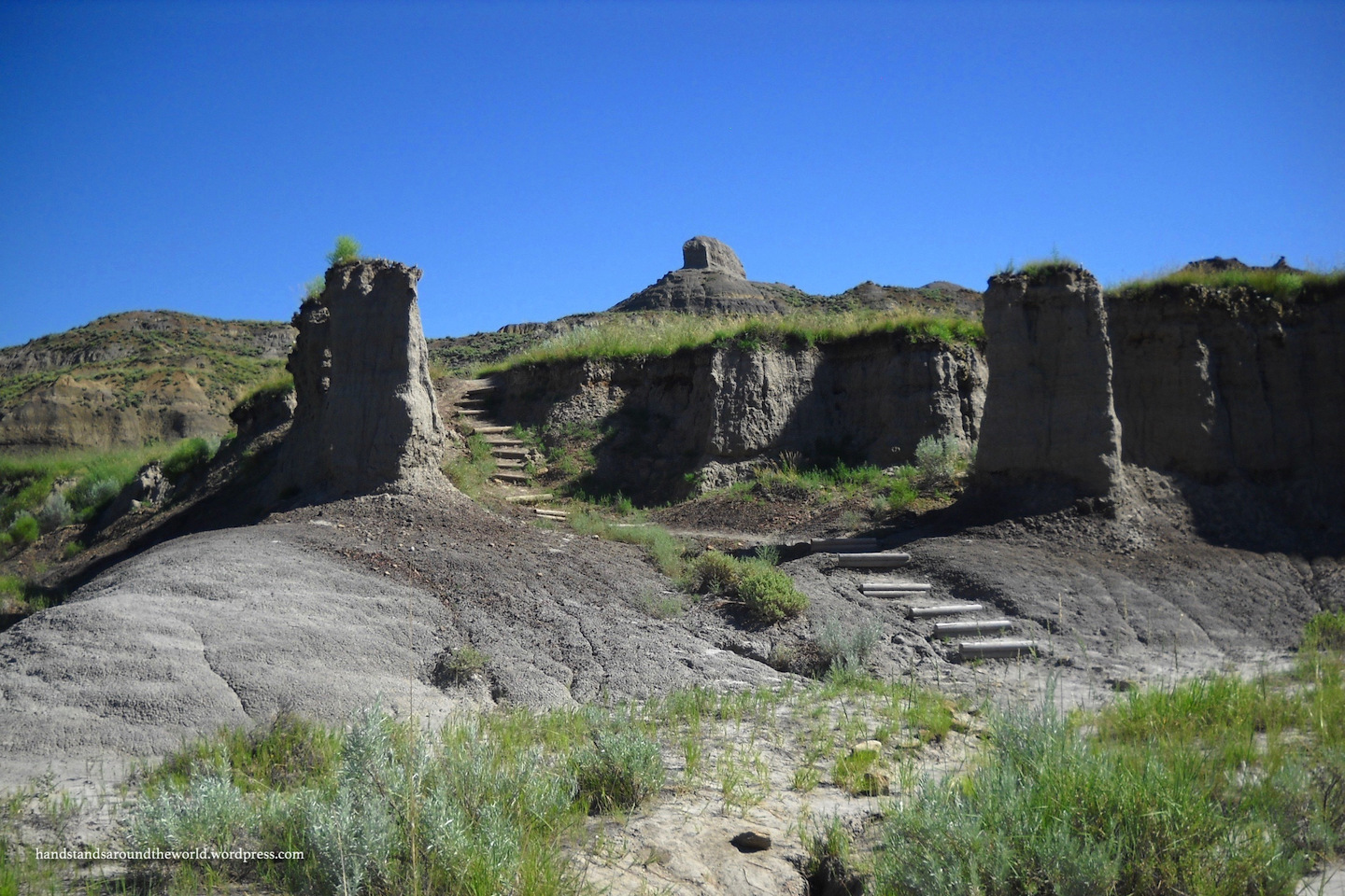
Badlands form over millions of years in a lengthy, two-step process. The first step is the deposition of a variety of types of clay, silt, sand, and minerals. Step two is erosion. Over the years, the deposited sediments begin to erode away. This erosion occurs at different rates depending on the composition of sediments. It is these differences that lead to formation of the remarkable features and colors of badlands.


Our third hike of the day was the 0.5 mile (0.8 km) Cap Rock Nature Trail. There are many cap rock features at Makoshika. These form when a harder layer of rock lies over a softer or less resistant layer, such that the lower layer erodes more rapidly, often undercutting the top layer. It almost gives the appearance of a balanced rock.


Cap Rock Nature Trail also stops at a Natural Bridge before looping back around to the trailhead. By this point in the afternoon it was sunny, dry, and very hot so we decided this would be our last hike.


I’ve always been more of a mountains person, and nothing quite compares to high mountain scenery. But I had a lot of fun exploring Makoshika. It’s a very different landscape and it taught me to appreciate the uniqueness of the plains in a way I never had before.
The Important Stuff:
- Getting there: located 0.25 mile (0.4 km) south of Glendive, MT off I-94.
- Fees & passes: free for MT residents, $6 per car for non-residents.
- Camping: Cains Coulee Campground – 28 sites, $18 per night, reservations accepted.
- Hiking: there are 9 trails at Makoshika, ranging in length from 0.5-3 miles (0.8-4.8 km) RT.
- Other: summers on the plains are hot and dry with the potential for afternoon thunderstorms, so be prepared for all of those conditions. In the winter, there is no running water in the park.
Leave a Reply