
Twelve. That’s the number of waterfalls we saw on the hike to Hyalite Lake.
If you’ve been following me for a while, you may remember when I talked about Hyalite Canyon, located in the Gallatin Mountains of Montana. (And if not, you can read all about it here). From the main road up Hyalite Canyon, keep right at the fork and head to the end of the road; it dead-ends at the parking lot for the Hyalite Creek Trail.
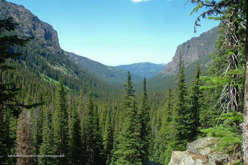
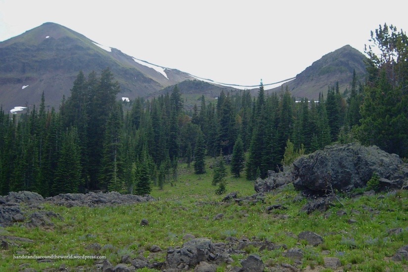
The Hyalite Creek Trail climbs 5.5 miles (8.9 km) up to Hyalite Lake, then continues an additional 2 miles (3.2 km) to the summit of Hyalite Peak. Hyalite Peak is the second-tallest mountain in the area, rising to a height of 10,298 feet (3139 m). The elevation gain to the lake is about 2000 feet (610 m), with an additional 1500 (460 m) foot gain to the peak. I’ve yet to summit Hyalite Peak, but it’s the #1 hike on my list for the next time I’m back home in the summer. However, a few summers back, my mom and I hiked to Hyalite Lake.
From the trailhead, the first waterfall is Grotto Falls. This is a relatively simple 1.1 mile (1.8 km) hike, and is extremely popular. However, very few people go beyond this point, so from here we had the trail mostly to ourselves. From Grotto Falls, the trail backtracks a short distance to the Hyalite Creek Trail, and then forks to the right.
Beyond Grotto Falls, the next waterfall is Twin Falls visible off in the distance. Next is Arch Falls, which requires some climbing around to actually get a good view. Fortunately, we had no problem with doing some bouldering.
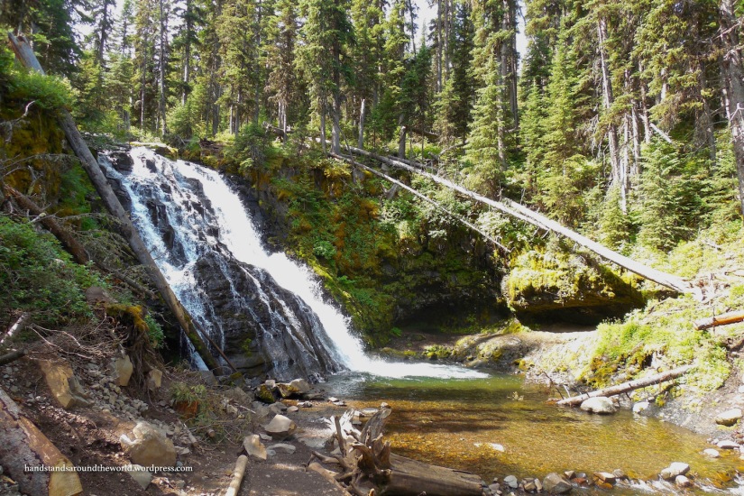


The next two waterfalls aren’t directly along the trail. Silken Skein Falls requires a short detour to the left; the turnoff is located about 2.4 miles (3.9 km) from the trailhead, and I highly recommend taking it. This is one of our favorite waterfalls. There are 5 different steps of the waterfall; all of them are not visible at once, but a little bit of scrambling and bouldering will get you up to each step in turn. From the top step of Silken Skein Falls, a glance to the west provides the best view of Maid of the Mist Falls, high on the face of Maid of the Mist Mountain.


The next three waterfalls are each about 0.7 miles (1.1 km) apart; #6 is Unnamed Falls, #7 is Champagne Falls, and #8 is Chasm Falls. From here, it’s a fairly short distance to Shower Falls, followed soon after by Apex Falls. Waterfall #11 is S’il Vous Plait Falls. And last but not least, in the middle of the last section of switchbacks on the climb to Hyalite Lake, is Alpine Falls. I don’t have photos of all of them, but I think I have enough that you’ll get the gist. Lots of pretty waterfalls on the way to a high mountain lake. Definitely a hike that I highly recommend!


The Important Stuff:
- Getting there: from Bozeman, head up Hyalite Canyon Road; when the road forks just past the reservoir, keep right
- Fees & passes: none
- Camping: 3 small campgrounds (10-17 sites); $14 per night, reservations accepted
- Hiking: Hyalite Creek Trail is located at the very end of the road; 15 miles (24 km) RT with 3500 feet (1065 m) elevation gain to the summit of Hyalite Peak; 11 miles (17.5 km)/2000 feet (610 m) elevation gain to the lake
- Other: Hyalite Canyon is a multipurpose recreation area, so be aware of horses, bikers, motorized vehicles, and hunters

This looks super pretty!! 🙂
LikeLiked by 1 person
Great pictures. It brings back memories. We hiked it a long time ago (before digital cameras) and I think we need to do it again……soon. Bozeman is one of my favorite places.
LikeLike
How cool! I haven’t run across many people on here who have been been to Bozeman, let alone hiked to Hyalite Lake! Bozeman has changed so much recently, if you make it back there, I’m sure you’ll be shocked.
LikeLike
Great photos. Looks like a great place for me to fly fish.
LikeLike
Montana is heaven for fly fishers, and Hyalite Canyon is no exception! Not a fisher myself, but I always see lots of people fishing when I’m up there.
LikeLiked by 1 person
This is one memorable hike! To get to see 12 waterfalls on the way up is a dream come true.
LikeLiked by 1 person
Gorgeous! I would love to do this hike!
LikeLiked by 1 person