Do you ever have one of those hikes where the scenery just blows you away?
There’s so much beauty in Colorado that the bar for that kind of awe has been set pretty damn high. But Isabelle Glacier exceeded that bar.
Lake Isabelle is one of the most popular hikes near the Front Range, and with good reason. It’s not terribly difficult and… well, the beauty speaks for itself. This was my fourth time hiking to Lake Isabelle, having previously completed it in summer, fall, and winter.
But this time, for the first time ever, I hiked beyond the lake.
The main starting point for this hike is the Long Lake Trailhead at Brainard Lake Recreation Area. Currently, a permit system has been implemented to manage crowds as this area is heavily overused. While the crowds have been successfully reduced, it can be challenging to get the permit you want.
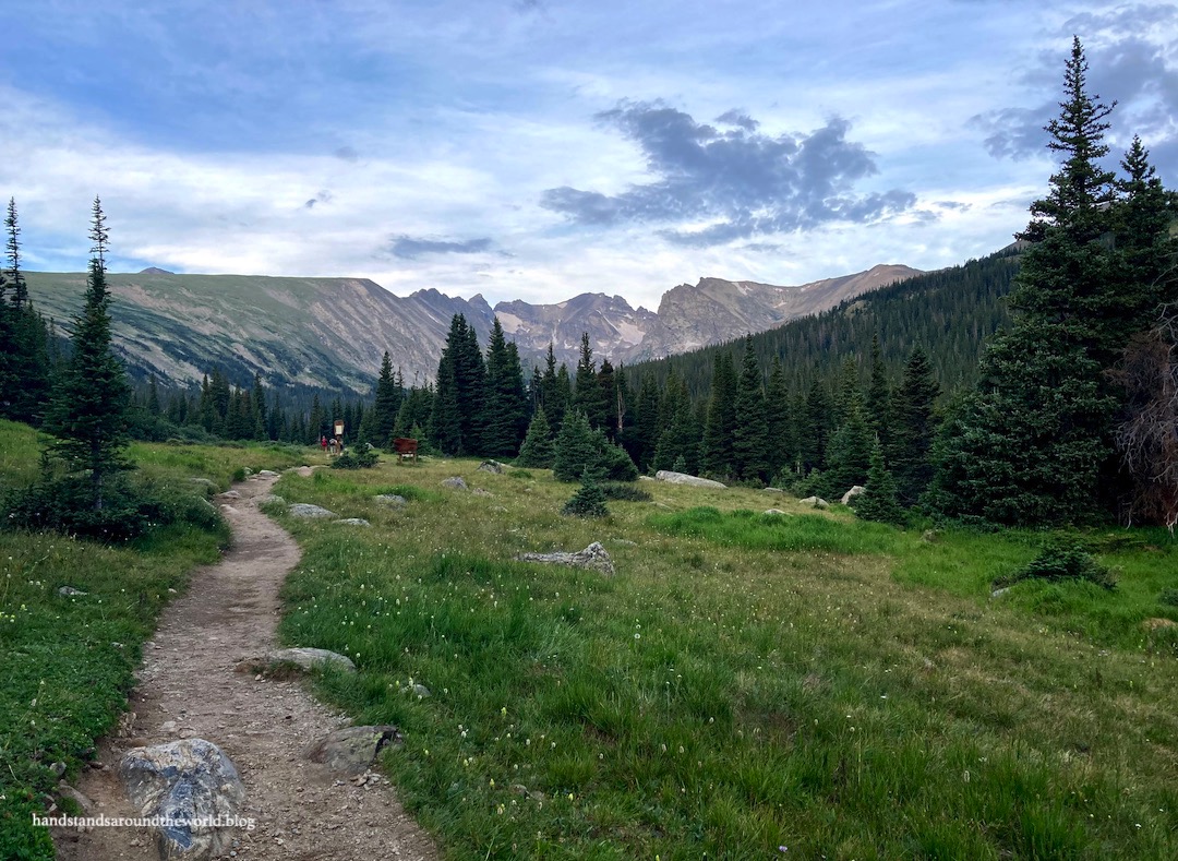
In fact, my friend and I weren’t able to get a Long Lake parking permit for our hike. We were able to instead get one for the Niwot parking area, which allowed us to take the 0.7 mile (1.1 km) Niwot Cutoff Trail up to Long Lake, adding only a short distance to our hike.
Shortly before reaching Long Lake, we were temporarily halted by three moose meandering near the trail. We carefully stepped off the trail and walked around, giving them plenty of space. We’d also seen two moose on the drive in and we saw another on the drive out, for a total of six. Brainard Lake Rec Area is prime moose habitat – I’ve never not seen a moose here in the summer. They’re beautiful, but also massive animals. Be on the lookout when you hike here; if you see one give it plenty of space, and if you bring your dog keep it on a leash to avoid a dog/moose encounter.
(It’s a wilderness area, so dogs are required to be leashed anyway.)

After safely passing the moose, we turned onto the Jean Lunning Trail and followed it along the southern shore of Long Lake.

Long Lake is aptly named; it was quite a walk along the shore to the opposite end. From here, we connected to the Isabelle Trail toward Lake Isabelle. It had been more than two years since I’d last been to Isabelle and I’d forgotten how gorgeous the approach is as it ascends next to a cascading stream amidst fields of wildflowers.

Upon reaching Lake Isabelle, we took a snack break on the shore before continuing our trek. The trail travels along the shore of the lake to the far end.


It was at this point that the difficulty level of the hike increased quite substantially. We had a lot of elevation gain to go in addition to navigating talus, mud, multiple fast-flowing creek crossings, and a couple sections without an obvious path. Simultaneously, we enjoyed beautiful wildflowers and cascading streams as we navigated our way through these obstacles.


About halfway between Lake Isabelle and Isabelle Glacier is a small unnamed lake at the base of a snowfield. It was a fairly calm day and the reflection of the surrounding landscape was stellar. As we continued up the trail above this lake, we gazed down upon the deep turquoise water.


It was a steep climb, switchbacking up through the rocks in what seemed at the time to be a neverending ascent. It wasn’t always easy to find the trail. And we had one final creek to cross. But at long last we crested the hill and there was Isabelle Glacier!

Isabelle Glacier – like all “glaciers” in Colorado – is not actually a glacier. To be a glacier, snow must compact into a sheet of ice that is thick enough to slowly move downhill. Isabelle used to meet this criteria, but nowadays it is just a stationary snowfield. There are no longer any glaciers in Colorado.
There’s a small tarn at the bottom surrounded by some watermelon snow. The color is caused by a species of algae that contains a reddish pigment called astaxanthin – interestingly, the same pigment that gives flamingos their pink color. This algae thrives at high altitude and cool temperatures, going dormant in the winter and germinating as the weather warms in the summer.
Because we were so close to the glacier and the surrounding mountains are so tall and sheer, it wasn’t the easiest thing to photograph. I did my best, hopefully you can get the gist from the photos below.


We weren’t able to spend too much time at the glacier; storm clouds were beginning to build and we had at least an hour of hiking to descend back below tree line. I wish we could have enjoyed the unique scenery for a little longer… but it did in fact start thundering about an hour later, so we were smart to leave when we did.
Over the last three years, I’ve done quite a few beautiful hikes in Brainard Lake Rec Area and this is one I’m glad I can now add to the list!
The Important Stuff:
- Getting there: this trail departs from the Long Lake Trailhead at the end of Brainard Lake Road, just a few miles outside the tiny town of Ward off Highway 72.
- Fees and passes: there is a $14/day entrance fee to Brainard Lake Rec Area from June-mid Oct (this trail would likely be impassable outside that window anyway); America the Beautiful passes are accepted. You’ll also need a timed-entry parking permit for Long Lake. Permits are released on a rolling basis at 8:00am MDT 15 days in advance.
- Hiking: round-trip distance from the Long Lake trailhead is about 9.2 miles (14.9 km) with 1934 feet (590 m) of elevation gain.
- Where to stay: this is an easy day trip from Denver or Boulder. For overnight stays, there is one campground at Brainard Lake Rec Area; reserve in advance, it fills up very quickly. Backpacking is not allowed in this area during the summer.
- Other: If you’re unable to get a permit for Long Lake, you can get one for Niwot or Brainard Lake parking areas instead; add 1.4 miles (2.3 km) to the round-trip hike distance from Niwot or about 2 miles (3.2 km) from Brainard Lake.
Leave a Reply to travelling_hanCancel reply