Estes Cone was not plan A for Chelsea and me on this particular weekend.
But April and May in Colorado are part of what Coloradans call the “spring of deception.” No matter how warm and sunny it is, no matter how many days in a row the nice weather endures, make no mistake: it’s not actually spring yet. There will still be at least one more snowstorm on the plains. And lots more snow in the mountains.
As was the case this weekend.

Estes Cone was mostly outside the radius of this particular snow storm, so it made a decent plan B. Estes Cone is an 11,000 foot (3355 m) peak, one of a handful of lower summits located on the eastern edge of Rocky Mountain National Park. Twin Sisters Peak and Lily Mountain are two others in the area and while the views from all three are maybe a little redundant, I enjoyed all three hikes.
The trail was, however, snowier than we expected. Recent reviews by other hikers made it sound as though the trail was mostly dry and easy to follow. Those reviews could not have been less accurate. The entire trail was snow-covered, and the last section to the summit was very difficult to follow. In fact, at one point we got completely off the trail and had to blaze our own path through the snow.


There are three options for reaching Estes Cone, including starting at Storm Peak or Lily Lake trailheads. We chose the Longs Peak Trailhead. This is by far the most popular starting point for this hike, especially in the offseason when the parking lot doesn’t fill well before dawn. During the summer, you’d probably be better off starting at one of the less busy trailheads.

Most of the hike is in the forest, beginning on the Longs Peak Trail before splitting off toward Eugenia Mine and Estes Cone. Eugenia Mine was an unproductive operation, yielding almost nothing profitable back in the late 1800s/early 1900s. Some of the mining remains are still visible today, although it was partially snow-covered.


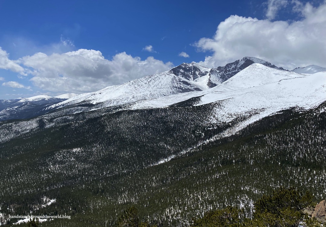
Eventually we reached the trail junction on the western saddle of Estes Cone. From here we headed east on the final climb to the summit, gaining about 800 feet (244 m) in the last 0.5 mile (0.8 km). It was slow going, made more difficult by the snow and our accidental off-trail excursion. The summit is rocky and requires a bit of scrambling, though nothing too challenging.


We found a spot with some shelter from the wind to eat a snack and enjoy the views before heading back down. Descending was almost as difficult as going up; the snow was slippery and soft, and between the two of us there was quite a lot of slipping, post holing, and almost-falls. And a few actual falls. Nothing serious… mostly just ending up on our butts in the snow.
The best part of the descent was when we caught a glimpse of a fox chasing a snowshoe hare! They ran off down the trail before either of us could snap a photo and we couldn’t see where they went – or whether the hare ended up being lunch.
The worst part of the descent was when a sudden snowstorm rolled in, reducing visibility to almost nothing and pelting us with blowing snow. Fortunately it blew out just as quickly as it had arrived… but it was nonetheless a reminder that May in Colorado is still very much winter in the mountains.


The Important Stuff:
- Getting there: the main trail to Estes Cone departs from the Longs Peak Trailhead at the end of Longs Peak Road off CO Highway 7.
- Fees and passes: there is a $30/car daily or $35/car weekly entrance fee to RMNP; America the Beautiful passes are accepted. From May-Oct, if you arrive between 9:00am-2:00pm you will also need a timed entry permit to access this trailhead. Since you do not pass through an entrance station, both items should be displayed on your dashboard.
- Hiking: 6.9 miles (11.1 km) round trip with about 1840 feet (560 m) of elevation gain; moderate.
- Other: although this is a lower elevation summit than some others in the park, there is still the possibility of any and all weather conditions so come prepared for the elements.
For more information, see my posts on visiting Rocky Mountain National Park and winter hiking tips and safety.
Leave a Reply to ourcrossingsCancel reply