
Today we’re going to talk about my favorite area of the park – the Grand Canyon of the Yellowstone!
I know, I know, I’m doing this all wrong. Yellowstone is about geysers and grizzly bears, not rivers and canyons. Don’t worry, I love geysers too. And bears are pretty cool. But Canyon is still my favorite part. Something about the waterfalls and the contrasting colors is just so incredibly beautiful.
The Grand Canyon of the Yellowstone River is 800-1200 feet (244-366 m) deep, up to 4000 feet (1220 m) wide, and stretches 24 miles (39 km) between Canyon Village and Tower-Roosevelt Junction. It begins when the Yellowstone River tumbles 109 feet (33 m) over Upper Falls and ends near Tower Falls, where the water of Tower Creek drops 132 feet (40 m) on its way down to the Yellowstone River.
Perhaps the most striking aspect of the Grand Canyon is the colors. The walls of the canyon are painted a variety of hues due to the fact that the area used to be a geyser basin and that many minerals are present in the rocks.


Today we begin at Canyon Village, home to a visitor center, a campground, a lodge and many amenities. This is also the entry point for the roads leading out to the canyon. North Rim Drive and North Rim Trail – as the names suggest – run along the north rim of the canyon.
Lower Falls is the tallest of the canyon-area waterfalls, at 308 feet (94 m). It has a defining light green stripe at the top left; a small notch at the brink of the falls causes the water to be deeper and less bubbly in this area. There are many stellar views of Lower Falls from the North Rim.


Upper Falls Drive crosses the river on a large bridge and ends at the parking area for – you guessed it – Upper Falls.


And finally, South Rim Drive runs along the South Rim all the way to Artist Point. The view from Artist Point is the one that most commonly appears in paintings and photographs.


My personal favorite in this area, though, is Uncle Tom’s Trail. The trail is named for H.F. Richardson, AKA Uncle Tom, who used to operate a passenger ferry down in the canyon below Lower Falls.
The ferry and the original trail are no longer in existence, but a set of 328 precarious stairs remain and lead 500 feet (150 m) from the South Rim down into the canyon near Lower Falls. This hike is not for the out-of-shape (elevation at Canyon is 7700 feet/2350 m) or those with a fear of heights (the stairs are steep and see-through), but for those willing to tackle it, it’s a highly rewarding hike.
It’s incredible to be so close to such a powerful waterfall, and if the wind is right the spray from the falls often makes it to the viewing platform. On a sunny day we also often see a rainbow in the spray, which is especially pretty against the backdrop of the colorful canyon walls.


Last summer, for the first time ever, we also hiked through an old thermal area to Clear Lake. The trail to Clear Lake departs from Artist Point can be hiked as an out-and-back hike or combined with Uncle Tom’s Trail to form a 6-7 mile (9.5-11 km) loop. We did the latter, and though our legs hated us by the end, it was a really cool hike.


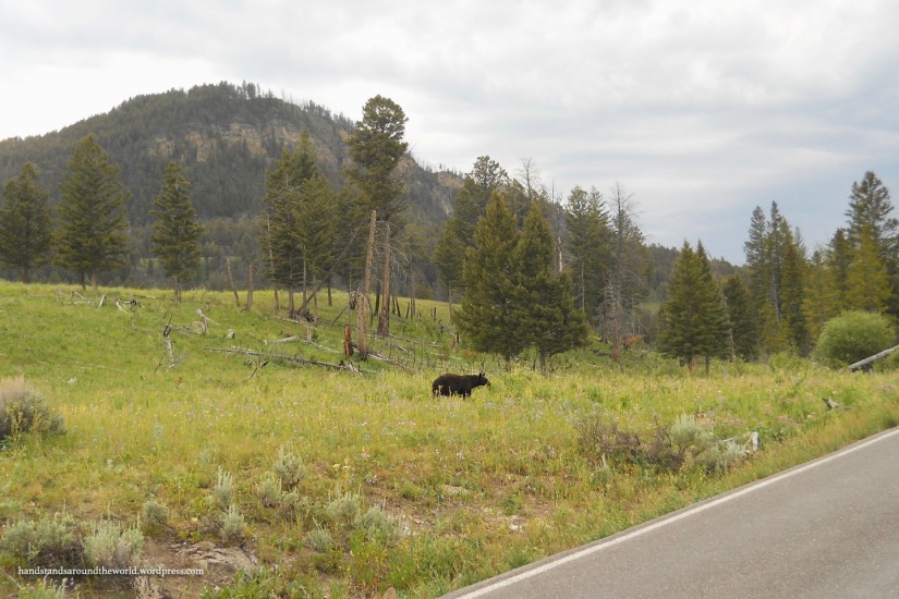
Beyond Canyon Village, the main road leaves the river behind and begins to climb up to Dunraven Pass, which cuts between Mount Washburn and Dunraven Peak. This is the highest point along the main road, topping out at over 8800 feet (2680 m). Views abound at Dunraven Pass, and there are multiple pullouts on both sides of the road. These are often good spots to look for wildlife – over the years, we’ve seen moose and bears here.


About halfway down the other side of the pass is Chittenden Road – a gravel road that leads part way up the 10,000+ foot (3050+ m) high Mount Washburn. The turn onto Chittenden Road from this direction is extremely awkward – it’s on a curve, it’s a very sharp angle, and the road immediately begins to climb. Not the most stellar example of functionality, but I guess they had to work around the steep terrain.
From the end of Chittenden Road, there’s a wide, moderately-steep trail leading the remaining 2.5 miles (4 km) to the summit. At the top is a fire tower and lots of wind, along with views over much of Yellowstone. I’ve done this hike, but it was before I had my own camera so I don’t have any photos. What I do have, though, is the memory of getting blown off balance by the wind.
After dropping down out of the mountains, this brings us to Tower Falls. There is a visitor center, parking area, and trailhead here, while Tower Campground is right across the street. Tower Falls is visible with a short 1/8-mile (0.2 km) walk to a viewpoint. The trail continues down below the viewpoint to the banks of the Yellowstone River; this a very pretty area, but the falls is not visible from the river.


(To see the Tower Falls area in the winter, visit my Winter in Yellowstone posts)
A few summers back, my sister’s friend came to visit and we took her to Yellowstone. We’d driven through over half of the park and seen no bears, which is always disappointing. Finally, just south of Canyon, we saw one… the one I shared a photo of in my previous post. Between Canyon and Tower, we proceeded to see four more bears in about 30 minutes. And just beyond Tower, we saw two more. Seven bears in under 2 hours, which is completely unheard of!


Anyway, between Tower Falls and Tower Junction, there’s an enormous, overhung cliff that always makes me a little anxious when we drive past/underneath it. On the other side of the road, though, there are many viewpoints that overlook the canyon. My personal favorite – actually, my favorite spot in the entire park – is Calcite Springs Overlook. It’s just a short walk up a ramp or a few stairs to the overlook, and once there, it’s a little bit of everything: river, canyon, forests, views, hot springs, and usually some wildlife.


This brings me to Tower Junction, which is where I’ll end for now. The next post will be a guest post – once again courtesy of my mom – and then I’ll wrap up my Yellowstone saga by talking about the northern section of the park. Stay tuned!

I can’t get over the falls. This isn’t how I pictured Yellowstone but sure hope I get to visit this part.
LikeLiked by 1 person
Yeah, the geysers made it famous and they get most of the attention but I really love the other areas of the park equally as much. I hope you have a chance to swing by Canyon as well, you won’t be disappointed!
LikeLiked by 1 person
Great photos.
LikeLiked by 1 person
Thanks!
LikeLike
All these waterfalls are stunning.
LikeLiked by 2 people
Love reminiscing as I read through this post and your beautiful images. We will be in Yellowstone for the summer, which is like coming back home for us.
LikeLiked by 1 person
Yay! So exciting!
LikeLiked by 1 person
The Canyon Area is my favorite part of Yellowstone, too I’d say Lookout Point has my favorite view. The thermal features and wildlife are great, but the waterfalls and colorful Canyon are hard to beat.
LikeLiked by 1 person
Glad I’m not alone! And I think you just might enjoy my next post about hiking down into the canyon 🙂
LikeLike