On our final day at Delaware Water Gap, we headed back over to the New Jersey side of the river. We’d seen waterfalls, the river, and mountains – now it was time for some lakes!
The New Jersey side of the park is accessed via winding back roads that aren’t always well-marked. At one point, we found ourselves in a residential area and weren’t sure we’d turned at the right location.
(Thankfully we had.)
Detailed maps are definitely a must for navigating this park, a fact we were reminded of on multiple occasions.

Somehow, we successfully found our way to Millbrook Village, an old mill town built along Van Campens Brook in the late 1700s. The old General Store doubles as the “visitor center,” where we picked up a brochure that guided us through the village. Most of the buildings that remain are from the 1850s and have been repaired or renovated, but the village is still a nice depiction of mill life in the early 1800s.


After touring the village, we continued north on Old Mine Road. This is a curvy, hilly road, and the brakes on my car were a little worse for the wear after this drive.
Our destination for the day was the Blue Mountain Lakes trailhead. From here, many trails depart, so there are lots of options for loop hikes of various lengths. We chose a 6.5 mile (10.5 km) loop to Blue Mountain Lake, Hemlock Pond, and Crater Lake.
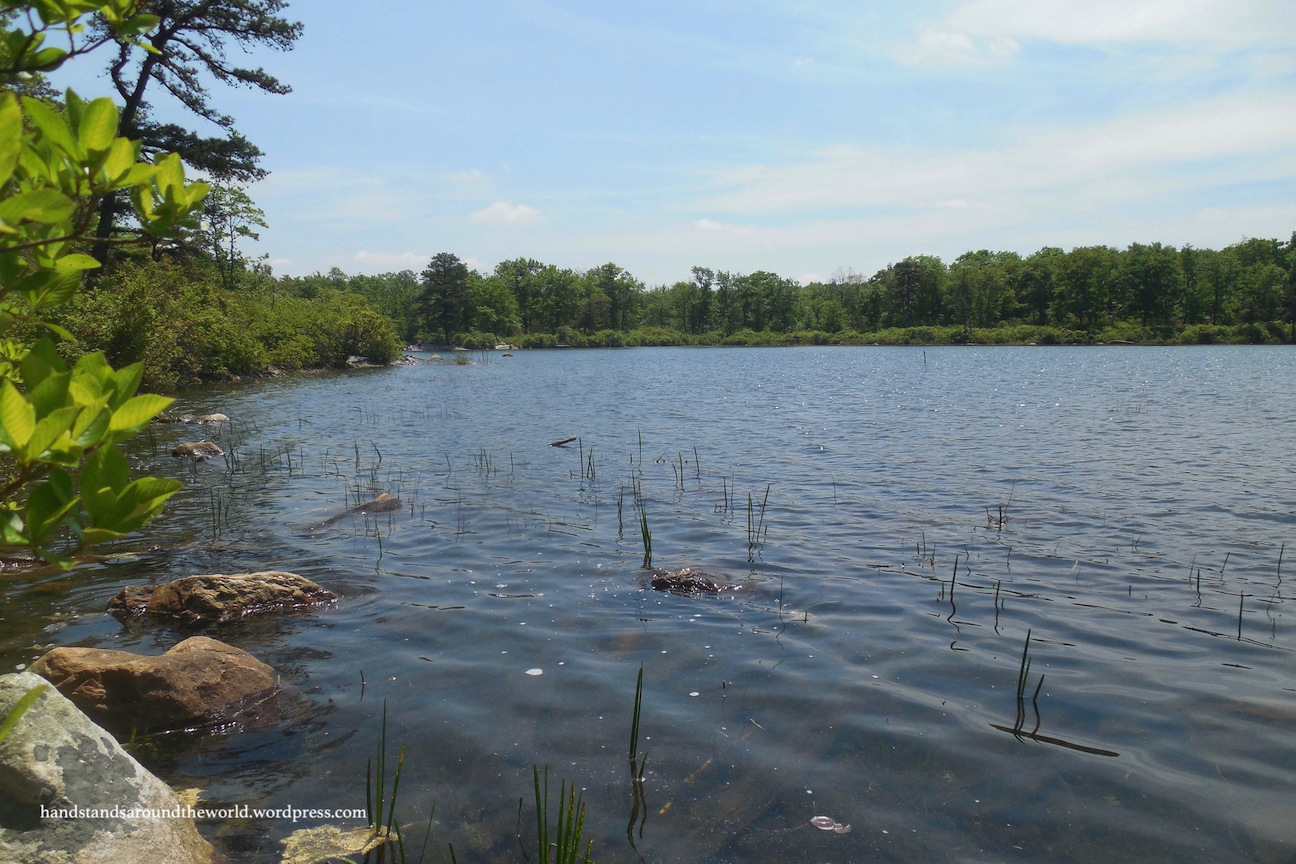
Blue Mountain Lake is just a short trek from the parking lot; from the main trailhead, take the right fork and walk for about 5 minutes.


This trail then continues along the shore of the lake for approximately 0.5 mile (0.8 km) before turning sharply to the right. Unlike the majority of the east coast, most trails here aren’t blazed; instead, they’re marked by posts that are located far enough apart to make you constantly question whether you’re still on the correct trail.
Anyway, 1.2 miles (1.9 km) beyond Blue Mountain Lake is Hemlock Pond. We were pleasantly surprised by this pond – it’s large, deep, and very pretty.

After Hemlock Pond, things started to get a little dicey. According to the trail map, the first right would take us towards the Crater Lake trail and the second right would put us on the Crater Lake trail. So we took the first right and what we thought was the second right, but after about 3 minutes the trail petered out and we found ourselves in the bushes.
So we headed back to the fork and encountered a group of three hikers with a more detailed trail map than we had who were likewise confused. After consulting with them, we all decided that we hadn’t yet reached the correct fork and we needed to continue straight here instead.
We did for about ten minutes, until the trail started to descend. According to their map, we were supposed to be gaining elevation, not losing it.
We turned around yet again and, after some searching, spotted a series of faded orange blazes lining a narrow thing that I guess could be considered a trail. It was very poorly maintained. But it did in fact take us up to the Appalachian Trail and then down to Crater Lake.
After having been to Crater Lake in Oregon, I wasn’t entirely sure what to expect here. Obviously this one was not located in an old volcano. It’s not really even in that much of a crater. But regardless of its name, the lake is very pretty, and there are many places along the shore to relax and have a picnic lunch.


After lunch, we retraced our steps back to our car, by which point it was getting towards late afternoon and we had a long drive back to our campsite.
Sadly, this concluded our time in Delaware Water Gap. As always, there was much more to see, especially on the New Jersey side of the park. Buttermilk Falls, located a few miles north of Millbrook Village, is the tallest waterfall in New Jersey. Unfortunately, the main road to the falls was not in 2WD condition, and we were too short on time to take the detour. But this just gives us a reason to return someday!
Whenever we do return, it certainly won’t be over Memorial Day weekend. Late May is apparently silkworm hatching season. These tiny green worms develop in the trees and then lower themselves to the ground on thin, silk-like strands. For the entire duration of our hike, there were so many of them falling to the ground that it actually sounded like it was raining. It was absurd.
Also, quite a few of them ended up on our shoulders and in our hair.
Ideally, I’d like to come back here in October when all the leaves are changing (and when it’s hopefully not raining silkworms). I’m sure the views are even more fantastic when the colors of fall are at their peak!
The Important Stuff:
- Getting there: this park is located off I-84, running 44 miles (71 km) along both sides of the Delaware River in Pennsylvania and New Jersey.
- Fees & passes: it’s free to visit all areas except the beaches.
- Camping: there are 3 campgrounds in the rec area with a total of ~200 sites; reservations are highly recommended.
- Hiking: there are many trails in the rec area.In this post, I discussed the Blue Mountain Lakes trail to Crater Lake (6.5 mi/10 km, moderate).
- Other: good maps are absolutely mandatory, especially for the New Jersey side of the park. Even with our trail maps (and knowledge of how to use them), we struggled to find our way.
Leave a Reply