After a wonderful week exploring maritime Canada, we crossed back into our home country for the final few days of our vacation. Our destination – Acadia National Park, located on the east central coast of Maine.
This relatively small park has three disconnected sections: Isle au Haut, the Schoodic Peninsula, and Mount Desert Island. Mount Desert Island is the largest, most developed, and by far the most popular section of the park. This is where we went.
We only had 2 days to spend in Acadia, and I can say with certainty that this was not enough. Not even close. Acadia is beautiful, and it quickly became apparent to me that I needed to plan multiple additional vacations to Maine.
(This was 4 years ago. Currently, the vacations are planned but have yet to be executed. Oops.)
Anyway, after a 5-hour drive from New Brunswick, we entered Mount Desert Island from the north, which is the only way to reach the island by car. A long bridge connects the mainland to the tiny Thompson Island (home to a visitor information center) and then Mount Desert Island.

Acadia encompasses approximately half of Mount Desert Island. For such a small park, getting around is somewhat complicated (see map here).
First of all, it’s an island so the topography is variable. There are lakes, ponds, and a few sounds and coves to deal with, which means there’s not really a direct route across the island in any direction. However, the Park Loop Road connects the major attractions on the eastern half of the island and many local roads lead to some of the less popular destinations on the western half.
In addition, old carriage roads are open for hiking and biking, if you’d prefer to travel around the island that way. I’m not much of a biker, but traffic was awful so I’d actually recommend biking to avoid the crowds. There are also free shuttle buses that travel the entire loop road. Every single parking lot was overflowing and traffic was a disaster; we definitely made the right decision by using the buses to travel around this part of the park.
(Be aware that there are quite a few restrictions on large vehicles in the park. For more information, click here.)
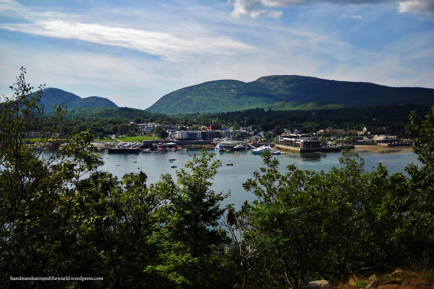
We stopped first at Hulls Cove Visitor Center at the start of the loop road. We then made the mistake of driving into the town of Bar Harbor. I say “mistake” because Bar Harbor was an absolute zoo. I’ve never seen so many tourists in one small town. We couldn’t have found a parking space if we’d wanted to. As it was, we could barely drive down the streets.
After leaving Bar Harbor, we headed south to Blackwoods Campground. It’s worth noting that the Park Loop Road only can only be accessed from certain points, and the campground is NOT along the road. However, there’s an entry point onto the road just a couple miles from the campground.
After setting up camp, we caught the Loop Road and drove the western portion of it. We passed Jordan Pond and then exited near Eagle Lake to drive over to the western half of the island.

Here, we drove along the edge of Somes Sound, which is supposedly home to the largest fjords on the east coast of the US.
Spoiler alert: they weren’t very large.

We also stopped at Echo Lake, Seawall, and the Bass Harbor Head Lighthouse on the southernmost tip of Mount Desert Island. It was built in this very scenic location in 1885 and belongs to the Coast Guard, not the National Park Service. It’s not open for tours, but there are plenty of opportunities for photography. In fact, this is one of the most photographed lighthouses in the US!


It was late in the day as we looped around the western half of Mount Desert Island and arrived back at our campground.

The next morning, we were up early in a race against the tide. Bar Island is located just off the coast of the town of Bar Harbor; both get their name from the fact that, during low tide, a sand bar connects Bar Island to Mount Desert Island. This means that for 1.5 hours on either side of low tide, the island is accessible on foot.
(Keep track of the time when out on Bar Island; outside of that 3 hour window, the water is too deep to get back to the mainland on foot.)
We were at Bar Harbor nice and early to find a parking space and ensure we had plenty of time to get to the island, climb to the top, and get back before the tide came in. We were there about an hour early and it was pretty neat to watch the sand bar slowly appear.


After about half an hour, the water was shallow enough that we could take off our hiking boots and wade the remaining distance across the sand bar to the island. So we did.


Once on the island, there are many options. The island is rocky and covered in sea shells around the edges, but the center of the island is forested and rises to a high point, from which there are beautiful views back to Mount Desert Island.


Once back on the mainland, we spent the rest of the day exploring the eastern coast of Mount Desert Island and the cliffs that rise above the Park Loop Road, which will be the subject of the next post.
Stay tuned!
The Important Stuff:
- Getting there: the main Mount Desert Island section of the park is located just off the coast of Maine, accessible from State Highway 3.
- Fees and passes: $35/car for a 7-day pass; America the Beautiful passes are accepted. Timed entry reservations may also be needed for certain areas of the park.
- Where to stay: There are two campgrounds within the boundaries of Acadia on Mount Desert Island. Reservations are required. There are also some private campgrounds and other lodging options on Mount Desert Island.
- Hiking: the walk out to Bar Island takes 5-10 minutes; climbing to the top wasn’t overly challenging either. For other hikes in Acadia, click here.
- Other: I can’t emphasize enough how horrible the traffic was, especially on the Park Loop Road. There aren’t enough parking spaces anywhere. I’d recommend saving yourself a lot of hassle by biking the carriage roads or riding the free shuttles.
Leave a Reply