
This one is being filed in the category of hikes I will probably never do again. It was pretty. It was definitely really pretty once we emerged from the trees. But it was also brutally steep and, frankly, there are less challenging hikes that will get you above tree line.
There are two ways to get to Hope Pass; from the west via Sheep Gulch or from the east via Willis Gulch. We climbed Willis Gulch. The trail begins along Lake Creek near the town of Twin Lakes. There’s a decent amount of parking and while the lot filled, it wasn’t overflowing – unlike most trailheads we’ve visited here in Colorado. Willis Gulch is over two hours from Denver, which seems to be the point at which usage declines. It makes sense; we don’t usually drive more than two hours for a day hike either. But we were camped nearby for the weekend, so it was only about a 25 minute drive for us.

The hike begins by crossing the creek and climbing up and around the hill on the opposite side to reach Little Willis Gulch. For a time, we wove through a grove of squiggly aspens and hiked alongside a cascading creek. But even the pretty scenery couldn’t completely detract from the reality of this relentless hike that gains nearly 3200 feet (975 m) of elevation over about 4.7 miles (7.6 km). Some sections were steeper and others flattened out slightly, but the overall elevation profile was steadily uphill. I struggled more than I expected.

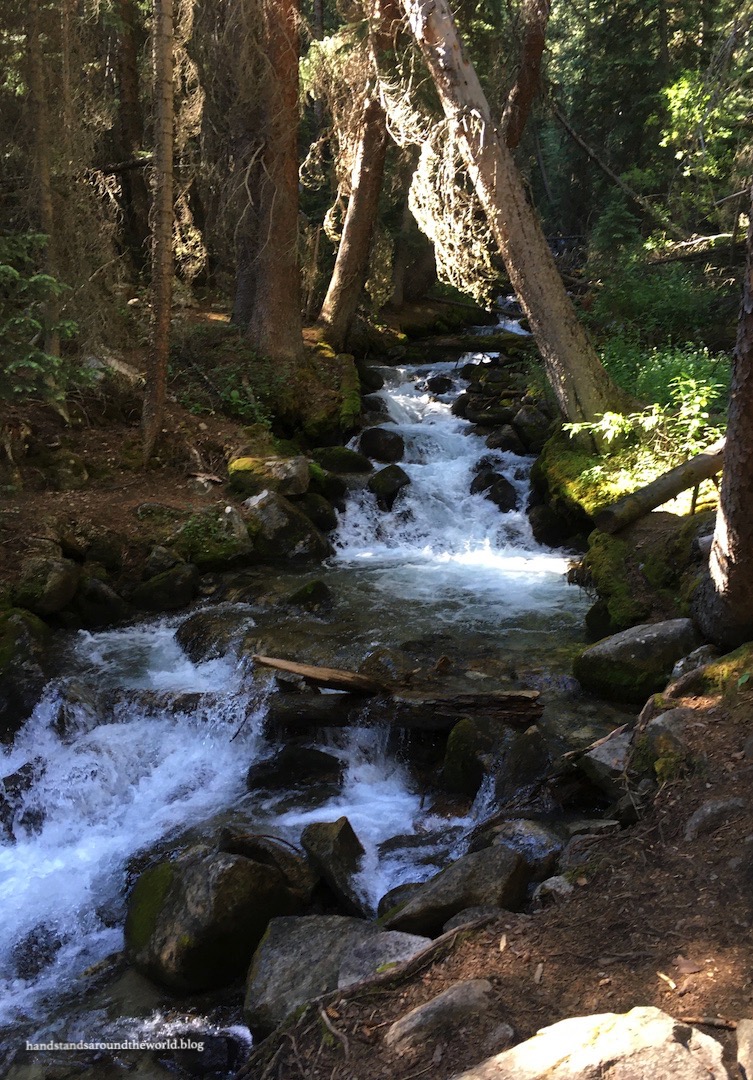
The first 3 miles (4.8 km) were spent almost entirely in the forest, save for the traverse through an old avalanche path and, later, a section of willows alongside a small stream.


After 3 challenging miles, we finally emerged from the forest and into the tundra. From this point on, the views became steadily more expansive. Up ahead, we caught our first glimpses of the 12,508 foot (3812 m) Hope Pass, nestled between Quail Mountain and Mount Hope. Behind us, we could see all the way out to Twin Lakes and Leadville. Off to the right, a small, unnamed lake was nestled in a low spot. You can see it in the second photo below; its green color allows it to blend into the landscape remarkably well.


The upside to being able to see your destination from the trail is that you can visually confirm you’re getting closer. The downside is that sometimes it doesn’t look like you’re actually making any tangible progress. This hike was one of the latter. The final section was so steep and we were moving so slowly and Hope Pass just never seemed to get any closer. But at long last we turned onto the final switchback and the summit marker finally came into view.

Once we reached the pass, we were beautifully rewarded for our efforts. It was a warm, sunny, and surprisingly calm day, despite the elevation. I’d deliberately worn pants, anticipating wind, but I would have been plenty warm in shorts.
From this perch high in the Sawatch Range, we could see in all directions. The view back down the trail was similar to what we’d enjoyed during the final mile of the hike. North and south, we could see Mount Hope and Quail Mountain now towering above us. And to the west were more of the towering Sawatch Mountains, including 14ers Huron Peak, Missouri Mountain, and Mounts Harvard, Belford, and Oxford. This was our first time seeing these mountains and they are massive and beautiful. Huron is supposedly one of the prettiest 14ers and, after standing here looking at it, I think I see why. I’ve added that one to the to-do list for some future date.


Though I don’t have a good photo of it, Mount Elbert – the highest peak in Colorado – is visible from here as well; you can see the ridge of it on the left of the photo above, with just a few patches of snow remaining. Pat and I had initially planned to return to this area of the state the following weekend and climb our 8th state high point, but we ended up changing our plans. One day soon, though, we will return to the Sawatch Range and stand atop the highest point in Colorado.
(Update: in September 2022, we did!)
Until then, I hope you’re all still enjoying reading about our never-ending explorations of Colorado. A couple weeks after this hike, Pat and I returned to the San Juan Mountains of southwestern Colorado to accomplish some bucket list items; I’ll be talking all about these adventures after the start of the new year. Stay tuned!
The Important Stuff:
- Getting there: the Willis Gulch trailhead is located off CO Highway 82 just west of Twin Lakes, Colorado
- Fees and passes: none
- Hiking: 9.4 miles (15.1 km) round-trip with 3175 feet (968 m) of elevation gain. Hope Pass can also be reached from the west side via Sheep Gulch; it’s slightly shorter and with slightly less elevation gain, but overall is just about as steep as the Willis Gulch route
- Where to stay: there are many camping and other lodging options in the Twin Lakes area, and Leadville, about 30 minutes away, also offers lodging opportunities
- Other: the final couple miles of this trail is above tree line and very exposed to the elements, and you won’t necessarily be able to see incoming weather because the surrounding mountains block the view; be prepared for storms and have a plan for quickly seeking shelter in case of lightning

This looks beautiful! I might have to add to my to do list!
LikeLiked by 1 person
Brutal but pretty!
LikeLiked by 1 person
I’ll have to add this one to my list. Thx!
LikeLiked by 1 person
That’s a lot of elevation to hike in a short amount of time! At least you had fabulous weather and were able to get nice views. Imagine how much this would suck to hike through tough terrain while also battling rain? Pass.
LikeLiked by 1 person
Excellent post, very nice hike and well reported on your blog!
Also, very nice to see the panoramic photo with Mount Belford, Missouri Mountain, and Huron Peak.
Looking forward to your newt post
LikeLiked by 1 person
Thank you!
LikeLike
You’re definitely brave for trekking Hope Pass! There have been trails which I’ve hesitated to or avoided attempting out of fear, but I’m sure they were a cakewalk compared to this hike! That green lake certainly was hidden; I had to take a closer look to find it. But of course, despite the treacherous paths, it is the sublime views which reward you for your efforts in the end. 🙂
LikeLiked by 1 person
I’ll end up hiking Hope Pass a couple times…once when I get to that section of the Colorado Trail and at least once more to do the 13ers up there. At least it’s beautiful haha
LikeLiked by 1 person
You’ll have to climb it from both sides and see which is better!
LikeLike
It does look beautiful, thanks for doing the hard work for us 🙂 Maggie
LikeLiked by 1 person
Beautiful! The vista is rewarding and one can imagine the challenges of this hike.
LikeLiked by 1 person
Courageous hike, this one is done; pleasantly narrated.
LikeLiked by 1 person