
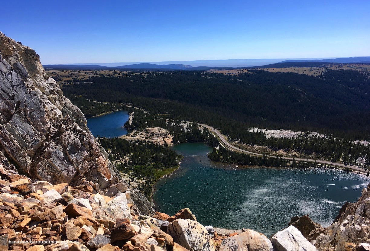
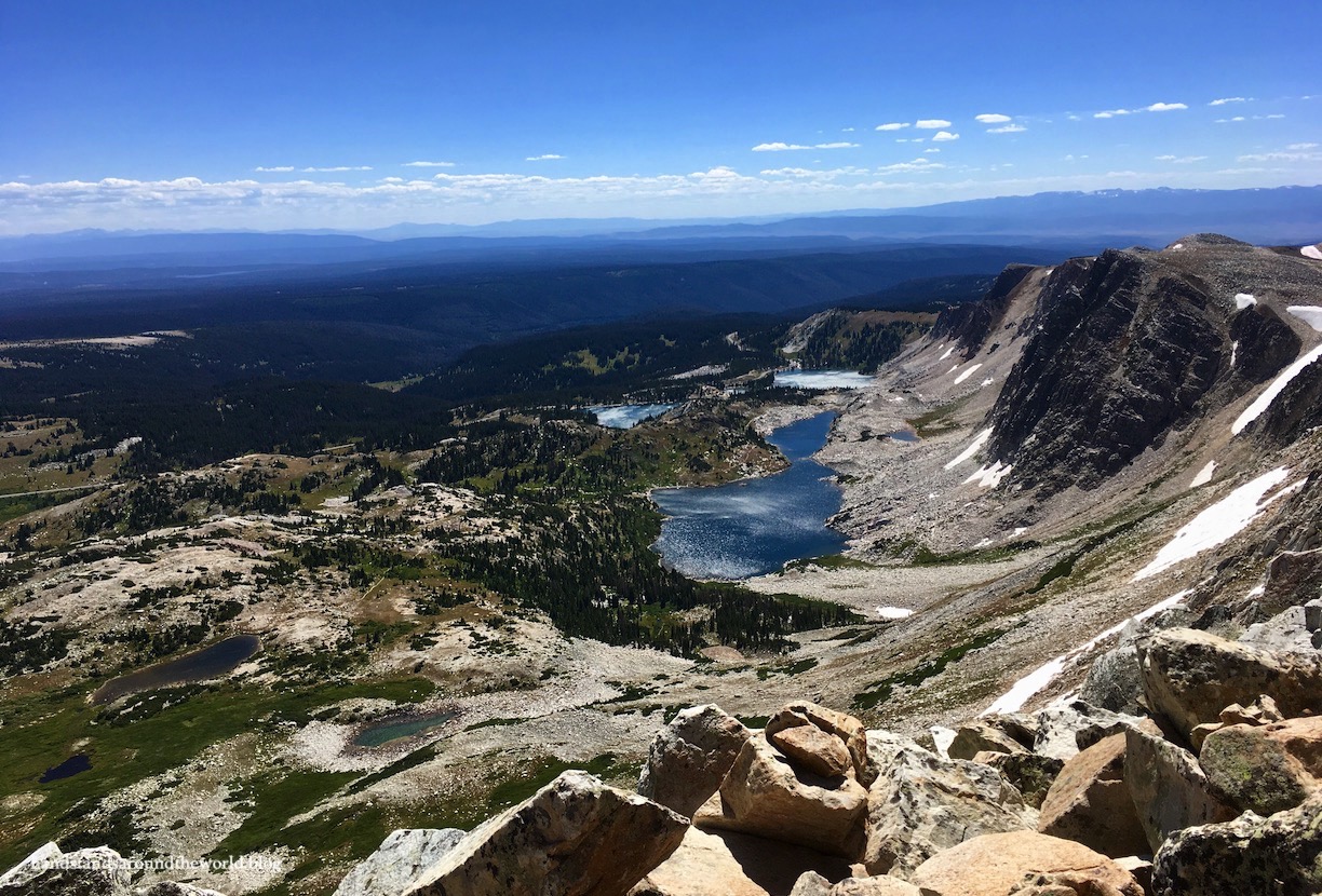
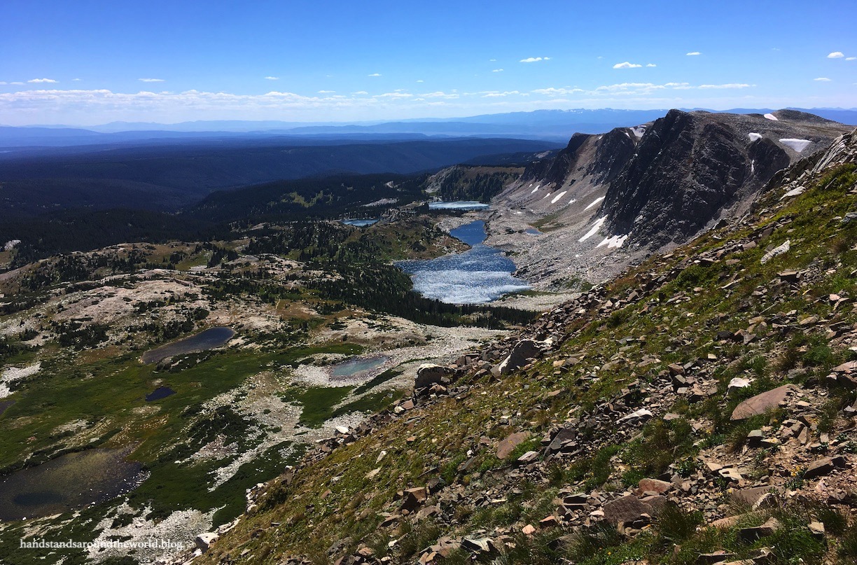
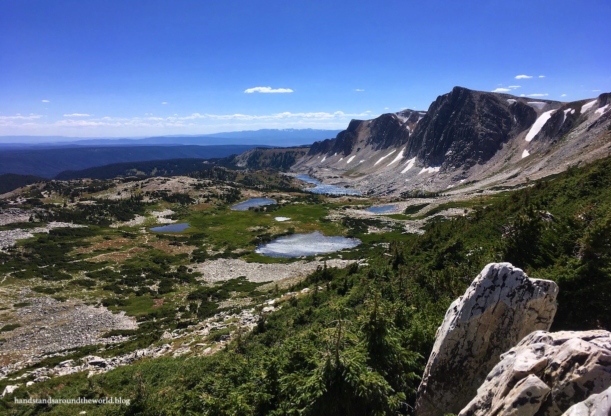
If you read the title of this post and assumed the “fifty lakes” is an exaggeration, let me begin by assuring you that it’s not. If anything, it’s an underestimation. At one point, from where I was standing on the Medicine Bow Peak trail, I could see 32 lakes!
At an elevation of 12,013 feet (3662 m), Medicine Bow Peak is the highest peak in the Wyoming half of the Medicine Bow Mountains (which extend into northern Colorado). The Snowy Range – the northernmost section of the Medicine Bows – is traversed by a scenic byway and was our destination for Labor Day Weekend 2019.
Snowy Range Scenic Byway (Wyoming Highway 130) traverses 40 miles (64 km) between the town of Centennial and the Highway 13/230 junction. It climbs up and over the Snowy Range, topping out at Medicine Bow Pass. We drove it from east to west.
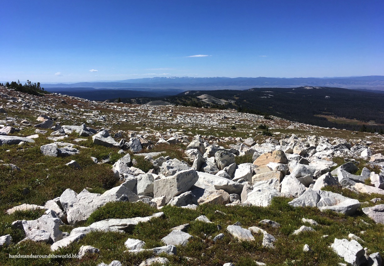
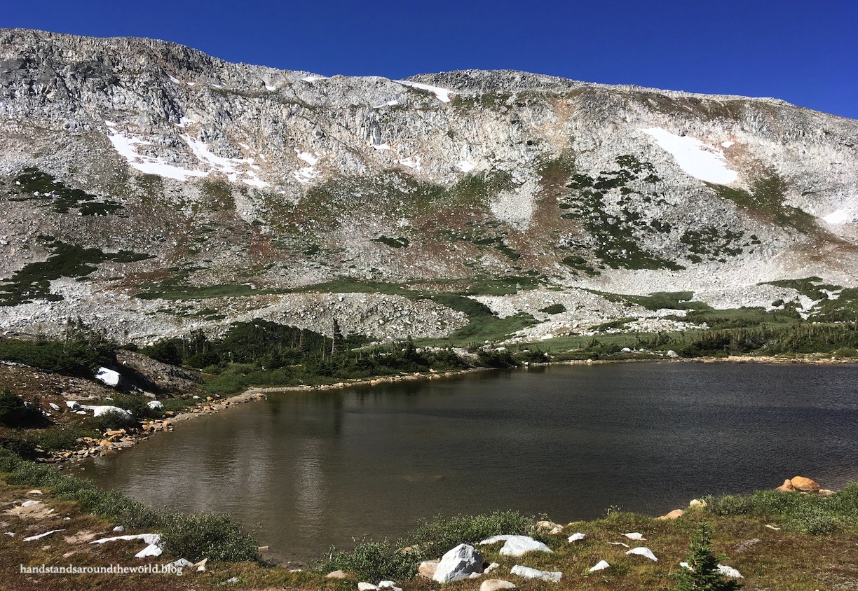
In addition to an unbelievable number of beautiful alpine lakes – more on those in a minute – the mountains of the Snowy Range are very unique. The range is predominately made of quartzite which is very light in color; the mountains are almost white in places. I would hazard a guess that this is where their name comes from. They’re also not the pointy, jagged mountains that you see elsewhere in Wyoming; it’s more of a gently undulating ridgeline with a few rounded high points. Of course, the ridgeline didn’t feel very gentle or rounded when we were hiking it – it’s plenty rocky and steep in places – but it wasn’t the vertical climb you often encounter when summiting mountains.
But more on the hike shortly.
Our first stop on our way up the Byway from the east was Brooklyn Lake, located north of the highway down Forest Service Road 317. There’s a beautiful little chapel up there as well, and as we drove past people were arriving for a wedding. There’s also a campground, though this isn’t where we stayed.

From Brooklyn Lake, we opted to take the scenic route back to the Byway along Forest Service Road 312. The map they gave us at the visitor center labeled this as a maintained road, but it’s a good thing we had our Forester because my Corolla wouldn’t have made it. We didn’t need 4WD but we definitely needed the clearance, and it would have been nice if the brochure had mentioned that.
Back on the Byway, we soon arrived at the Sugarloaf Recreation Area. Here you’ll find a well-maintained road that’s marked on the brochure as being 4WD (it isn’t… they need to update their map) leading to Libby Lake, Lewis Lake, two picnic areas, and Sugarloaf Campground. A few trails depart from here as well. There is a day use fee in effect, or you can hang your Interagency Pass from your rearview mirror.
Back on the main road, our next stop was at Libby Flats and Medicine Bow Pass, the high point of the Scenic Byway at 10,847 feet (3306 m). A short walk out to a viewing platform provides scenic views in all directions. You’re above tree line at this point so bring a wind jacket!
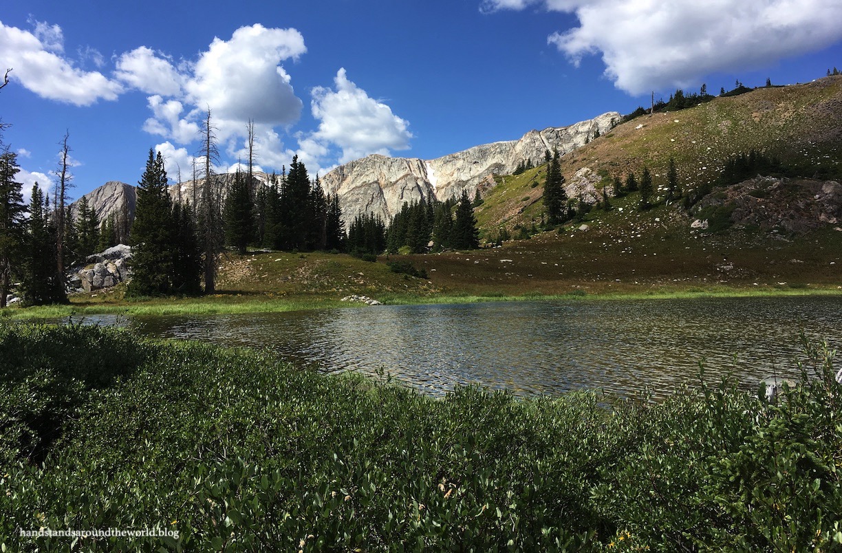
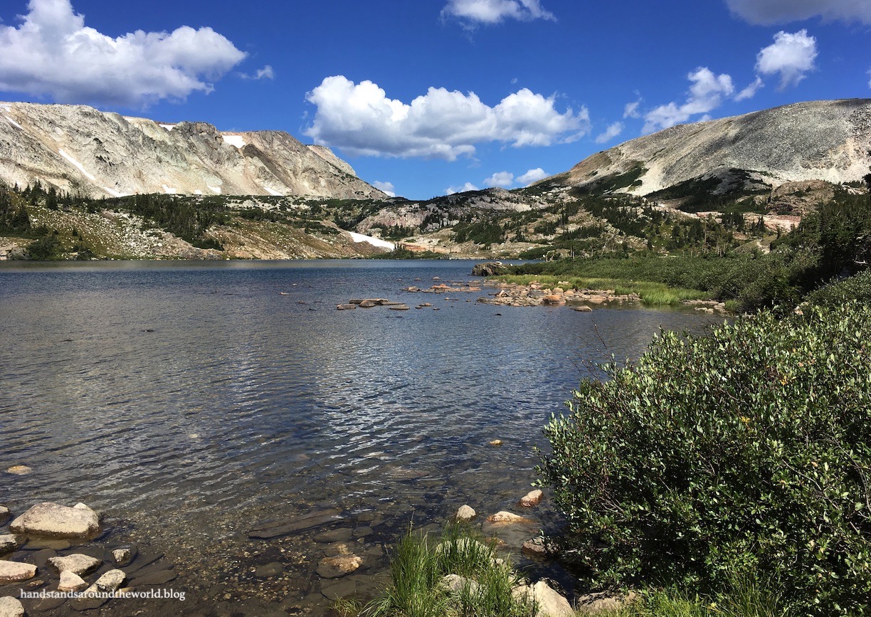
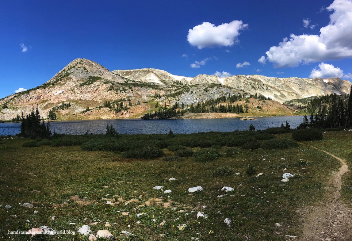
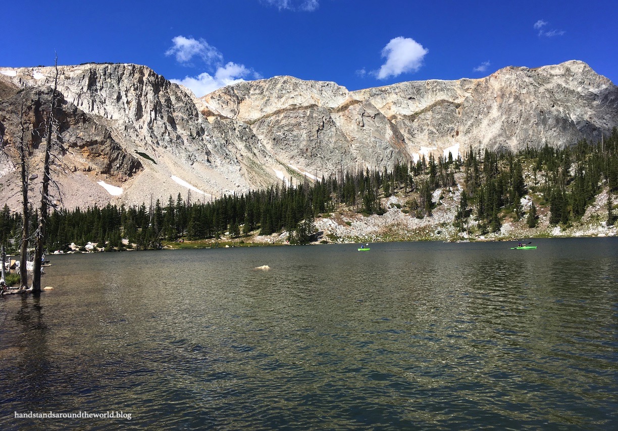
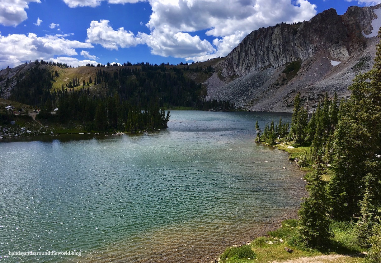
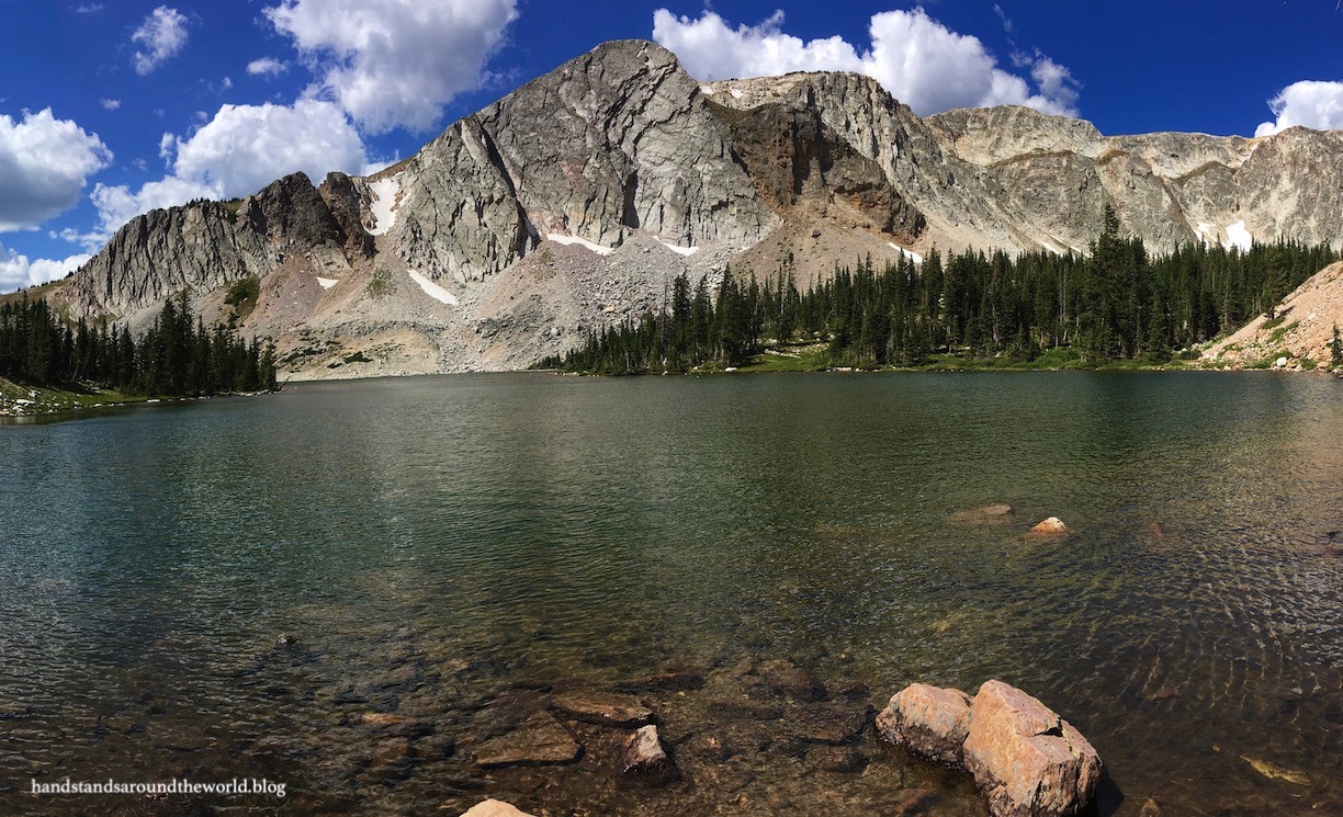
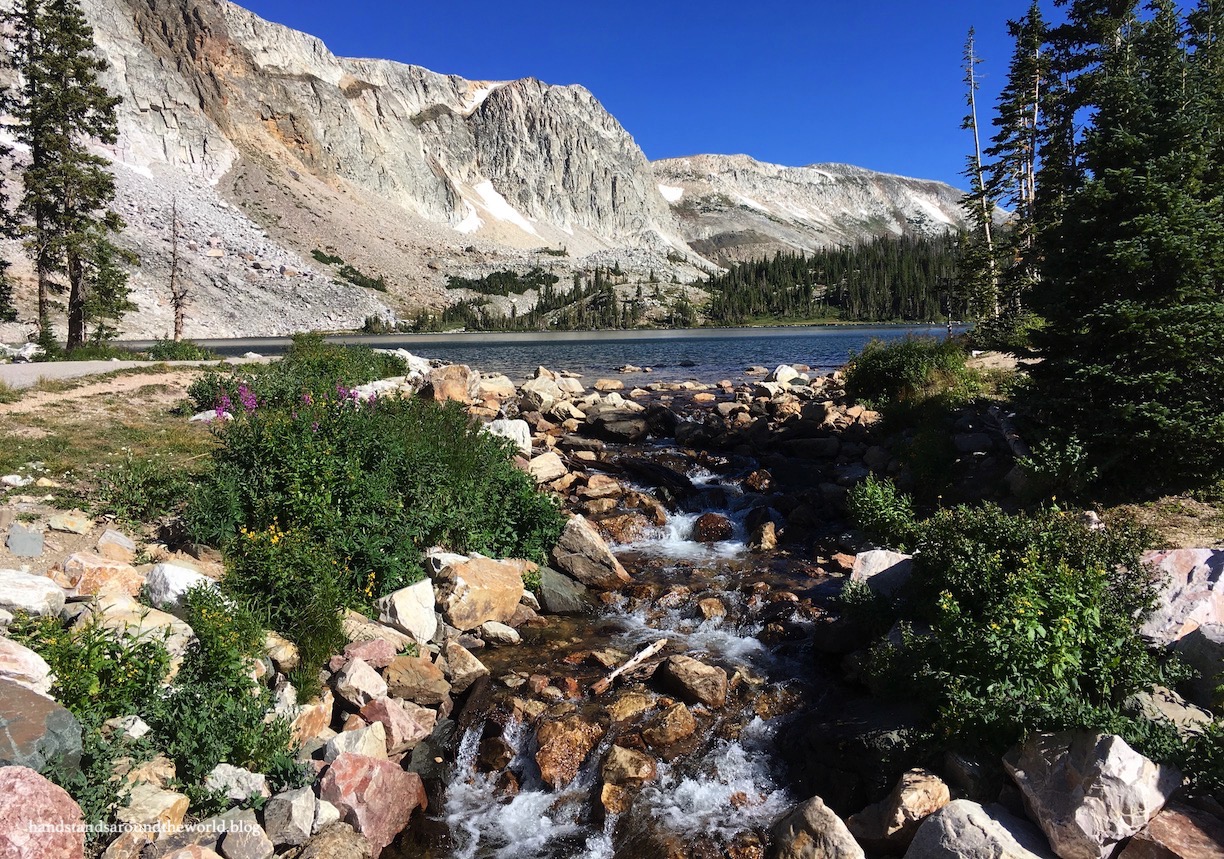
Definitely the highlight of the Byway is Mirror Lake and Lake Marie, both of which sit in the shadow of Medicine Bow Peak. These are beautiful lakes and we enjoyed some time on the shore of each one. This area and Sugarloaf are the most popular and crowded locations along the Byway. There is a suggested $5 donation for day use visitors to the Mirror Lake area.
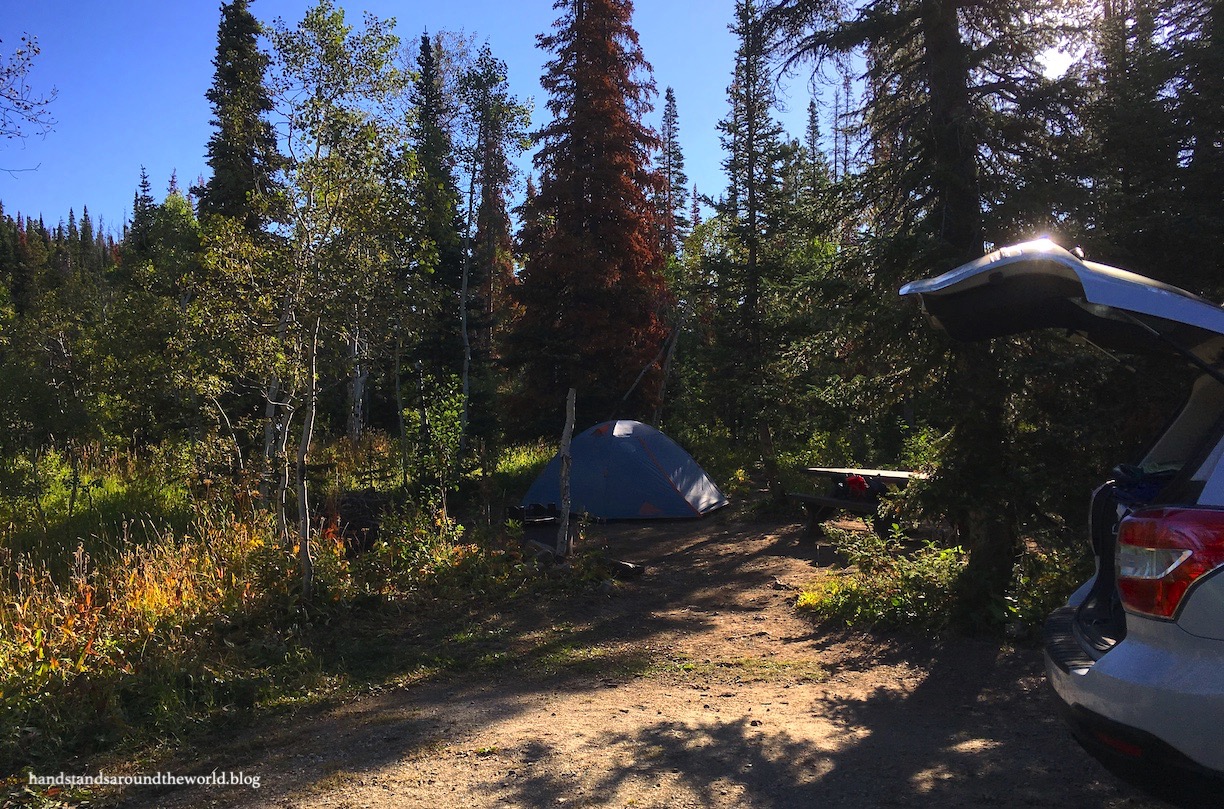
Our final stop was at our campground for the next two nights: Ryan Park. I reserved our site three months in advance but the campground never completely filled despite being a holiday weekend. A word of advice about this campground: there are some sites that are meant for RVs and some that are meant for tents. My mom and I looked at photos of the sites when we made our reservation and chose what appeared to be a tent site, but it was very clearly a pull-through RV site.
Right as we finished putting up our tent in the middle of the pull-through (which was the only mostly-flat spot in the whole site), a couple arrived with their giant RV and promptly realized there was no way in hell it was going to fit into their site. A woman who was camped at a site between us and them noticed our respective conundrums and suggested a campsite swap. We both had plans to check out on the same day and were more than happy to make the switch; the RVers even kindly helped us carry our tent across to our new site!
Aside from that initial issue, Ryan Park was a pretty nice campground. Some spots are wide open and sunny but ours was shaded with some privacy. There is running water and the cleanest, nicest pit toilets I’ve ever seen. The campground hosts were very friendly and provided solar lights, a pretty fake plant, and some hand sanitizer in each restroom!
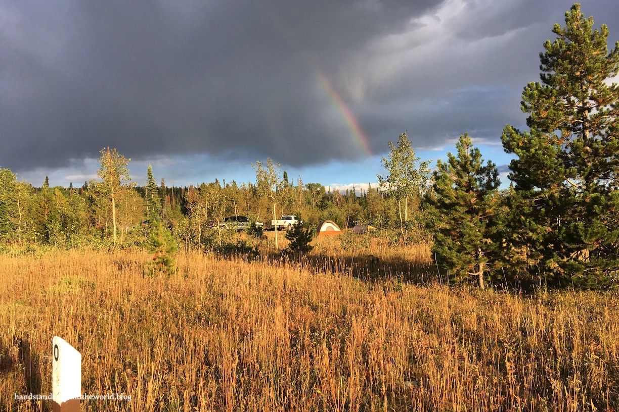
Ryan Park Campground happens to be built on what was once a Civilian Conservation Corps (CCC) camp and subsequently a Prisoner of War camp during WWII. Captured Italian and German soldiers were housed here and put to work doing some logging. Each was given a small stipend for their efforts and, apparently, most enjoyed the beautiful location so much that almost no one tried to escape and many allegedly didn’t want to leave when the war was over.
What remains of the camp (predominately crumbling foundations) can be seen on a short walk through a field in the middle of the campground, using a brochure provided at the trailhead. There wasn’t much to take photos of, but the rainbow that appeared while we walked the trail was pretty!
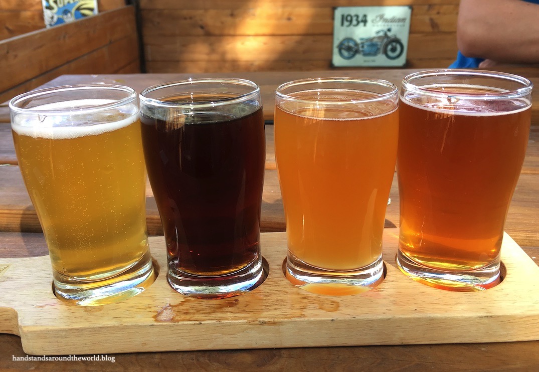
We ended our day by following the Byway all the way to its western end and then turning north toward the town of Saratoga. It’s a quaint, rural western town with a beautiful hot springs resort, complete with an attached brewery. Not only did I have one of the best beer samplers of my life at Snowy Mountain Brewery, but we also enjoyed relaxing in their outdoor biergarten.
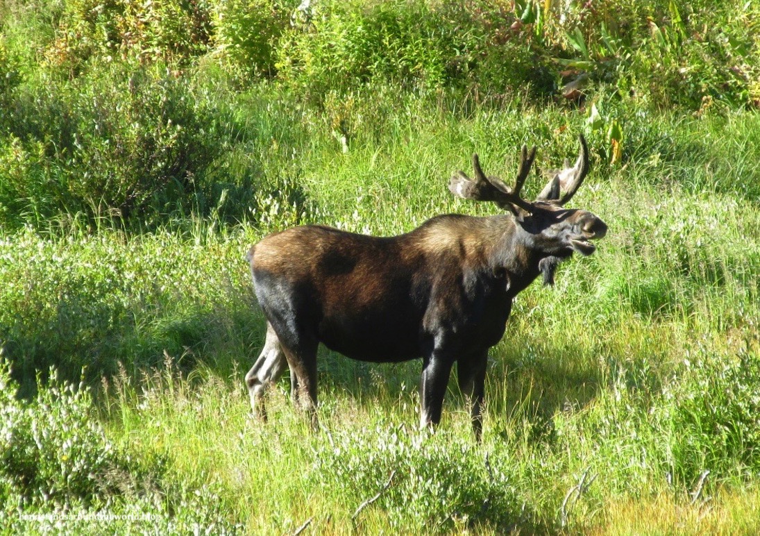
The next morning we were up fairly early and headed back up the Byway for our hike. We stopped on the way to watch a couple moose munching happily on some willows and then pulled into the Lake Marie area to find it substantially less crowded than it had been the previous afternoon.
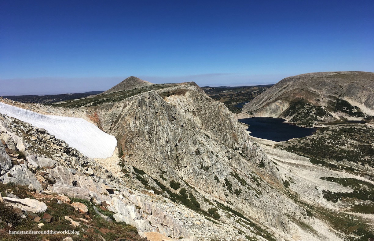
There are many routes up to the summit of Medicine Bow Peak, including one that’s short and extremely steep; we opted for the longer and slightly more gradual loop option. This route departs from Lake Marie and switchbacks up the western slope of the Snowy Range.
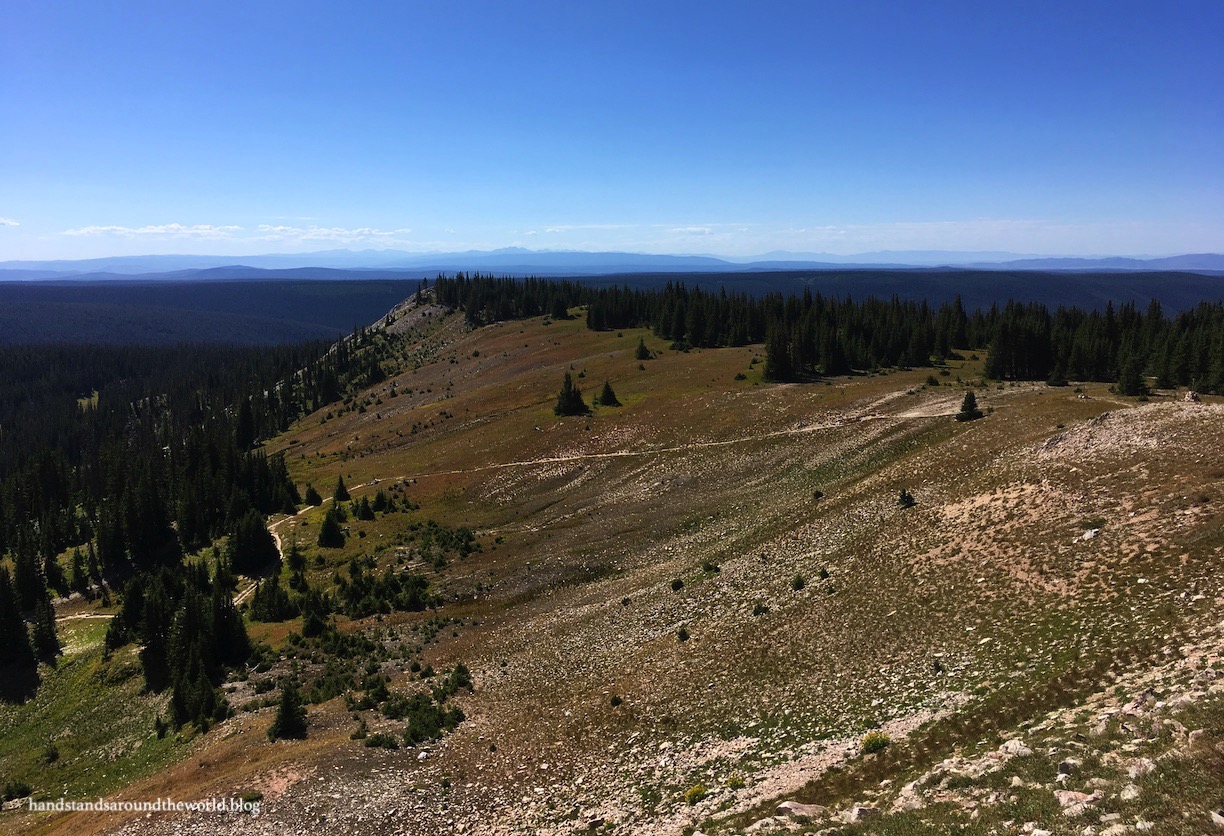
The initial climb is fairly steep but once you reach the ridge it flattens out substantially. However, what relief we found from elevation gain was overshadowed by the challenge of the endless rock fields we would navigate for the next few miles. The Forest Service has fortunately done a fairly good job of creating somewhat of a trail through the talus.


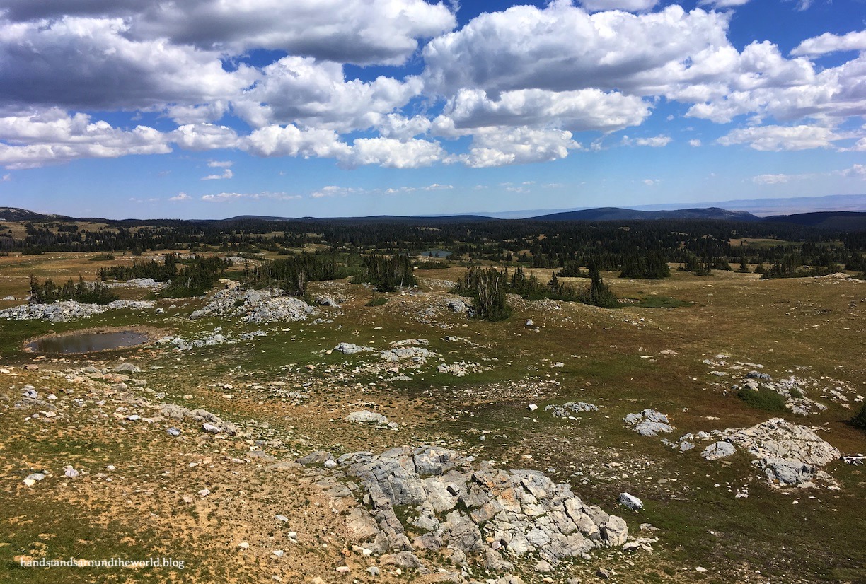
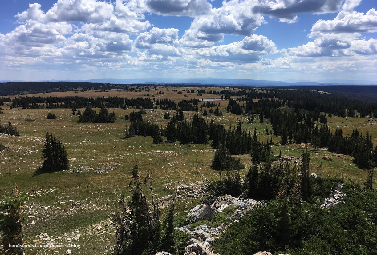
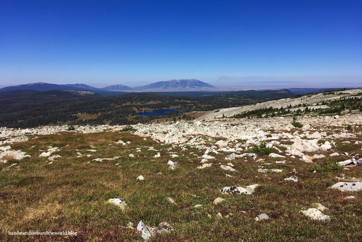
The trail dipped down the back side of the Snowy Range, providing panoramic views into central Wyoming. Smoke from a distant forest fire blurred the horizon but the many lakes at the base of the mountains were unobscured.

At last, we reached the summit of Medicine Bow Peak at 12,013 feet (3662 m). This was my mom’s first ever 12,000+ foot peak, and it was a struggle but she did it! Elevation really is its own kind of beast.
It was expectedly windy on the summit but we were able to find a little nook to enjoy some lunch and the incredible views. As we were preparing to begin our descent a bald eagle soared overhead, a wonderful addition to an already incredible hike!

The loop trail led us down the eastern slope of the mountain, right across a small snowfield that hadn’t yet melted. I’m extremely glad we didn’t climb up this way, as this section of trail was far steeper than our route to the top had been. After our rapid descent, the trail leveled out and curved back towards Lake Marie, traversing beautiful meadows and passing multiple lakes en route.

This is quite possibly the most beautiful summit hike I’ve ever done. It’s so easy to think that the higher the mountain, the better the hike… especially in Colorado with all its 14ers and the hype surrounding them. But this hike reaffirmed the notion that oftentimes it’s the shorter peaks that are not only much less crowded, but also just as – if not more – incredible!
The Important Stuff:
- Getting there: the Snowy Range Scenic Byway is Wyoming Highway 130 between Centennial and its junction with Highways 13 and 230; the highway closes in the winter but can be accessed on foot or by snowmobile
- Fees and passes: it’s free to drive the Byway, but there’s a suggested $5 donation at Mirror Lake/Lake Marie and a required day use fee (I think it’s $5/car) at Sugarloaf Rec Area
- Hiking: there are 102 lakes that can be visited from the Byway; a few are accessible by car but most can only be reached on foot; more hiking information here (scroll down and expand the hiking link)
- Where to stay: there are many campgrounds (scroll down and expand the camping link) along the Byway, most of which are fairly primitive; some accept reservations. Limited lodging options are available in Ryan Park, Saratoga, and Centennial
- Other: I had trouble finding detailed Byway information online when I was researching for this trip; this brochure and this brochure are the best resources I came across

gobsmackingly beautiful!
LikeLike
I am literally giddy reading this post. As long as we can travel next summer we are definitely going here! Thanks for the info and all the beautiful (!!!) photos.
LikeLiked by 1 person
One of the joys of blogging is being able to share written and photographic images with others which potentially expands the viewer’s experience. Diana does a superb job in doing this and comments like yours are a great validation. (Not trying to speak for her, but just as an observer)
LikeLiked by 1 person
You guys are gonna love it! Definitely one of the prettiest hikes I’ve ever done!
LikeLike
It looks lovely! Very refreshing to see that life goes on somewhere and it is not all about lockdowns everywhere. Thank you for taking us with you on this trip. The historical info was fascinating.
LikeLiked by 1 person
I love that area. I skied out there 32 years ago in a tiny resort called Snowy Range. Not sure if it’s still there or not.
LikeLiked by 1 person
It is! I don’t know if it’s operational but we did see the turnoff for it.
LikeLiked by 1 person
What a great post with stunning photos and amazing views!
Thanks for sharing
LikeLiked by 1 person
Thanks!!
LikeLike
Such stunning views! Really incredible that you can see multiple lakes at once from a single vantage point. Wyoming hasn’t been a state I’ve visited too much of (exception being Yellowstone), and it’d be awesome to check out more of what it has to offer. Thanks for sharing!
LikeLiked by 1 person
The mountains of Wyoming are incredible! Definitely worth exploring. I know I’ve only scratched the surface.
LikeLiked by 1 person
A wonderful post with outstanding photos (except no handstand…!) I love when you include pictures from a brewery and the historical info on the POWs was fascinating. I had never expected that we would have housed them in the US during the war.
LikeLiked by 1 person