
Memorial weekend 2019 in Colorado was a snowy mess, so it was fortunate that I’d already made plans to fly home to Montana and visit Bighorn Canyon with my mom. Despite the fact that it’s only 4 hours from my hometown, I’d never been there before and was eager to explore a new place.
We set off on Friday morning, reaching Bighorn Canyon by early afternoon. The main visitor center is located in the town of Lovell, Wyoming a few miles from the Rec Area boundaries.
(The other visitor center is located near the Yellowtail Dam in the northern section of the Rec Area. Note that even though the Rec Area encompasses the full length of the Bighorn River from Yellowtail Dam to the southern tip of Bighorn Lake, no road traverses from one end to the other. It’s a 2-3 hour drive out and around to get from one half of the park to the other.)
Once inside the Rec Area boundaries we stopped first at Horseshoe Bend, where we snagged what I would consider one of the best campsites in this half of the park (site A11). It’s first-come-first-serve so we were a little worried about the prospect of finding a site, but that turned out to be unwarranted. The campground never filled. This appears to be a fairly undiscovered location, and most of the visitors are day use boaters.
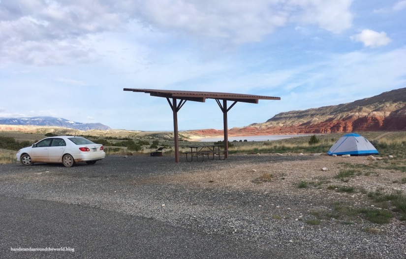
Horseshoe Bend campground has running water in the bathrooms and seasonal potable water at a spigot; I’m not sure what constitutes “seasonal” (the website says Memorial Weekend) but it hadn’t been turned on yet. Fortunately, there were drinking fountains just up the road at the Horseshoe Bend Marina where we could fill our water containers.
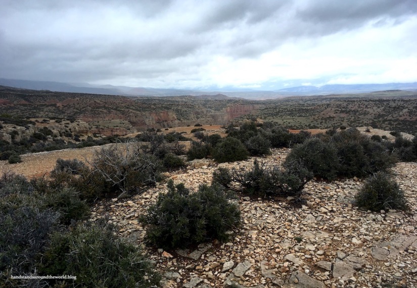
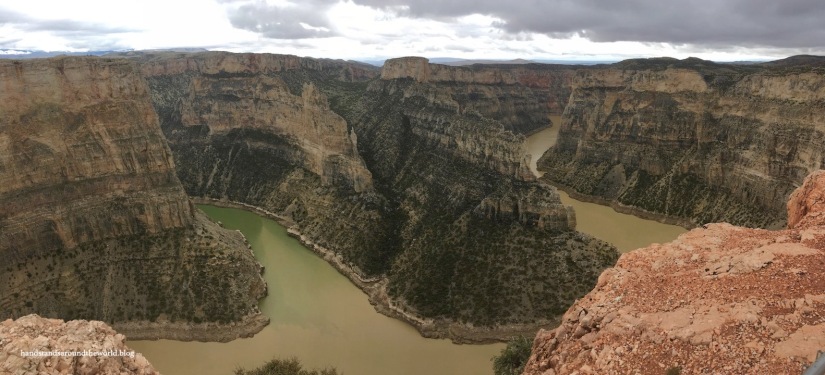
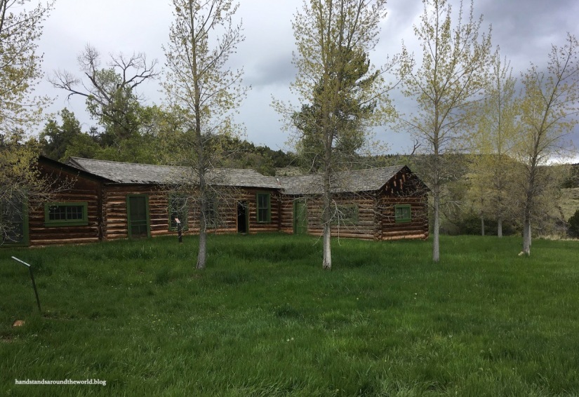
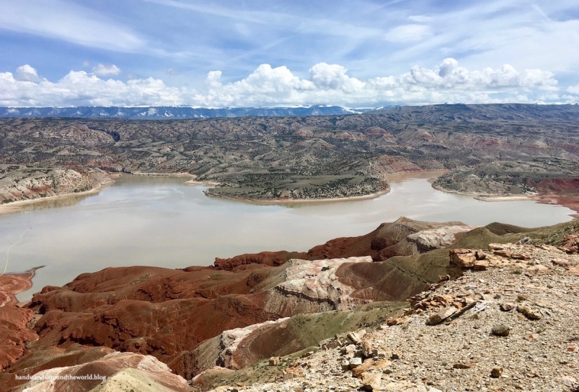
It was a drizzly afternoon, so after setting up camp we decided to just acquaint ourselves with the park by driving all the way to the end of the road. This took us back across the border into Montana to Devil Canyon Overlook (which is arguably one of the best views in the park), through the Pryor Mountain Wild Horse Range, and to the old Ewing Snell and Caroline Lockhart Ranches. The road turns to dirt 2.5 miles (4 km) before the Lockhart Ranch; our car ended up covered in red mud, but we didn’t have any trouble with the drive. However, in heavy rains I could see how AWD or 4WD might be preferable or even necessary for this section.


We also drove up to Barry’s Landing, which is the location of the other campground, a boat ramp, and a picnic area. The ranger at the visitor center actually recommended we camp here because it’s more remote but we found it to be far from most of the attractions and trails, a little too remote for us, and lacking running water. We definitely stand by our decision to camp at Horseshoe Bend. Plus, the view from our campsite was far better than any of the tent sites at Barry’s Landing. That being said, if you have an RV and are planning to do some boating, there were a couple nice riverfront RV sites here.

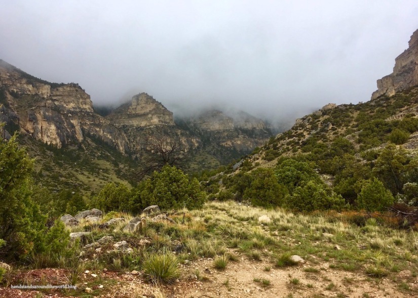
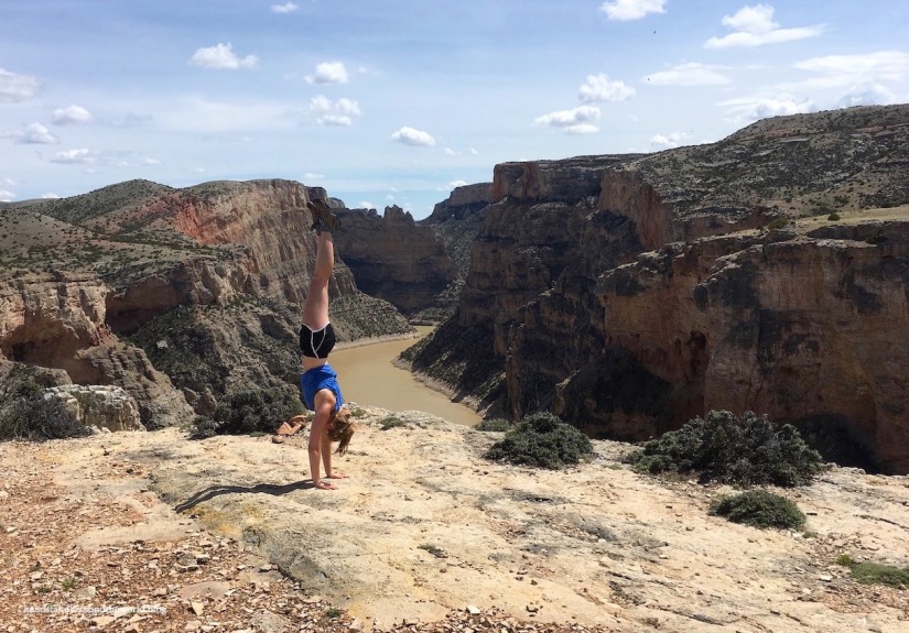
Day two dawned sunny and much drier, so we took advantage of the opportunity to do some hiking. Hike #1 was up Sykes Mountain, which provided unparalleled views of Bighorn Lake and Horseshoe Bend. The trailhead is across the road from the Crooked Creek Ranger Station, at the sign for Horseshoe Bend Road.
Truthfully, I’m being very generous by referring to this as a trail. The first section is marked with periodic brown posts, the first of which blends into the bushes so well that we completely missed it and started our hike by turning the wrong direction towards the much more obvious line of what I now assume are old wooden fence posts. As specified by the trail description, they led us around to the first drainage. What our trail information failed to mention is that we should have been going to the first drainage on the left; we ended up in the drainage on the right.
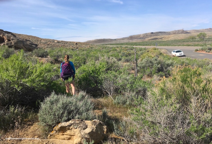
Miraculously, we managed to eventually find the actual trail. We figured we couldn’t get lost as long as we just made our way up the mountain and kept the highway behind us, and that turned out to be a workable strategy. However, no sooner had we found the trail than we lost it again. For whatever reason, there were no more trail markers after the first 1 mile (1.6 km) or so; the occasional cairn marked the way, but they were too small and far apart of be of any use so we just forged our own path once again and eventually made it up to the summit ridge. Since this is a national rec area rather than a national park, there are no regulations about staying on trails. However, we still did our best to walk only on rocks and avoid crushing plants.
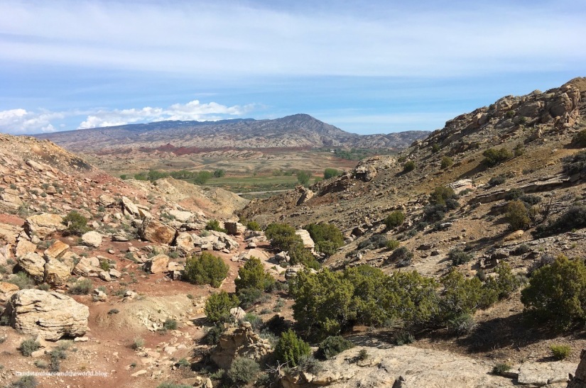
We were most of the way to the summit when I decided to pull up the hike in AllTrails and see if we could use that to guide us, but even this proved largely unhelpful. We found the “trail,” according to the app, but there was still no discernible path. Also, the Bighorn Canyon trail guide shows this as an out-and-back hike while AllTrails has it as a lollipop loop. I’m not sure anyone actually knows where the trail is.
Also, had we followed the AllTrails map, we would’ve turned around far before the best views. Instead, we continued along the ridge until we were directly overlooking Horseshoe Bend. I’m not sure if we technically summited the mountain, but these were views you couldn’t find anywhere else in the Rec Area!

After forging our own path down with the vague assistance of AllTrails, we caught up with that final trail marker and followed the correct path down the left drainage and back to our car. The hiking guide lists this at 3.75 miles (6 km) with 250 feet (76 m) of elevation gain, but my mom’s Fitbit clocked us at least 5 miles (8 km), and there’s no way we only climbed 250 feet. I’m certain we gained 3-4 times that much elevation.
Our next hike was the much shorter, easier, and better marked 1 mile (1.6 km) lollipop loop out to Sullivan’s Knob. From this point on the canyon rim you’re rewarded not only with excellent views, but also a triple echo if you shout loudly enough.


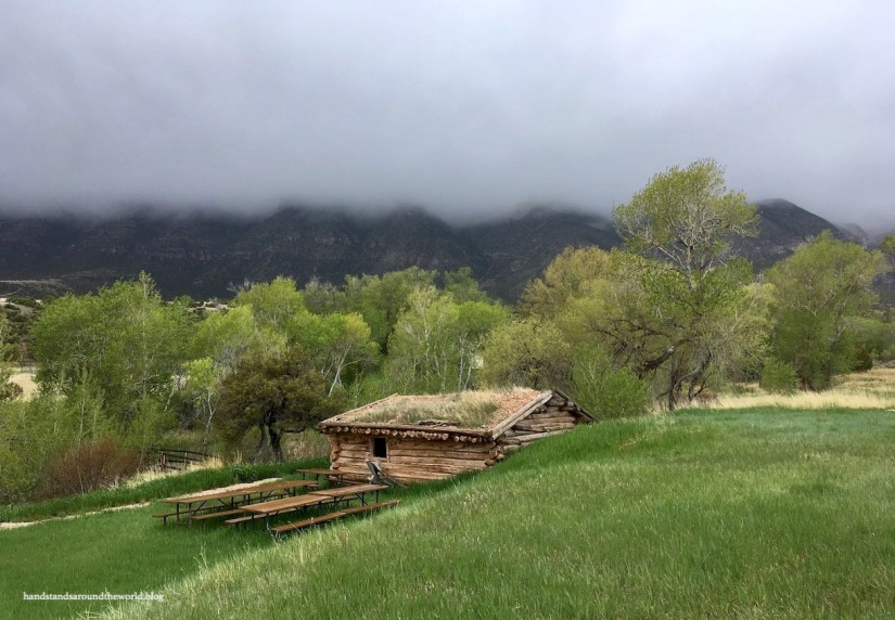
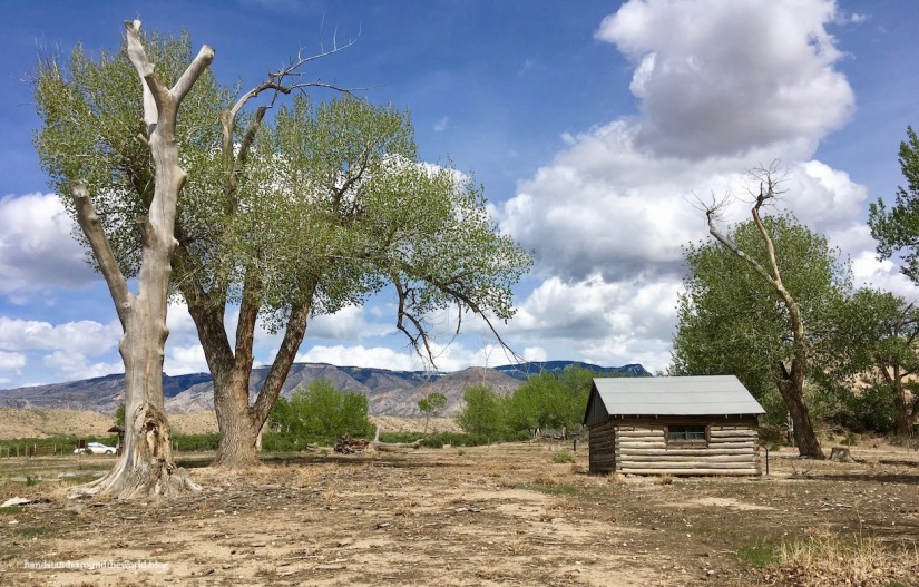
Next, we drove down and around to the historic Mason-Lovell Ranch, located across Bighorn Lake on the eastern boundary of the Rec Area.

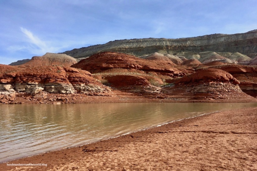
And later that evening, we walked down to the Horseshoe Bend boat launch area and wandered along the shore of the reservoir. The water level was fairly low, allowing us to walk all the way around to the base of Sykes Mountain where we found ourselves in amongst washes and tiny canyons carved through the deep red rock.
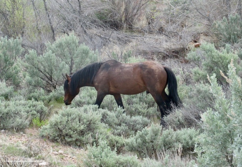
The final attraction at Bighorn Canyon is the wildlife, specifically the wild mustangs. We drove the entire park road on our first day and saw plenty of horse poop but no horses; between that and the rain, our morale was a little low. However, at the very end of our evening we spotted the first few and we saw a second, larger herd the next morning.

There were a few trails we didn’t hike, but aside from that we completed a fairly thorough exploration of the southern section of Bighorn Canyon. My mom has been to the northern section before and reports that it’s largely geared toward boating, so I don’t feel as though I missed too much by not visiting that section.
If you’re ever in north central Montana or Wyoming, this is a stop I highly recommend.
The Important Stuff:
- Getting there: the northern entrance is located outside of Fort Smith, Montana on Highway 313; the southern entrance is just east of Lovell, Wyoming on Highway 310
- Fees and passes: Admission is free! If you bring a boat you have to stop at the entrance station and have it inspected, but I believe that is free as well
- Hiking: there are multiple trails of varying lengths, but beware that this is predominately a boating park so not a lot of money or effort goes into marking or maintaining trails
- Where to stay: there are a few small campgrounds and most sites are first come first serve, but even on a holiday weekend the campgrounds never filled. The nearest town is Lovell, Wyoming, about 15 minutes south… it’s small but does offer lodging opportunities
- Other: as mentioned above, there is no road connection between the northern and southern sections of the rec area. Also, the surrounding land belongs to the Crow Reservation and is private property; please respect their land and obey all no trespassing signs

Beautiful pictures. I lived in Missoula for a few years, but I’ve never been to this area of the state. Thanks for sharing.
LikeLiked by 1 person
Yeah that would’ve been quite the drive for you! I, on the other hand, have seen very little of your area of the state. Montana is just too big!
LikeLiked by 1 person
This place looks wonderful!
LikeLiked by 1 person
It really is!
LikeLike
Sounds like an enjoyable trip. I would love to see some horses CB out in the wild.
LikeLiked by 1 person
Looks like a fun trip! I love the picture of Devil Canyon Overlook.
LikeLiked by 1 person
It’s a really neat place if you guys ever make it up that way!
LikeLiked by 1 person
Great information. Thanks for taking us there. We’ll definitely check it out when in the area!
LikeLiked by 1 person
Glad you enjoyed it! Thanks for reading 😊
LikeLiked by 1 person
A wonderful summary and outstanding pictures. Thank you.
LikeLiked by 1 person
Thank you!
LikeLike