
After leaving the Columbia River Gorge, we turned south at Hood River, OR and began the 4.5-hour journey to Crater Lake National Park.
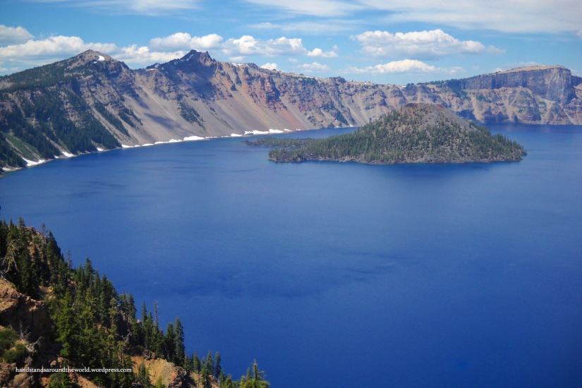
Crater Lake was formed about 7,000 years ago when Mount Mazama erupted so violently that it collapsed. The top of the mountain was blown off and what remained formed a caldera that is 5 miles (8 km) across and nearly 4,000 feet (1220 m) deep. A few subsequent eruptions were small enough to form the 755 foot (230 m) tall Wizard Island in the middle of the caldera. The mountain has not erupted since. Many Native American tribes actually lived in the area when Mount Mazama erupted; this event is still alive in some of their legends, and Crater Lake is considered sacred.
Because the lake is in a caldera, there are no inlets or outlets. The only source of water for the lake is precipitation – either that which falls onto the surface of the lake directly, or that which is absorbed into the ground of the caldera and eventually seeps out into the lake. The only way out of the lake is by evaporation. Due to these factors, Crater Lake is home to some of the cleanest and clearest water in the world. Clarity readings range from 115-175 feet (35-53 m), which is incredibly unusual.
Crater Lake is also the deepest lake in the US and among the deepest in the world, with a maximum depth of 1,949 feet (594 m). Geologists have estimated that it took about 700 years to fill the lake to this depth. Above the surface of the lake, the walls of the caldera rise anywhere from 800 to almost 1,800 feet (245-550 m)!
Okay, so now that you know all the fun factoids, let’s move onto some adventures. We entered Crater Lake National Park from the north and followed the North Entrance Road to the Rim Drive, which is the main thoroughfare. What we didn’t know is that the campground is on the south side of the lake, at least an hour away from the north entrance. After a long day on the road, we were a very grumpy group of travelers by the time we arrived.
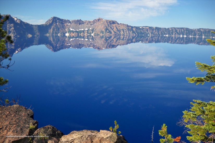
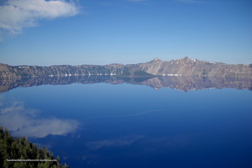
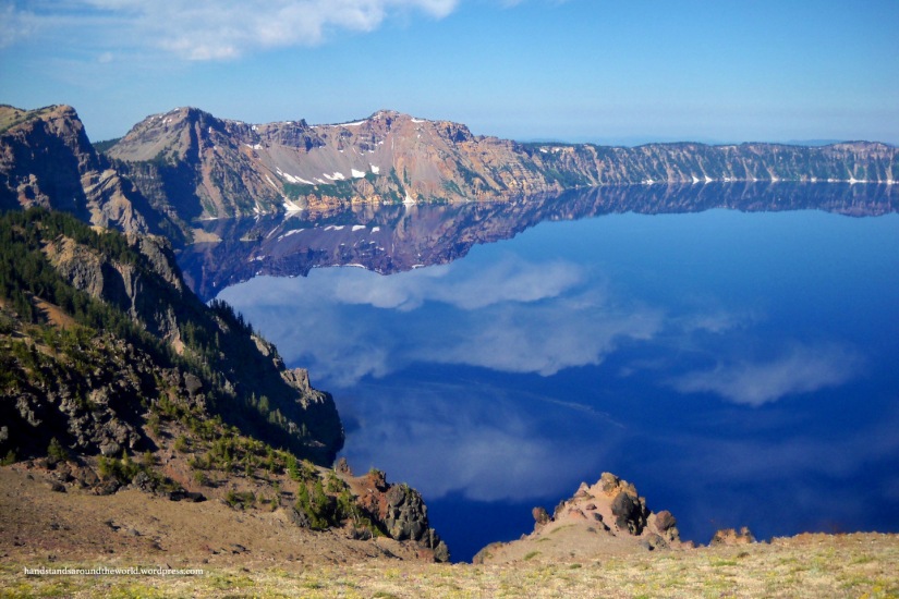
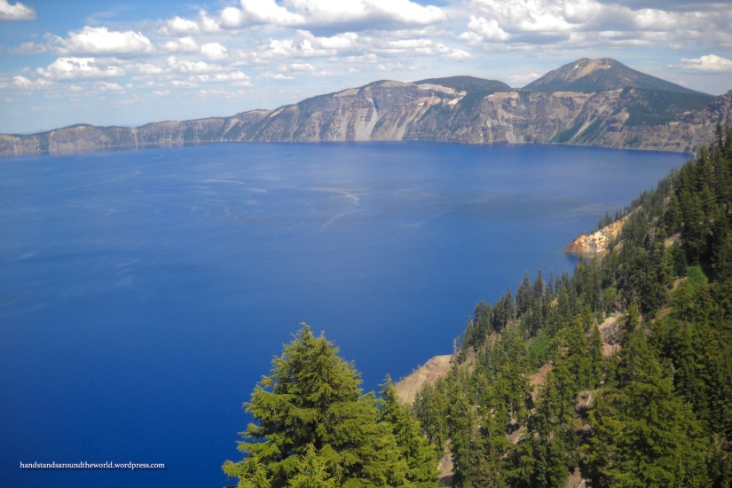
After getting a good night’s sleep and de-grumpifying, we began our tour of the park the next morning by driving the 33 mile (53 km) Rim Drive that encircles the lake. We stopped first at the Rim Visitor Center, from which we were afforded some of the best views of the lake. The air was calm, making for excellent reflections of the caldera walls on the smooth surface of the lake.

From the Rim Visitor Center, we headed counter clockwise around the Rim Drive. Our first stop was Vidae Falls, visible with just a short walk from the parking area. As the road continues on, it winds around the landscape, sometimes running near the edge of the lake, while at other points, the lake is not visible.
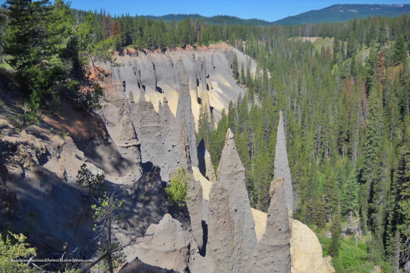
About a quarter of the way around the Rim Drive, Pinnacles Road branches off to the southwest, leading through Pinnacle Valley to the trailhead of The Pinnacles.
Just a mile up Pinnacles Road is the trailhead for Plaikni Falls. When we were there in July 2012, this trail had just been built. The path leads 1.1 miles (1.8 km) through pine forests up to Plaikni Falls, which cascades downstream through a field of wildflowers. We didn’t go to Crater Lake expecting to see waterfalls, but Plaikni Falls was a beautiful, quiet spot that we really enjoyed.


From the end of Pinnacles Road, the hike to the Pinnacles is an easy 1 mile (1.6 km) round-trip walk with views of pumice spires formed from the eruption of Mount Mazama. The trail turnaround point is at the park boundary, which is well-marked.
Back on the Rim Drive, we continued counter clockwise the rest of the way around the lake, stopping at the many viewpoints along the caldera rim. It’s interesting how different Crater Lake looks from each angle. In particular, there’s a small island called the Phantom Ship, so named because from certain angles it’s nearly impossible to spot. Particularly on a calm day when the walls of the crater reflect on the lake’s surface, the Phantom Ship is incredibly well-camouflaged.

This concluded day #1 in the park. The Rim Drive is long, curvy, and steep in some places; once you factor in time to stop for food, hikes, and views, it takes the majority of the day to drive the entire distance. And so we turned in for the night, ready to relax and prepare ourselves for the excitement that awaited us the next day. Stay tuned!
The Important Stuff:
- Getting there: located in SW Oregon off of Highway 62 or 138
- Fees & passes: $25 per car for a 7-day pass; Interagency Annual Pass accepted
- Camping: Mazama Campground; 214 sites, $22/night, reservations accepted but some sites also available first-come-first-serve. Closed in the winter
- Hiking: there are trails of all distances at Crater Lake; we hiked to Plaikni Falls (2.2 miles/3.5 km round-trip, easy) and the Pinnacles (1 mile/1.6 km round-trip, easy)
- Other: early in the morning is the best time for photos, as the wind is calm and the surface of the lake is very reflective

Not going to lie: there were a few amazed expletives when I saw some of those photos. Crazy gorgeous.
LikeLiked by 1 person
Just gorgeous. Love the colours of the landscapes and the beautiful wild flowers.
LikeLiked by 1 person
I had forgotten those amazing factoids about Crater Lake! Also I’m curious if I got Phantom Ship in any of my photos 4 years ago; I don’t remember seeing it but I don’t remember not seeing it either! Looking forward to your next post!
LikeLike
Wow, stunning!!
LikeLiked by 1 person
Those reflections are just incredible! I turned by laptop upside down and you really tell the difference between land and water, it’s so perfect.
LikeLiked by 1 person
We got really lucky to be there on such a calm day!
LikeLiked by 1 person
Superb reflections!!
LikeLiked by 1 person
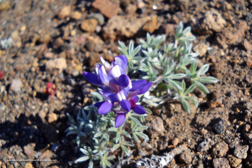
Don’t you just love and be amazed by that blue color? Beautiful photos of the lake and wildflowers.
LikeLiked by 1 person
One of my favorite places!
LikeLike
We were there a couple of weeks ago. Most of the trails are not open and we could not get to the falls 😦
LikeLike
Bummer. Guess you’ll just have to go back 🙂
LikeLike
Yep. Sigh!
LikeLike
I could not find the phantom ship. hehe, de-grumpifying.
LikeLiked by 2 people
We had a hard timing finding it too. Phantom is the right name for it 🙂
LikeLiked by 1 person
Look on the left of the photo, right near where the patches of snow are reflected in the lake
LikeLike
Oh, does it just look like part of the outside part of the crater?
LikeLike
Similar, yes. I have a second Crater Lake post that will be up next week, and that one has some close up photos of the Phantom Ship so you can really get a good idea what it looks like.
LikeLiked by 1 person
We were at Crater Lake a few weeks ago! It looks like the snow has melted quite a bit. 😃
LikeLiked by 1 person
Well this is actually from the end of July about 5 years back, so I’m actually not sure how the snow is doing this year.
LikeLike