
Last week, I left off in the southeastern portion of Yellowstone National Park near Yellowstone Lake. Picking up from West Thumb Geyser Basin, today we’ll continue north along the lakeshore and up to the Grand Canyon of the Yellowstone.
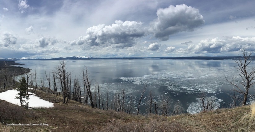
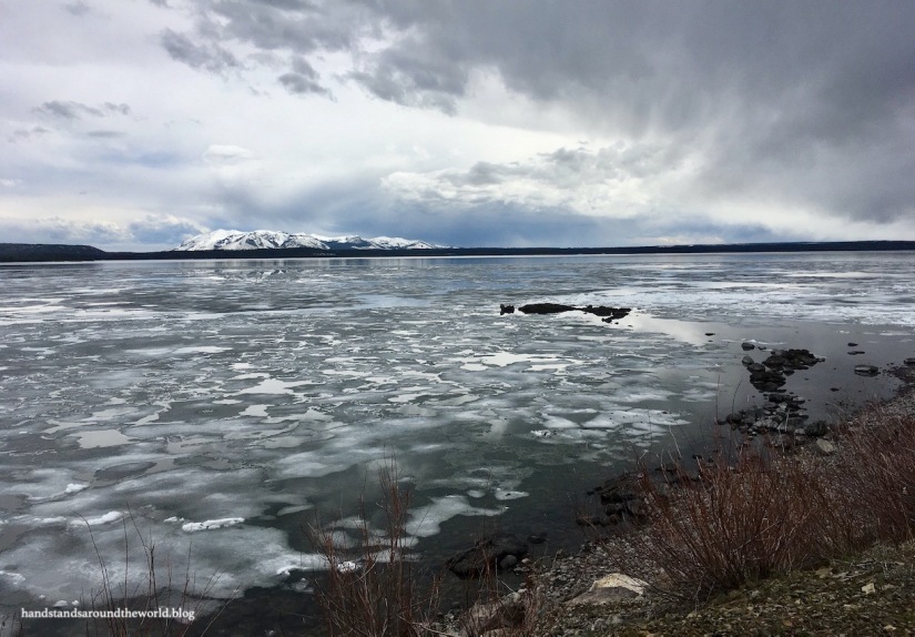
Yellowstone Lake is giant and also very uniquely shaped, with three protruding arms. It has a maximum depth of over 400 feet (122 m) and its surface elevation is approximately 7,700 feet (2350 m). In short, it’s a large, deep, weird-shaped, high altitude lake.
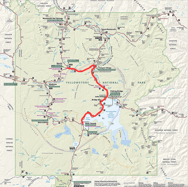
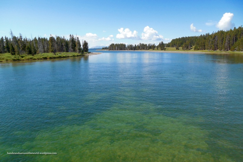
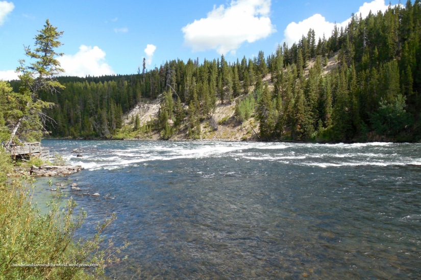
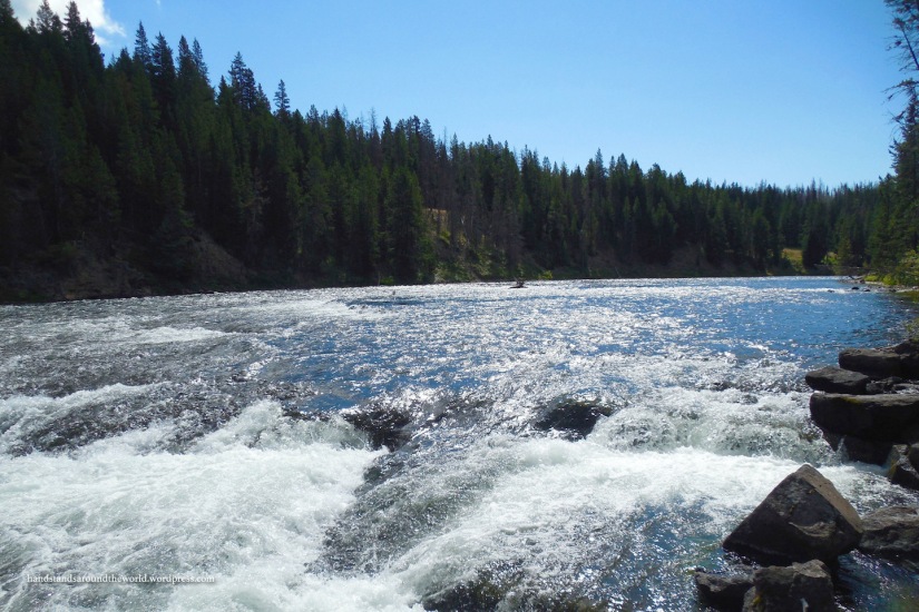
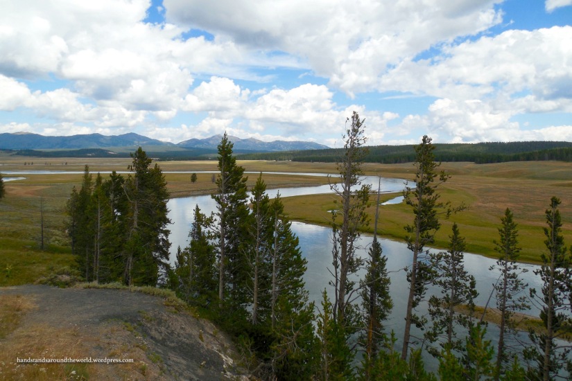
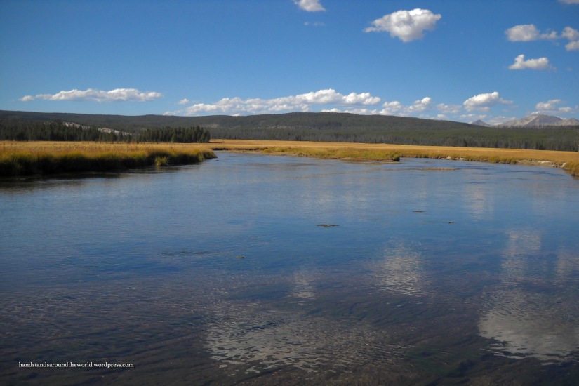
The main park road runs along the western shore of the lake all the way from West Thumb up to Fishing Bridge. The Yellowstone River begins at Fishing Bridge and flows north from Yellowstone Lake through Wyoming and Montana before eventually joining the Missouri River.
I haven’t spent a ton of time in this area of the park due to the fact that it’s far from many of the other attractions and also because the campground at Fishing Bridge is permanently closed to tent campers due to bear activity. However, we’ve recently discovered that the nearby Bridge Bay campground is a very nice – albeit slightly windy – place to stay. We returned to our site one afternoon to find our canopy laying on its side.
From Fishing Bridge, US Highway 20 leads east out of the park. I think I’ve been this way once or twice, but it was long ago and I have no memory of it.
Edit: in May 2019 my mom and I drove this section of road, so I decided to come back and add some photos.


Back on the main park road, from Fishing Bridge we will continue north along the Yellowstone River for 16 miles (26 km) to Canyon Village.

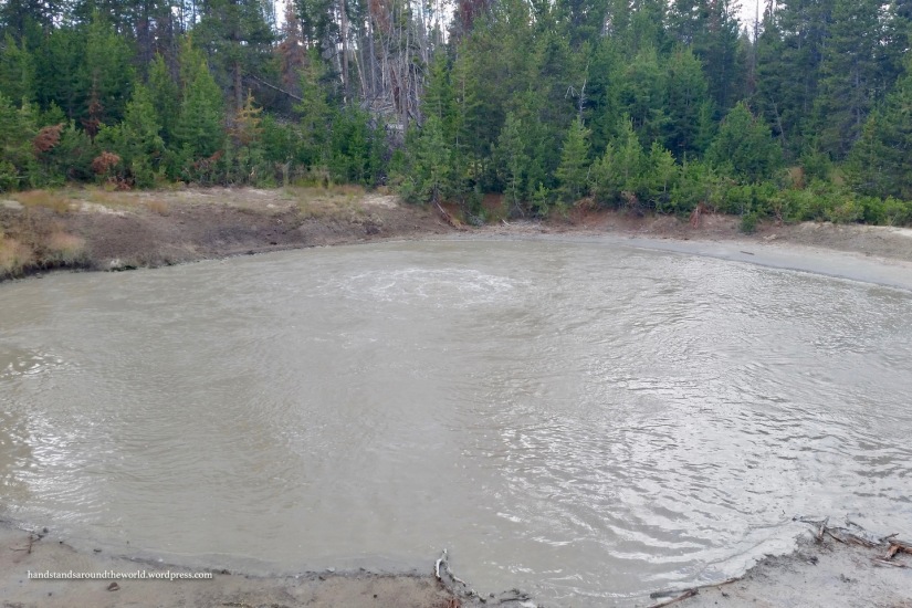
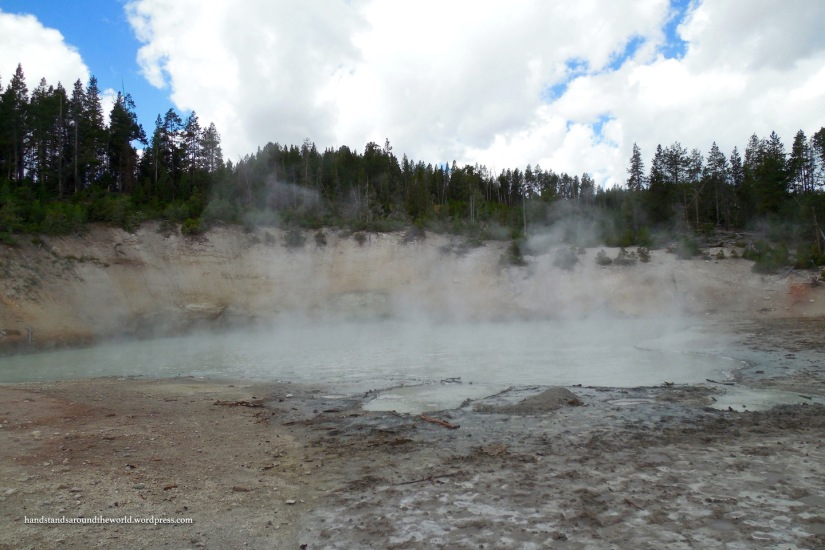
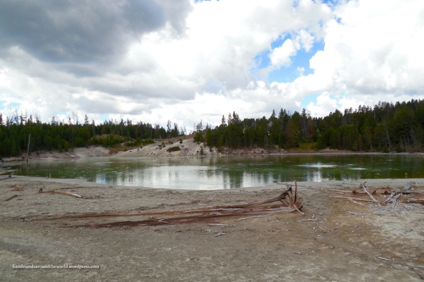
Along the way are the remaining two thermal areas – Mud Volcano and Sulphur Caldron. Mud Volcano is a second set of mud pots, very similar to Fountain Paint Pots which I discussed in a previous post. The mud here is grey and thick and splatters up in blobs as it boils. A boardwalk leads up and around this area to a few hot springs as well.
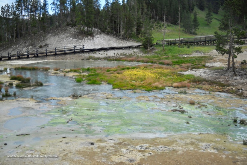
Sulphur Caldron is a mixture of mud pots and hot springs, but it’s probably best known as the place that smells like rotten eggs. Much of Yellowstone actually smells this way, as sulfur is one of the minerals commonly found in the thermal areas. But the odor at Sulphur Caldron is particularly pungent.


It’s funny – since I’ve visited Yellowstone so many times, the smell of sulfur never makes me think of rotten eggs. To me, it just smells like Yellowstone.
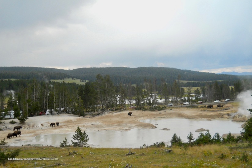
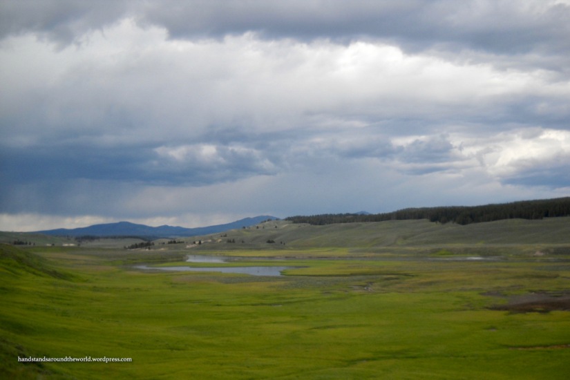
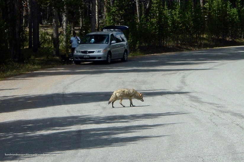
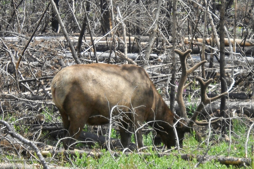
Beyond Sulphur Caldron, we find ourselves in the Hayden Valley. The Hayden Valley is large and lush and many animals spend their time here grazing in the fields of grass and drinking from the Yellowstone River.
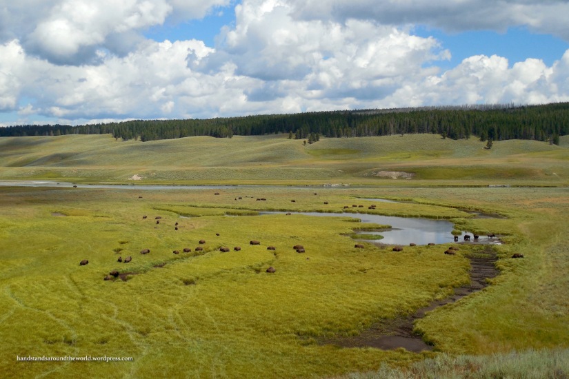


This brings me to my second obligatory Yellowstone safety spiel: wildlife. It is illegal and dangerous to approach or feed any of the wildlife, including ducks and squirrels. Yet, every year, there are people who try to pet a bison or take a selfie with an elk or approach a bear to get a better photo. It typically doesn’t end well for these people. For the safety of everyone, just bring a camera with a zoom lens.
We’ve now reached Canyon Village, home to a visitor center, campground, other amenities and – most importantly – the Grand Canyon of the Yellowstone. I’ll pick up here in my next post.
But first, I want to take a short detour through the middle of the park: the center portion of the road figure eight. I talked about Norris Geyser Basin in my very first Yellowstone post, but I haven’t yet covered the 12 mile (19 km) road that connects Canyon to Norris. The Gibbon River flows calmly through the area and a picnic area and a few trails can also be found here.

This portion of the road has undergone quite a bit of construction in recent years so I don’t have many photos of the area. Truth be told, some section of the road is always under construction in Yellowstone. Between the millions of visitors and the harsh winter weather, the roads are under a lot of stress. Summer is short at this altitude, therefore so is the construction season. Plan to get caught in construction traffic at some point.
Plan to also get caught in traffic jams caused by wildlife. Often these jams are due to people not fully pulling over to view an animal, but sometimes they’re the result of animals in the roadway. Especially bison. For some reason, bison never just walk straight across the road. They walk right down the middle of it. A couple summers back, we sat in traffic in the Hayden Valley for 45 minutes because a herd of bison was taking their sweet time crossing the road.
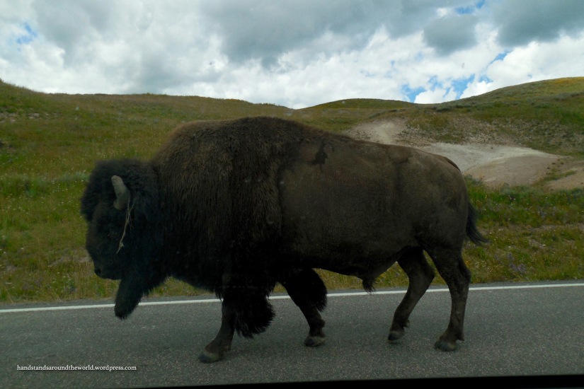
Yellowstone… land of geysers, hot springs, and bison jams.

Awesoome blog you have here
LikeLike
The Gibbon River looks just like what I thought gold panning rivers look like, when I used to read books about cowboys.
LikeLiked by 1 person
What an amazing post! We long to drive through Yellowstone some day.
LikeLiked by 1 person
Do it!!!
LikeLiked by 1 person
I remember the acrid smell of sulphur from my time in Japan, when we crossed the Japan Alps. There were signs everywhere warning people about the high levels of sulphur, and some paths were even closed off as it was perceived to be too dangerous to be that close to the source. The bison jam reminds me of a wildlife show I used to watch on the African Savannah where there would be a similar situation with wildebeest!
LikeLiked by 1 person
Interesting, I’ve never heard of sulphur in Japan! Or the Japan Alps, for that matter. Clearly I need to learn more about Japan!
LikeLiked by 1 person
The Japan Alps are probably one of the most scenic places I’ve been – if it makes you feel any better, I hadn’t heard of them either until I planned a trip to Japan!
LikeLiked by 1 person