
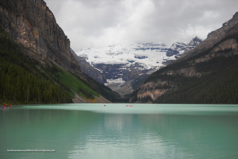
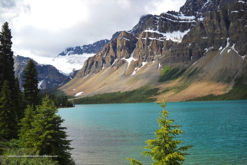
For the remainder of our time in Banff, we continued north on the main road, eventually leading us up to Jasper National Park, which will feature in my next post. Last week, I left off at Moraine Lake. In the same general area of the park is the other iconic Banff lake – Lake Louise. This lake is larger than Moraine Lake and – at least on the day we were there, which was very overcast – a much lighter shade of turquoise. There’s just something about the color of glacial lakes that’s always so beautiful. I love the way the hues subtly change with the weather and the sky.
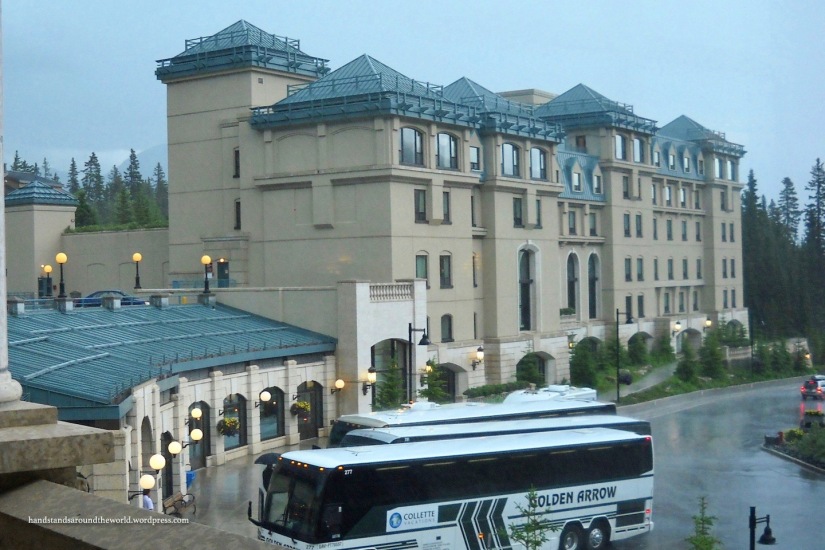
It was actually raining fairly hard when we first arrived at Lake Louise, so we sought cover in the lobby of the Chateau Lake Louise – a luxury hotel located near the lake that was built in the early 20th century by the Canadian Pacific Railway. Once the rain subsided, we were able to hang out at the lake for a while before continuing north. There are many trails in the Lake Louise area, but due to the rain and time constraints we didn’t hike any of them.
Just past Lake Louise, the road splits. The Trans-Canada Highway heads west, out of the park and into the neighboring Yoho National Park. Meanwhile, Alberta Highway 93 – also known as the Icefields Parkway – continues north through Banff and into Jasper. The Icefields Parkway is a 143 mile (230 km) long road connecting Lake Louise to Jasper National Park. Construction of the road began during the Great Depression and took 10 years and a crew of 600 men to complete.
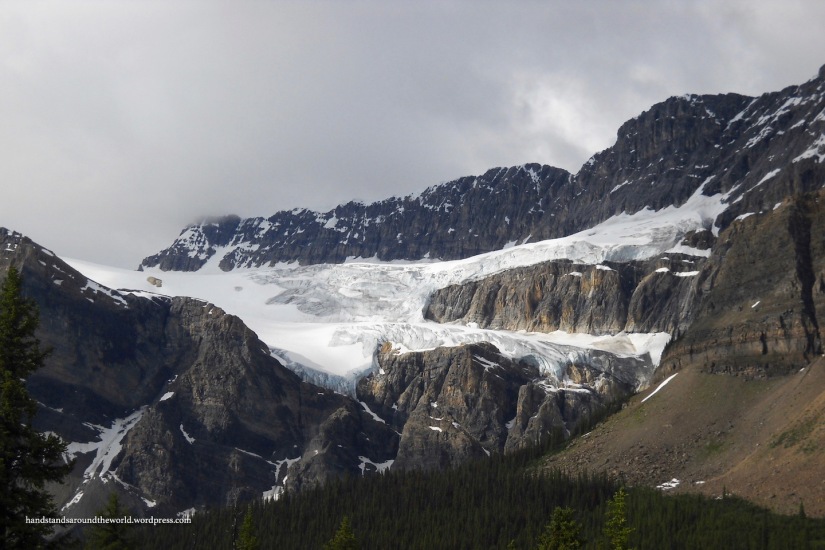
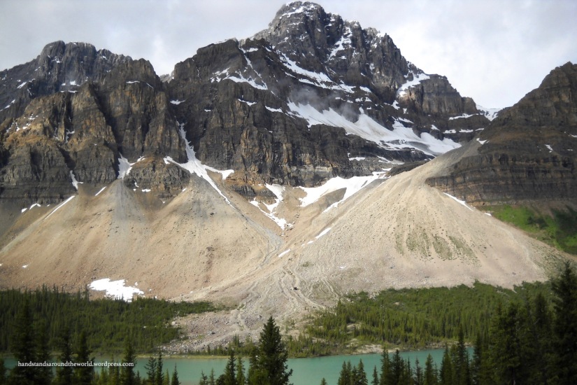
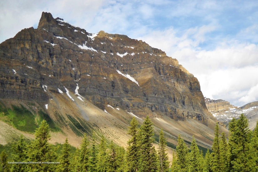
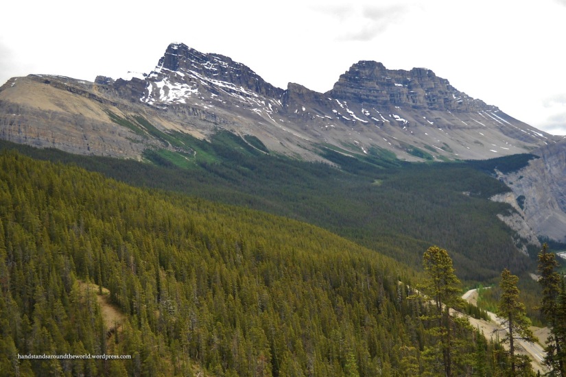
As we made our way up the Icefields Parkway, it was impossible not to notice the increasing magnitude and ruggedness of the mountains. The Canadian Rockies have a tendency to make me feel incredibly small, and the feeling only intensified as we traveled further north. In addition to towering mountains, the Parkway is lined with lakes of all shades of blue, many of which are fed by the giant glaciers perched on the mountains behind them.
Next is the unmistakably-turquoise Peyto (PEE-tow) Lake. Peyto Lake is the brightest turquoise lake I’ve ever seen anywhere. From certain angles, it’s also shaped remarkably like the front of a dog or a wolf, with two ears and a snout protruding in extraordinarily life-like proportions.
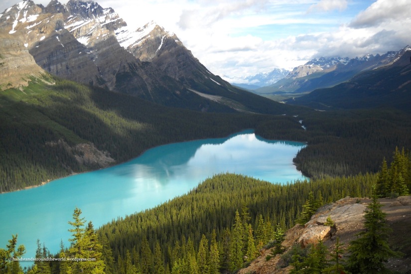
From parking lot, it’s a short 1 km walk to Bow Summit. This is the highest point along the Icefields Parkway and it provides the best views of Peyto Lake. I know from experience that this walk can be completed in 5 minutes if necessary. When I first visited Banff with my family many years ago, my mom, sister, and I headed back to the car, leaving my dad at Peyto Lake to wait for the appropriate lighting for an optimal photograph. He tends to underestimate how long it takes him to take photographs, and indeed, his “I’ll be back in a few minutes” turned into well over an hour. We were used to his photography taking longer than planned, but when he still hadn’t returned a while later, we started to get worried. And so we hiked back to Peyto Lake as fast as we could – in 5 minutes, to be exact – and found him still there with his camera.
I must admit, he did capture some beautiful photographs of Peyto Lake. (The one above was taken by me, though.)
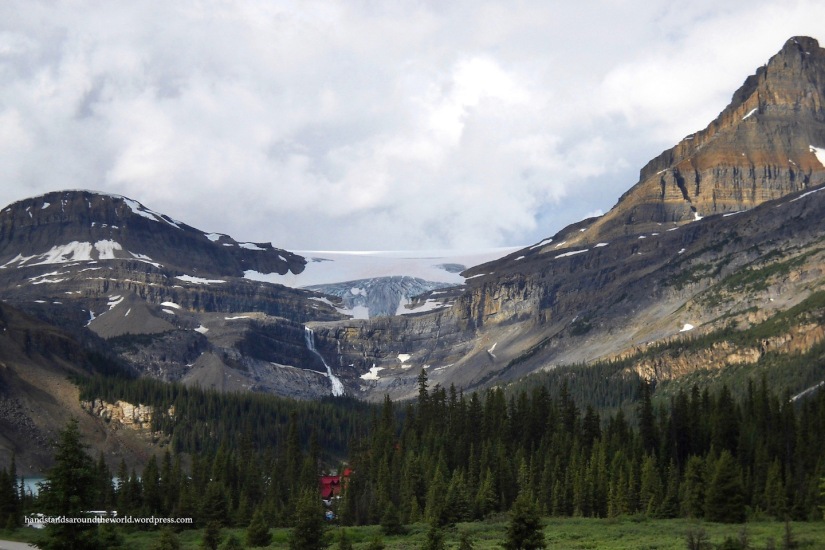
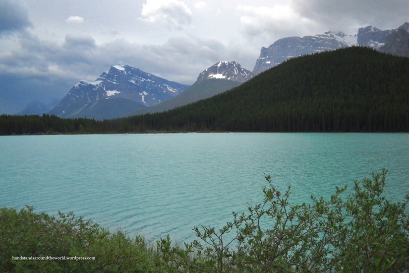
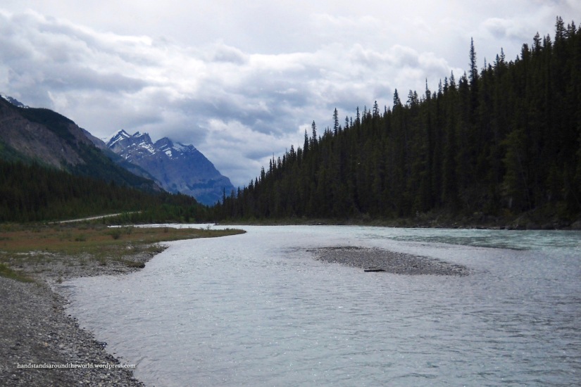
Continuing along with the string of lakes is Mistaya Lake and the Waterfowl Lakes. These lakes are located on the Mistaya River, which begins at Peyto Lake and retains some of its opaque, turquoise coloring. Beyond Waterfowl Lakes is the Saskatchewan River Crossing, at the junction of Highway 11 and the Icefields Parkway. Once we passed this junction, the North Saskatchewan River was flowing alongside the road, and we were officially on the Columbia Icefield!
And finally, that brings me to Sunwapta Pass, the border between Banff and Jasper National Parks. There’s a pullout right at the top of the pass – with good reason, the views are incredible – but the pullout isn’t nearly large enough to accommodate all the cars. Traffic was backed up, and as a result we drove halfway up the pass at about 15 mph (24 kmh).
This concludes our time in Banff National Park. We were sad to leave it behind, but equally excited to begin exploring Jasper!
The Important Stuff:
- Getting there: Banff National Park is located along the Trans-Canada Highway about 80 miles (129 km) west of Calgary. Highway 93/Icefields Parkway begins at Lake Louise and continues 144 miles (232 km) up into Jasper National Park.
- Fees & passes: $9.80 CAD/person/day or $19.60 CAD/car – this is good for Banff and all the surrounding Canadian Rockies parks; Parks Canada Annual Pass accepted
- Camping: There are 13 campgrounds with almost 2,500 total sites in the park. We stayed at Johnston Canyon, which is $28 per night (prices of other campgrounds range from $21-38 per night) + optional $9 fire permit. Reservations necessary in the summer.
- Hiking: there are 1000 miles (1600 km) of trails in Banff; here, we hiked the 2 km (round-trip) hike to the Peyto Lake overlook
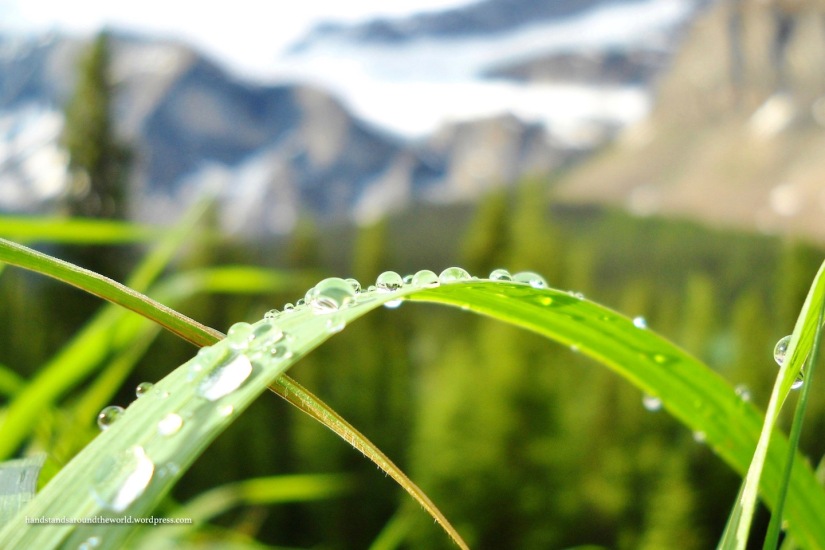
- Other: Be prepared for all sorts of weather at all times of year. We visited in July and it wasn’t exactly warm. It was also pretty rainy.

Wow how are these colors even real!
LikeLiked by 1 person
Right? It’s such an incredible place! Thanks for reading 🙂
LikeLiked by 1 person
Thanks again for the Sunshine Blogger Award nomination! We’ve finally finished our answers and they’re up for you to read if you like! http://gonefloatabout.com/2017/01/16/sunshine-blogger-award/
LikeLiked by 1 person
I really enjoyed reading it!
LikeLiked by 1 person
Thanks! It was fun to do!
LikeLiked by 1 person
Amazing photo selection…
xx
https://www.youtube.com/channel/UC_zn7IqrAY1I44bRuN6dH-Q
https://theonethattravels.wordpress.com/
LikeLiked by 1 person
Thank you!
LikeLike
This is very high on my To Visit list – Lake Louise especially. The pictures are lovely, as always!
LikeLiked by 1 person
Thanks!
LikeLike
Wow.
LikeLike
Amazing photos of an amazing place! I agree that those glacial lakes in the Canadian Rockies are simply stunning. They are each a different shade of blue, too. Peyton Lake is my favorite.
LikeLiked by 1 person
I think it’s my favorite too. The color plus the shape just makes it so unique!
LikeLiked by 1 person
Stunning photos. I really want to get there one day!
LikeLiked by 1 person